LoJ: #271 (Pre-LiDAR #269) / 13,484' T 10

Peak Summary
From Black Bear Pass, a relatively short but difficult Class 2+ hike with large broken rock and slippery sand amid small rubble for the final 200 feet to the summit. This peak has two summits of equal height on the USGS map. The northern summit seems to be the accepted summit. On Google Earth, the southern summit registers as higher. You be the judge, or climb both to make sure you've covered your bases. Pre-Lidar elevation was 13,477.
T.10 ENE Ridge Route
-
-
Red Mountain Pass - Black Bear Pass Access TH
We're writing this trip up with the assumption that climbers do not have a 4WD vehicle available, hence, the trailhead for this peak, Trico Peak, T.10, Three Needles, T.11 and UN13,159 is just south of the Red Mountain Pass summit. From Ouray, drive south on US 550 to the summit of Red Mountain Pass and park just south of the actual summit on the west side of the road where the Black Bear Pass road takes out. (FR823) From Ouray, this will take about 20 - 25 minutes of driving.
From Durango, drive north on US 550 to the Red Mountain Pass summit. Park on the west side of the highway just south of the summit where the Black Bear Pass road begins. (FR823)
If you have 4WD with good clearance, you may drive to the summit of Black Bear Pass and reduce both the mileage and elevation gain for the day considerably, if climbing UN13,510, Trico or T.10. In 1996, we found the road up to the pass surprisingly good with no real clearance problems. It was just steep in spots. The more rugged and notorious sections of the Black Bear Pass road are apparently further down on the Telluride side. However, our son reports from trips in 2012 - 2014 that the switchback at about the 11,700 ft. level is deteriorating and becoming progressively more difficult to navigate due to increased use and no maintenance.
Camping
While there are no designated Forest Service campgrounds in the immediate vicinity, north or south of Red Mountain Pass, there are numerous at-large, primitive sites close by. One is located on a knoll, by driving up the Black Bear Pass road about 1 mile and taking a left fork of the road that leads over to Porphyry Basin. Drive up to the knoll no more than .3 mile from the intersection. The elevation is appx. 11,600 ft.
Another good primitive camp location(s) if coming from Ouray is located at the south end of Ironton Park on the east side of the highway, in the vicinity of the road for Corkscrew Pass. If coming from Durango/Silverton, your best bet will be up the South Mineral Creek road.
Route Description
Year Climbed: 1996Note: the mileage and elevation for this hike assumes a walking start from the beginning of the Black Bear Pass road just south of the Red Mountain pass summit.
If you have 4WD with good clearance, you may drive to the summit of Black Bear Pass and reduce both the mileage and elevation gain for the day considerably. In 1996, we found the road up to the pass surprisingly good with no real clearance problems. It was just steep in spots. The more rugged and notorious sections of the Black Bear Pass road are apparently further down on the Telluride side. However, our son reports from trips in 2012 - 2014 that the switchback at about the 11,700 ft. level is deteriorating and becoming progressively more difficult to navigate due to increased use and no maintenance.
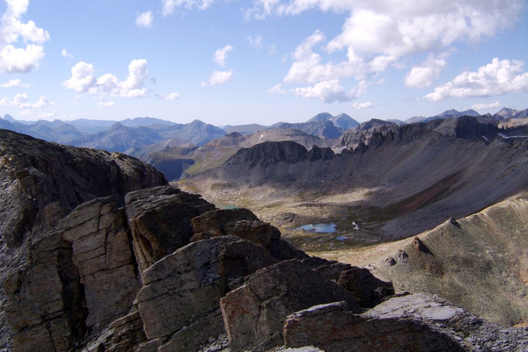
From the car park at Red Mountain Pass, either drive in 4WD or walk appx. 3 miles to the summit of Black Bear Pass road (FR823). If walking, you'll probably want to avoid the road traffic by heading more directly up into Mineral Basin. There will be two steep pitches with an intervening bench. Most of the hiking will be on tundra. At the pass, turn south (left) and begin the walk up to the T.10 summit directly along the ENE ridge. The hiking starts out easily enough with a side road leading part way up. As you ascend, the slope will steepen and rock conditions become more difficult. The last 200 feet will be over large, broken rock with sections of treacherous sand amid small rubble. Breathe a sigh of relief when you arrive at the summit, then decide if you want to make the one third mile traverse over to the southern summit. You only loose perhaps 120 feet to do so, but the connecting ridge is rugged and broken by protruding gendarmes. On LoJ, "Futhermore" reports dropping low below the ridge crest to avoid those difficulties but encountering much scree. He suggest that a higher route is better & we agree.
-