LoJ: #119 (Pre-LiDAR #118) / 13,778' Ulysses S. Grant Peak
Peak Summary
Ulysses S. Grant Peak is another of the Ice Lake Basin group of summits that offers a sporting and entertaining route to the summit from its south ridge and saddle between it and V.4. Can be accomplished as a day climb from the South Mineral Campground trailhead and if approached from there, can be accessed by passenger vehicle. We give this peak a solid Class 3 ranking, perhaps even Class 4 to some because of one difficulty, but can be done without rope. US Grant is sequenced with V.4, a summit that lies close by and should be included if at all possible.
US Grant South Ridge Route
-
-
South Mineral CK. CG & Ice Lake Basin TH
Use this trailhead for peaks located in the Ice Lake Basin group or around Island Lake. Includes the following summits: Pilot KNob, V.2, V.4 and US Grant. This can also serve as a trailhead of Fuller, Vermilion, and Golden Horn.
From the Town of Silverton and the US 550 intersection on the west side of town, drive north on US 550 and in a little over 2 miles turn west onto FR585. If coming from Ouray, drive south on US 550 over Red Mountain Pass and watch for the FR585 turnoff on your right before reaching Silverton. Drive west on this graded dirt road to the campground and trailhead parking appx. 4.7 miles in. The last mile of road gets a little rougher but should still be navigable by passenger cars.
When you arrive at the trailhead, the entrance to the campground will be to the left and parking for the trail will be in a gravel lot to the right. Overnight camping in the lot is not permitted. On summer weekends, the lot will easily fill by early morning. There is an alternate to this lot for a trailhead access into Ice Lake Basin. It is as follows: at 4.2 miles in on FR585 after turning off US550, there's a single-track road that veers off to the right at these coordinates: N 37° 48' 19.42" W 107° 46' 25.33". Elevation is 9,795 ft. The road is best suited for 4WD with good clearance. This is known as the "Clear Lake Road" and actually continues all the way to Clear Lake. The road does not show on the USGS 1955 quad.
Drive up the road to the first switchback and park. Perhaps 3 - 5 vehicles can be crammed into here. There's no room to camp. Elevation is 10,340 ft, so you'll save about 500 feet in elevation but little mileage by parking here. Coordinates are: N 37° 48' 37.71" W 107° 46' 35.46".
Camping
All along FR585, once you turn off US550, there are numerous at-large, primitive sites. Upon turning off US 550 and driving less than a mile, there's a large open area on the left with a vault toilet. There are usually a large number of RV's here. There is also the South Mineral Creek Campground and before arriving at the campground, you will see a number of other camp spots. Expect fierce competition on summer weekends for sites. This is a very popular area. There is no "allowed" camping at the trail head parking area.
Directions for South Mineral CG per San Juan NF: South Mineral Campground is accessed by turning off U.S. Highway 550, about 3 miles west of Silverton, onto Forest Rd. 585, which heads west along South Mineral Creek. The campground is 4 miles off the highway and has 26 mostly level sites. Several camping loops and well-spaced sites are mostly shaded, but some are sunny. A few are next to the creek, and some have large parking areas. The Ice Lake Basin Trail, a strenuous, steep, and popular hike, begins across the road from the campground. It leads up above timberline to high alpine lakes surrounded by meadows of wildflowers and rocky peaks. South Mineral Campground does not take reservations. All sites are first come first served. There are an assortment of designated areas along South Mineral Road where dispersed camping is allowed so there is plenty of camping in the canyon on all but the busiest days.
Picnic tables, composting vault toilets, fire grates, trash disposal, potable water. No electricity. Operated by concessionaire. The campground has 26 sites that are mostly level, at 9,800 feet. Some sites are handicapped accessible. Several camping loops and well-spaced sites offer plenty of privacy. Spruce and fir give lots of shade, but there are some sunny sites. A few sites are along the creek, and some have large parking areas.
Dispersed camping along Forest Rd. 585 is allowed only in designated camping areas. Please follow posted directions and instructions.
Campsite Locations
South Mineral CG › N 37° 48' 23.52", W 107° 45' 46.53"Elevation 9,855 ft.
Click thumbnail to view full-size photo + captionRoute Description
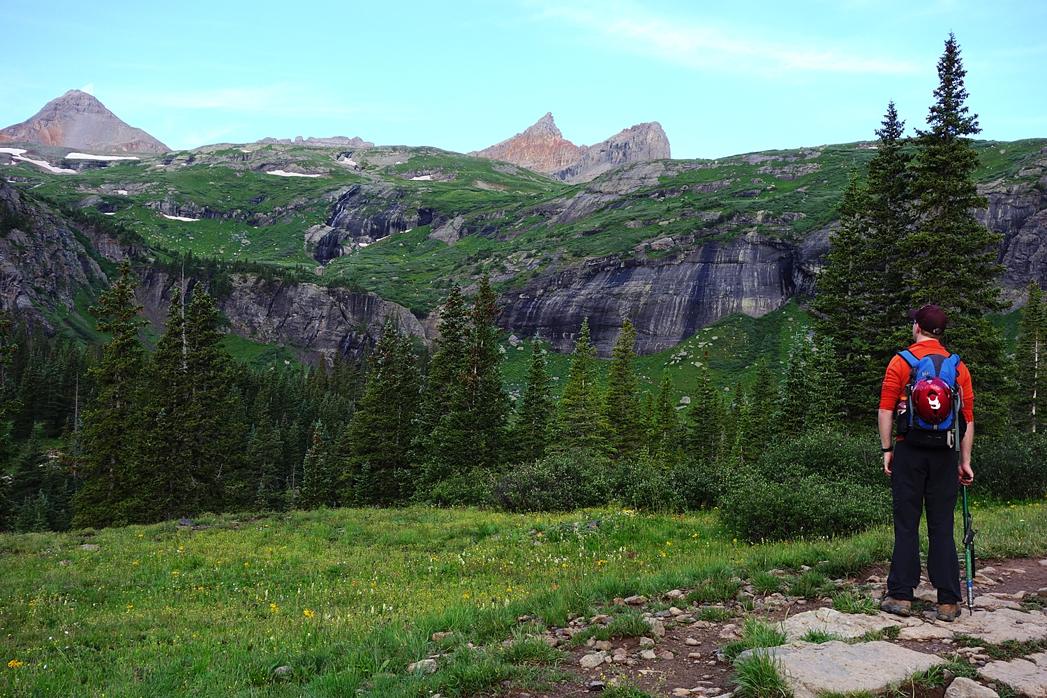
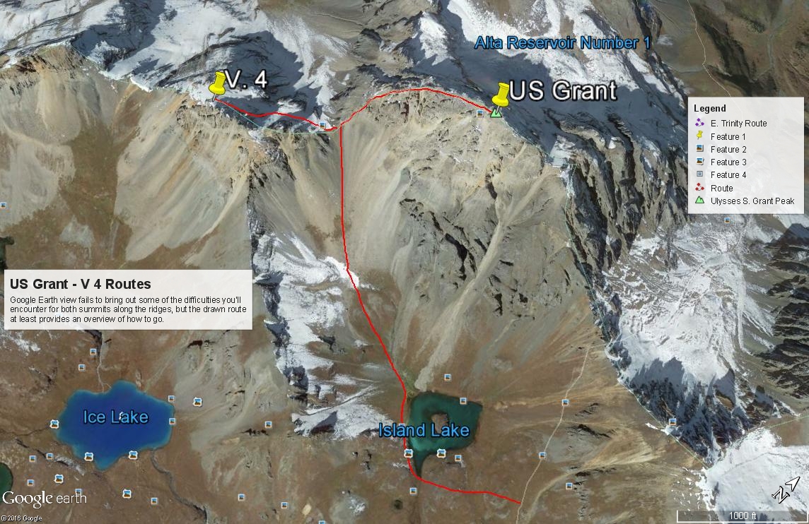
Year Climbed: 1995The route description we used for this climb in 1995 came from Mike Garratt and Bob Martin's book. Use either the lower trailhead that starts from the parking area across from the South Mineral Campground, or drive up to the higher trailhead on the Clear Lake road.From the lower trail head parking lot that can accommodate a large number of vehicles, begin hiking on the well-used and popular trail to Lower Ice Lake Basin. It's less than 2 miles into the lower basin area. The trail levels off some into the basin after a steep section of climbing on switchbacks. If backpacking into here, there are a number of good campsites in the lower basin. Not long after the trail levels in the lower basin, watch for a secondary trail turning off at these coordinates, on the right. N 37° 48' 45.33" W 107° 47' 29.55". This trail leads up first north, then west, then north again across mostly tundra to near Island Lake. Walk on over to the lake.
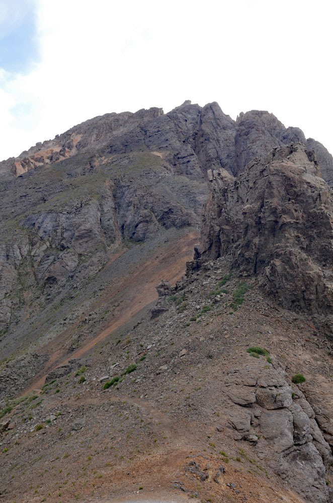
Hike to the west end of Island Lake on the south side. Head NW up the basin to the saddle between US Grant and V 4. There will be a bench-like area at about 12,700 ft. In earlier season, you may have snow on this part of the ascent so ice axe and/or micro-spikes would be handy. Without snow present, you can gain this bench on mostly tundra. Above the bench, there will be an area of rock rubble to contend with, another smaller patch of tundra and then a loose scramble on talus and rubble to the saddle at 13,220 ft.
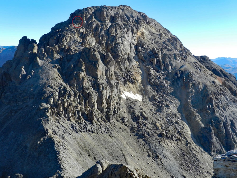
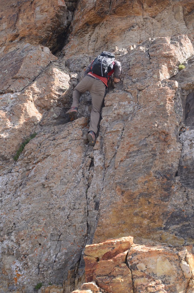
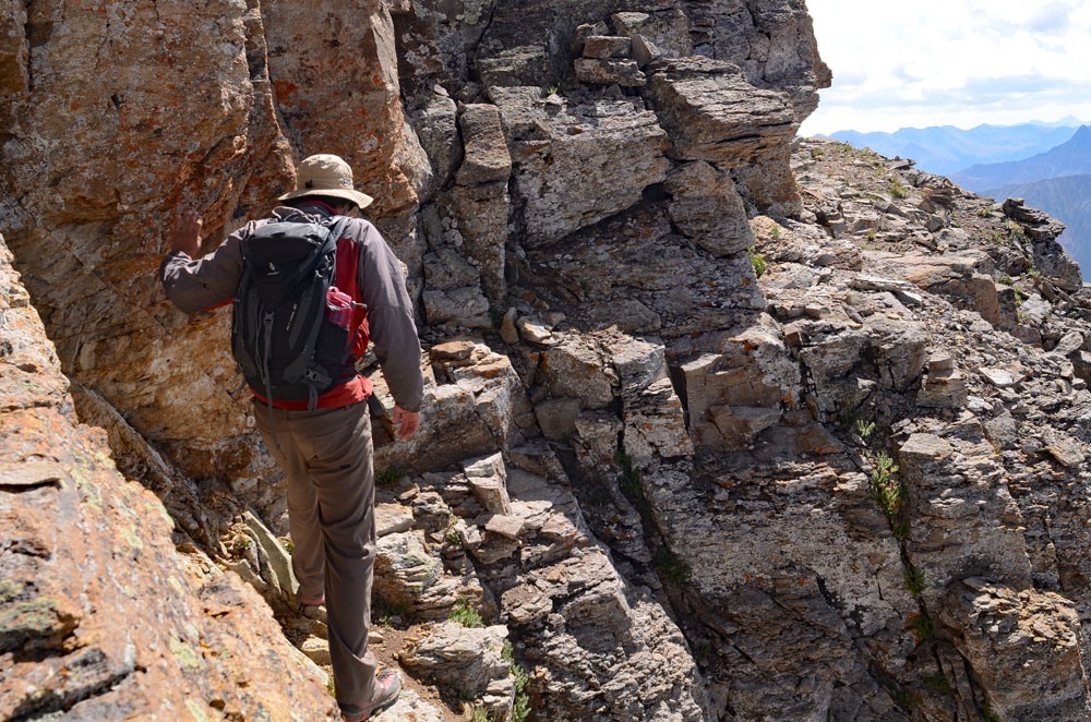
from the saddle, we found a clear trail that leads up the south ridge. The trail climbs mostly on small, broken rock between projections of rock outcroppings. it's all easy going through here. Eventually, the trail will lead to a section of ridge that will narrow to just a few feet wide. On both sides, steep, rock-filled gullies drop away. In front of you will be a 12 foot wall, described by G&M. The rock here is quite yellow. A good crack takes you up the wall for 8 feet to a small shelf. The last 4 feet is just a small step up to a 4 foot wide ledge system. We had a short piece of rope with us for this one section, but did not use it. This is the only section that rates at least 3rd class climbing. Some rate this 4th class. The upper ledge we found ourselves on was sufficiently wide and comfortable. It cuts across the south side of the peak at about the 13,600 foot level. Follow it east briefly (about 20 yards) to a wide couloir that's mostly solid rock with smaller rubble laying on top that tends to roll underfoot. The couloir is not too steep. Once out of the couloir, regain the south ridge and follow it to the summit on Class 2+ terrain.
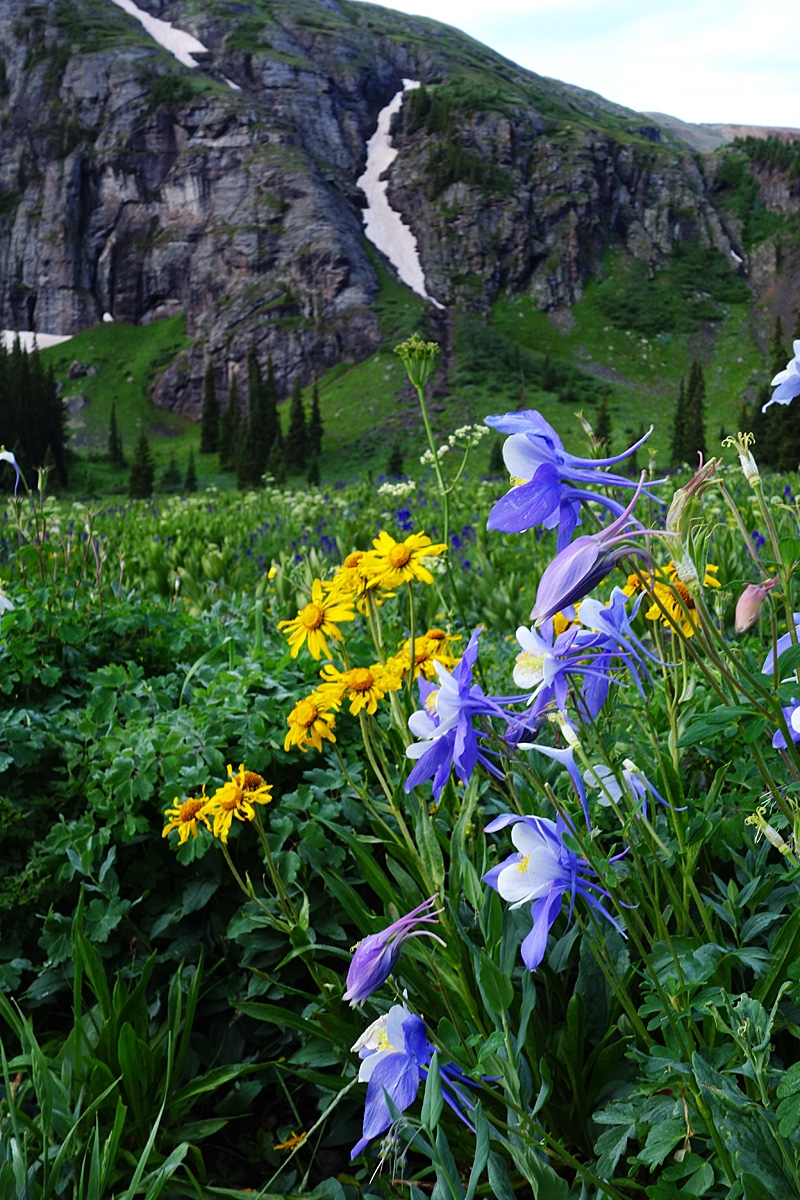
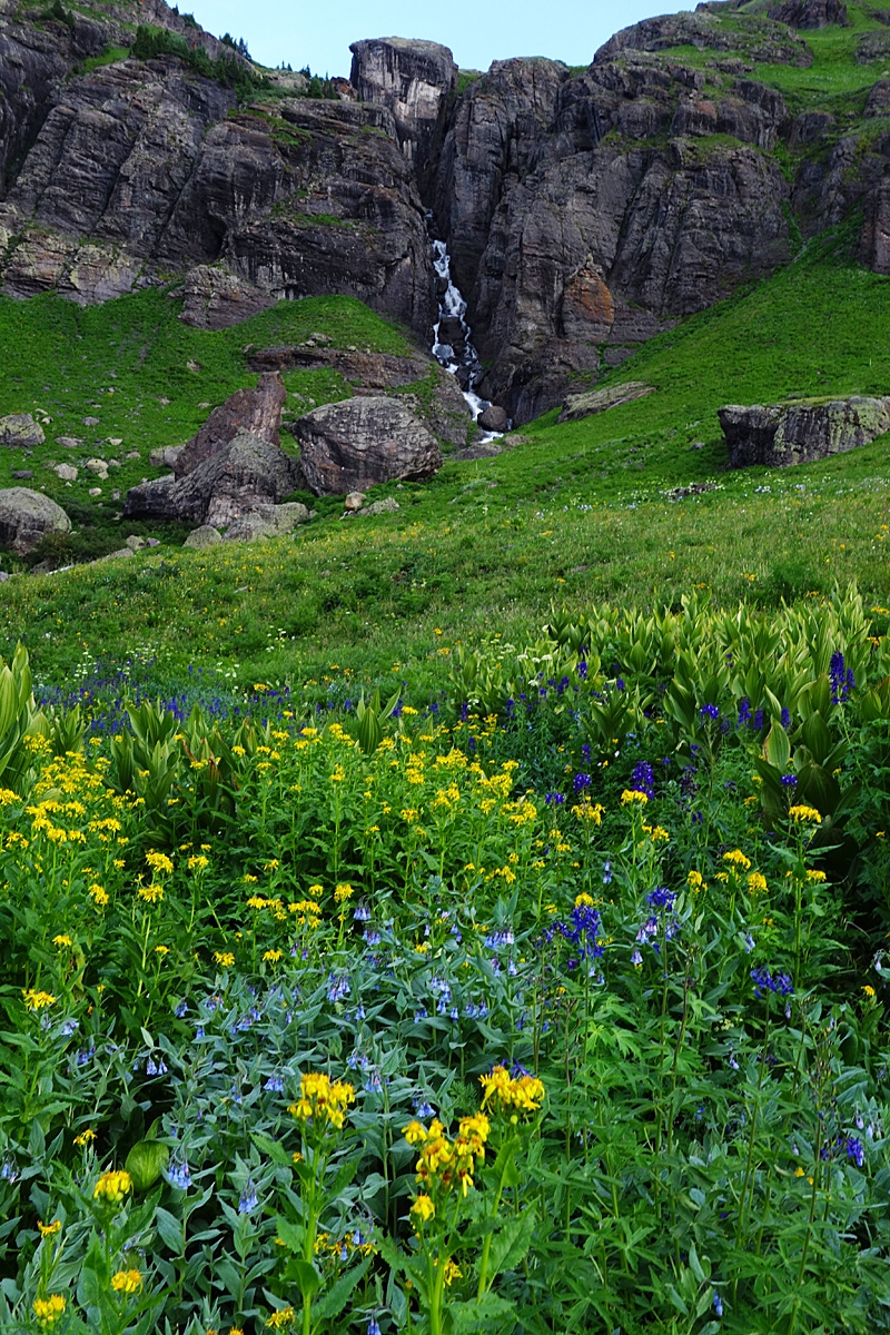
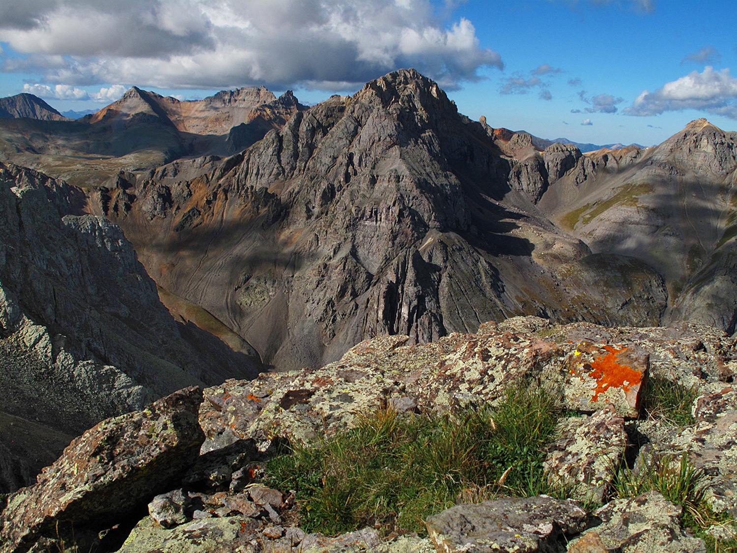
Enjoy the splendid summit view in all directions. If you haven't climbed South Lookout Peak yet, take a hard look at that one. Descend this peak as you came. We would definitely suggest climbing V.4 from the US Grant-V.4 saddle. V.3 to the NW of US Grant is a much more difficult traverse. Derek Wolfe (Furthermore) describes attempting this traverse and says "it did not go." It is also possible to traverse the east ridge of US Grant over to V.2. We have not sequenced V.2 with US Grant but for a report on that traverse, see the one filed by Eddie Mack (Mtnman200) for US Grant/V.4/V.2 on 14ers.com. That traverse does not sound any more difficult than a Class 2. Best features of this hike: Some scrambling on US Grant and the amazing wildflowers of Lower Ice Lake Basin.
Additional BETA
Links to other information, routes & trip reports for this peak that may be helpful. -