LoJ: #230 (Pre-LiDAR #201) / 13,543' UN 13543 Formerly UN 13580 B
Peak Summary
Significantly demoted by LIDAR, this was formerly interpolated as 13,580. Still a ranked, family friendly, Class 2 hike/climb over moderate terrain accompanied by possible moderate backpack trip of short mileage into a highly scenic location. Trailhead is accessible by higher clearance passenger vehicles.
Southwest Slopes Route

-
-
Willow Lake Trail #865 TH
The trailhead is located east of the small town of Crestone. Take US 285 south from Poncha Springs, over Poncha Pass for 21 miles and turn left onto CO17, another four miles south of Villa Grove. Drive another 13 miles to Moffat and turn left onto "T" Road, aka: Russel St. Drive about 13 miles east to Crestone. T Road will make a 90 degree jog right, then back left and a couple miles further will make a shorter jog left, then right. As the road enters the town, it will make a couple jogs again before you reach the center of town. From the town of Crestone, from the second stop sign, turn right on Galena. Follow the gravel road 1.5 miles to a location where 2WD vehicles can park. 4WD vehicles can proceed another .75 mile to the trailhead parking. South Crestone Lake trail #860 heads out straight ahead. Willow Lake trail # 865 veers to the right and crosses the creek.
If coming from Alamosa, head north out of town on CO 17 and continue north past both Mosca and Hooper to Moffat., appx. 29 miles. Turn right (east) onto "T" Road and follow directions as above.
Camping
Primitive sites are available along FR949 once you get on Forest land. Be careful about private property through here, especially on the south side of the road. Some limited car camping at the trailhead.
-
From Willow Lake Trail #865 TH via Willow Lake
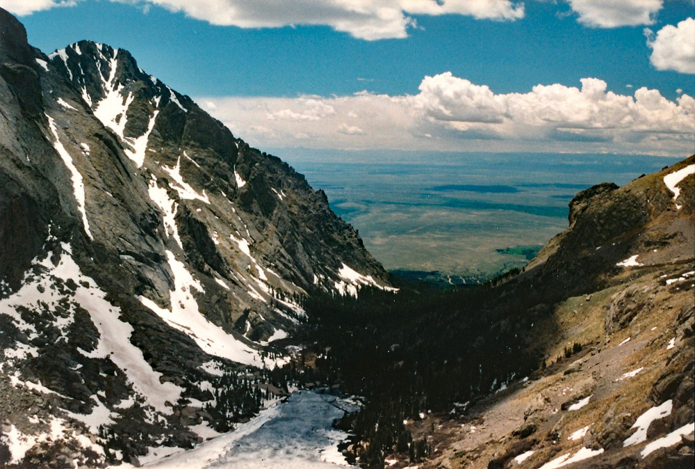
Last visited this trail in 2002. At that time, there was no official bridge crossing Crestone Creek at the TH. We were able to get across on fallen logs, but in higher runoff, you may have to wade. After crossing the creek from the TH, the trail climbs east up an open hill, then begins a series of switchbacks through forest, crosses a ridge and then contours up valley, well above Willow Creek. As the trail approaches a large waterfall it climbs on switchbacks more steeply, heading in a more southerly direction, crosses Willow Creek below the waterfall on a log bridge, and climbs steeply up an area of rubble as it turns back to the east and begins to level out as it approaches the beautiful Willow Lake. A scenic waterfall plunges into the far eastern end of the lake. Overall, this is a moderately strenuous backpack. Trail is maintained and easy to follow except where it crosses back over Willow Creek above the waterfall and a little before the lake.
Note: Expect high weekend traffic at the trailhead because this is an access for climbing Challenger and Kit Carson and has become very popular.
Camping
Main camping on the approach is at Willow Lake. In keeping with FS camping policies, campsites are located away from the lake and along the northern side, somewhat elevated above the lake. Also, there are sites well before reaching the lake on the hike in. Watch for FS signs designating where to camp. Camping locations may have changed due to FS regulations since our last visit in 2002. There are also some limited primitive camping spots at and just before arriving at the trailhead.
Note: This area has become very popular with the 14er bagging crowd. Competition for campsites at Willow Lake on weekends may result.
Open This Approach in a New Window
Click thumbnail to view full-size photo + captionRoute Description
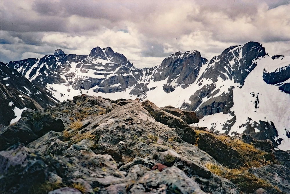
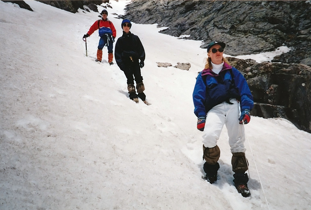
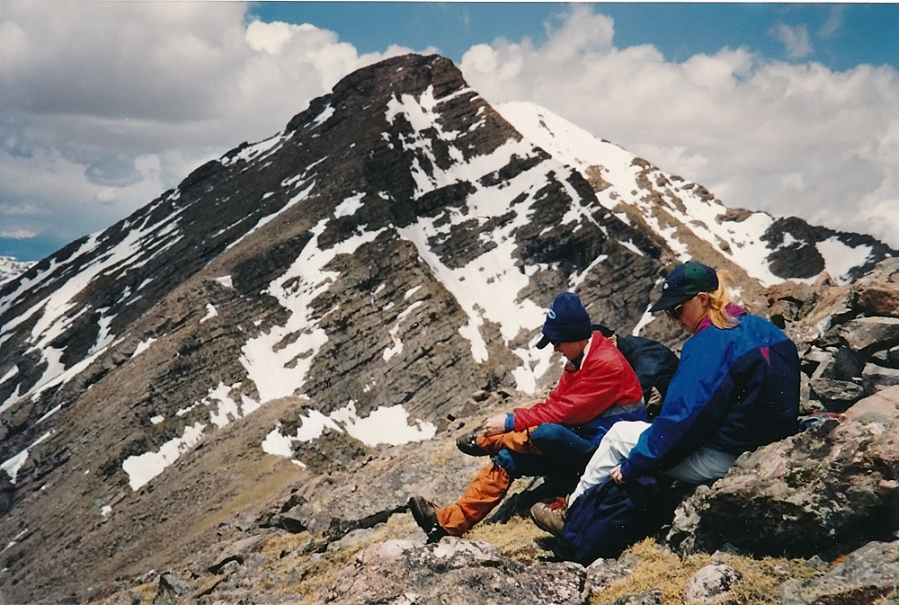
Year Climbed: 1995From Willow Lake, walk around the north side of the lake on the trail access into the upper Willow Creek basin. From the NE shore, you can proceed up directly toward the summit by heading up mixed tundra/rock slopes that steepen and become more of a tundra/rock/scree mix as you gain elevation. There is a shallow couloir that can be utilized or a parallel rib of stable rock embedded in tundra. You may encounter one short rock-scramble section. In early season, there may be snow, so ice axe is handy, especially for a nice glissade back down. Return by the same route, or proceed over to Mt. Adams or UN13,541, both along connecting ridges.
Alternate: From Willow Lake, head directly north through trees for a brief while and enter a drainage that comes in from the north and that leads into a basin that curves east and below the foot of Mt. Adams. From the basin, head ESE toward the summit of UN13,543 on moderate slopes.
Additional BETA
Links to other information, routes & trip reports for this peak that may be helpful. -