LoJ: #621 (Pre-LiDAR #626) / 13,028' UN 13028 Formerly UN 13020 B

Peak Summary
One of the more isolated and remote 13ers that does not attract much attention. From South Colony Creek and Broken Hand Pass, a fairly easy hike, but longer day through varied terrain with a rocky finish with 4WD useful or, from Pico Aislado a moderate ridge walk that can be completed without too much additional effort, however a backpack trip into upper Sand Creek is highly suggested along with a required 4WD to reach the upper Music Pass trailhead. Lidar added 8 feet of elevation.
UN13028 NW Approach Route
-
-
South Colony TH
From the town of Westcliffe: Drive south on HWY 69 for 4.5 miles and turn right onto Colfax Lane (CR119). Proceed about 5.5 miles on this partially paved and graded dirt road to an intersection where you must turn right or left. Go right (west) on CR120 and in about one more mile, if in a low clearance passenger car, park at a fence line. This is referred to by some as the "lower trailhead." If you have a better clearance vehicle (CRV, Outbacks or better) with care you can drive another 2.5 miles to the "upper trailhead" close to and before where the road crosses South Colony Creek. This last 2.5 miles has deteriorated significantly over the last few years. The Forest Service has put in a parking area here that they say can hold about 50 vehicles. On summer weekends, you may find even this amount to be insufficient. Also, the FS has considered introducing a "use fee" of $20, however at the date of this writing, the idea appears to be in limbo. Best to go prepared, however. From the parking area, a bridge takes hikers over South Colony Creek so no need to prepare for wading.
Camping
On the 2.5 mile drive into the upper trailhead, there are some at-large spots available and then at the trailhead, the FS has installed 4 - 5 camp spots that have tent platforms and fire rings. There is presently no fee for using these spots. Wag-bags are supposed to be available from a dispensary of some kind to help with the human waste problem. There are no vault toilet facilities. Here's a hint for those peakbaggers spending multiple days in the Westcliffe area and in need of a shower: The Westcliffe Inn, a little south of town on HWY 69, may offer use of their showers for a small fee. We last availed ourselves of this in 2009. Stop in and inquire if they are still open.
Campsite Locations
South Colony Creek › N 37° 58' 34.74", W 105° 30' 20.75"
-
From South Colony TH via Upper South Colony Trailhead
From the upper trailhead at the crossing to the north side of South Colony Creek, walk up the old roadbed for 2.8 miles to the old terminus for the road where it crossed the main creek. Last time we were on this road in 2009, we could still drive it and sections of it were unrelentingly rocky. Still, you should be able to walk this access in about an hour. Where there use to be parking at the upper terminus, look for the "shortcut" trail that heads more directly west to the lower and upper South Colony Lakes. This trail is the main access for Humboldt or Kit Carson if heading in that direction.
Camping
There is plenty of camping available in the vicinity of where the road used to end at 11,000 ft. and all along the trail "shortcut" trail to the lakes and at the lakes.
Open This Approach in a New Window
Click thumbnail to view full-size photo + captionRoute Description
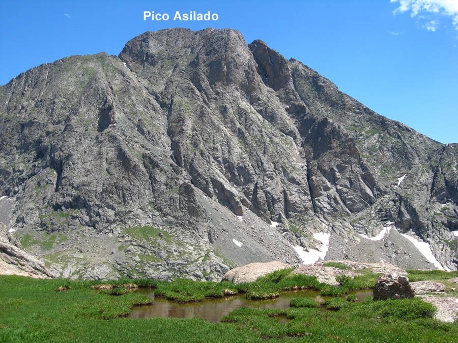
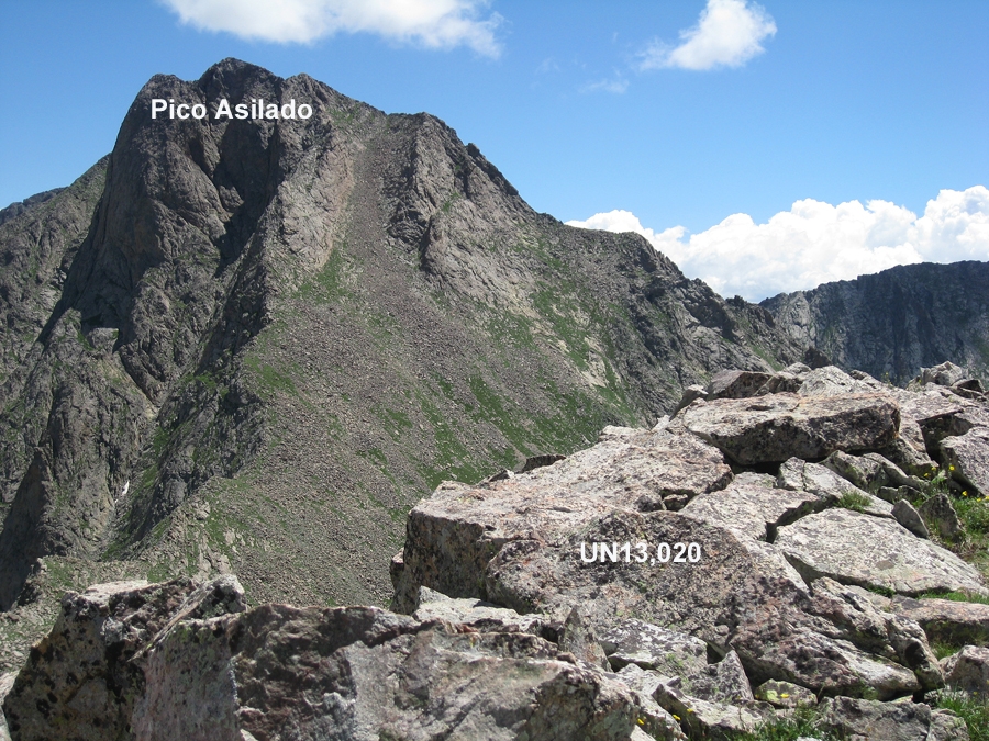
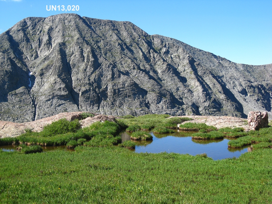
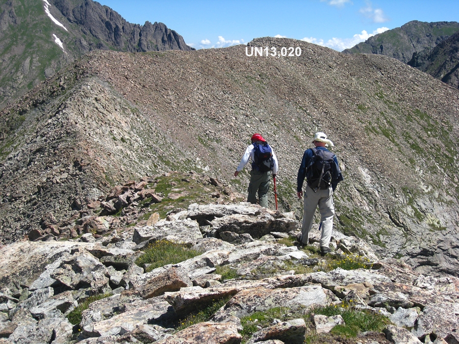
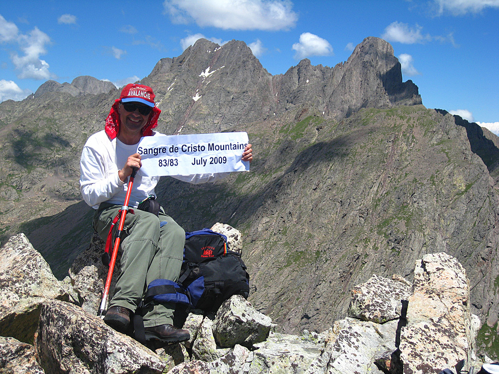
Year Climbed: 2009Note: UN13,028 would be an easier and shorter climb if combined with Milwaukee and Pico Aislado on a backpack trip to the Sand Creek area. Unfortunately, when we climbed those other two summits in 1995, we were not even considering going on to climb all the 13ers, leaving UN13,028 as a "hanging or orphaned peak" as we call them. This required us then to find another route and so it made the most sense to us to combine it with our climb of Crestolita. There is an excellent description of the Milwaukee/Pico/13,028 climb on LoJ by looking under any of those peaks. The traverse from Pico Aislado to UN13,028 is described as Class 2. We have included a photo in the UN13,028 gallery of the connecting ridge for those considering an approach from Pico. If using that approach, we would recommend the return route also described on LoJ that drops you off UN13,028 to the small lake WNW of the summit and dropping down into Cottonwood Creek, locating the trail that returns one back east to "Milwaukee Pass" and then returning to your starting point in the Sand Creek drainage.
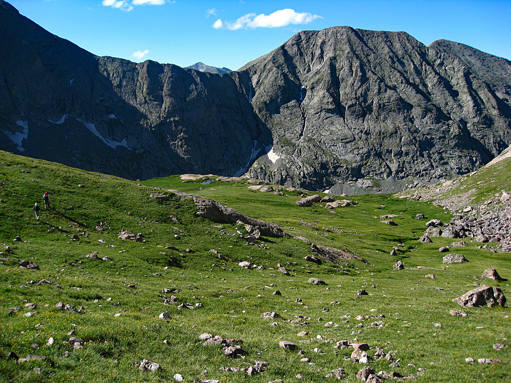
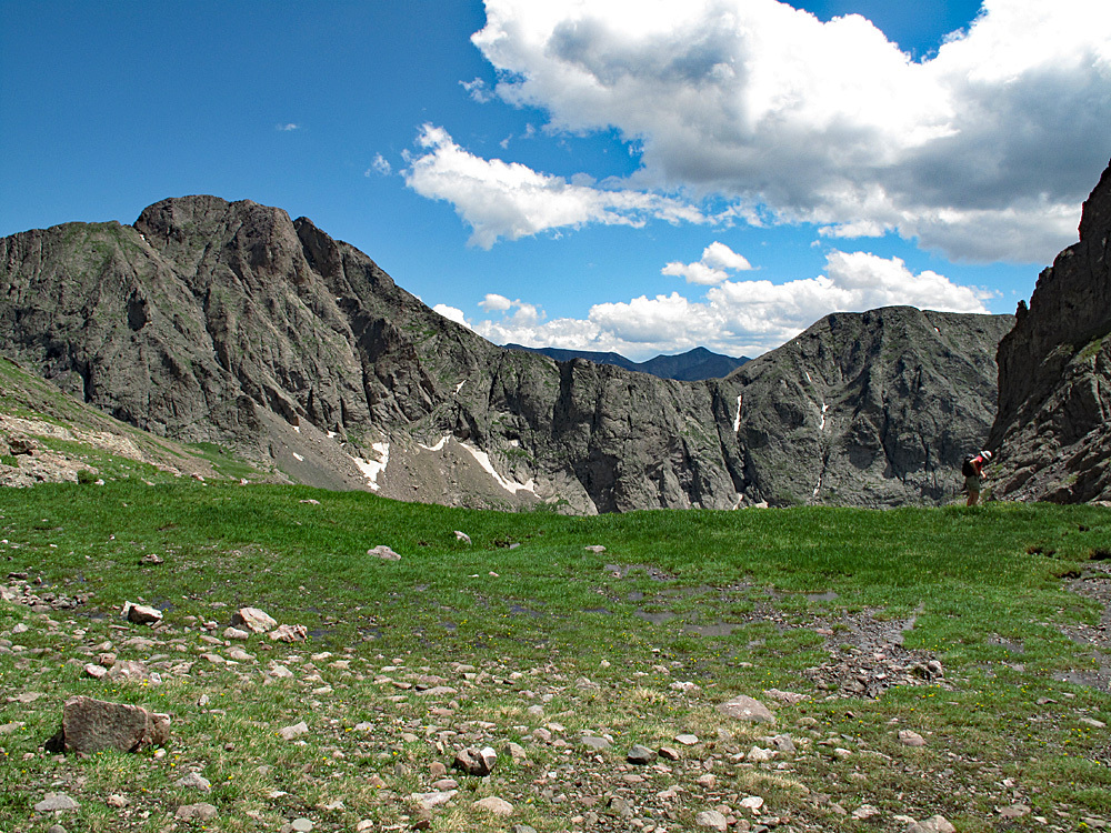
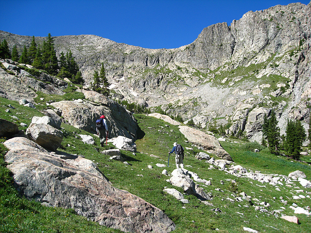
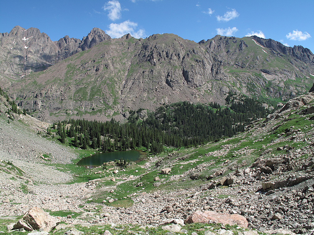
Route from Broken Hand Pass: From the end of the access route at 11,000 ft on South Colony Creek, follow either of the two trails to South Colony Lake and proceed up the trail to Broken Hand Pass as described for Crestolita. From the pass, drop about 200 feet in elevation on the trail to Cottonwood Lake and watch for a trail to the left (south) that contours over to the Broken Hand/Crestolita saddle. (Alternately, if climbing Broken Hand, drop straight from the summit to the same saddle on mixed tundra and scree and rock.) Enjoy the amazing view of Crestone Needle from this saddle. From the saddle, continue south on lush grass and tundra losing about 350 feet elevation to a flat, marshy area with several reflective, small tarns. From this location, obtain a view down into Cottonwood Creek below and aim for near the last group of trees you see and for a break in the willows surrounding the creek. From the tarns, begin a steeper descent punching your way through willows and dense evergreens, avoiding short cliffbands and rocky outcrops as best you can, while dropping down steep chutes at times. Cross the creek near a beautiful waterfall on some large boulders and once across, contour somewhat uphill for half a mile to the small but beautifully situated lake at just above 11,800 ft., WNW of the UN13,028 summit.
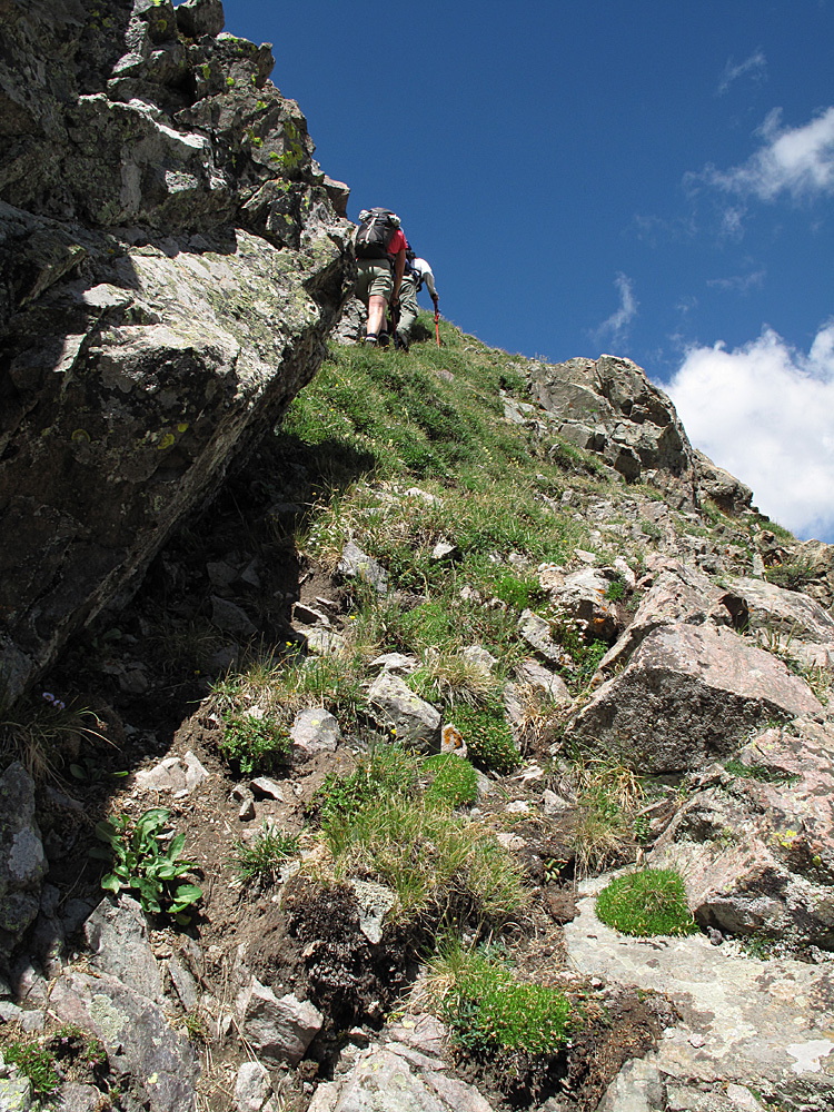
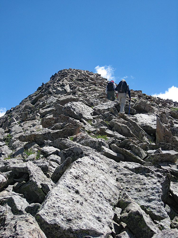
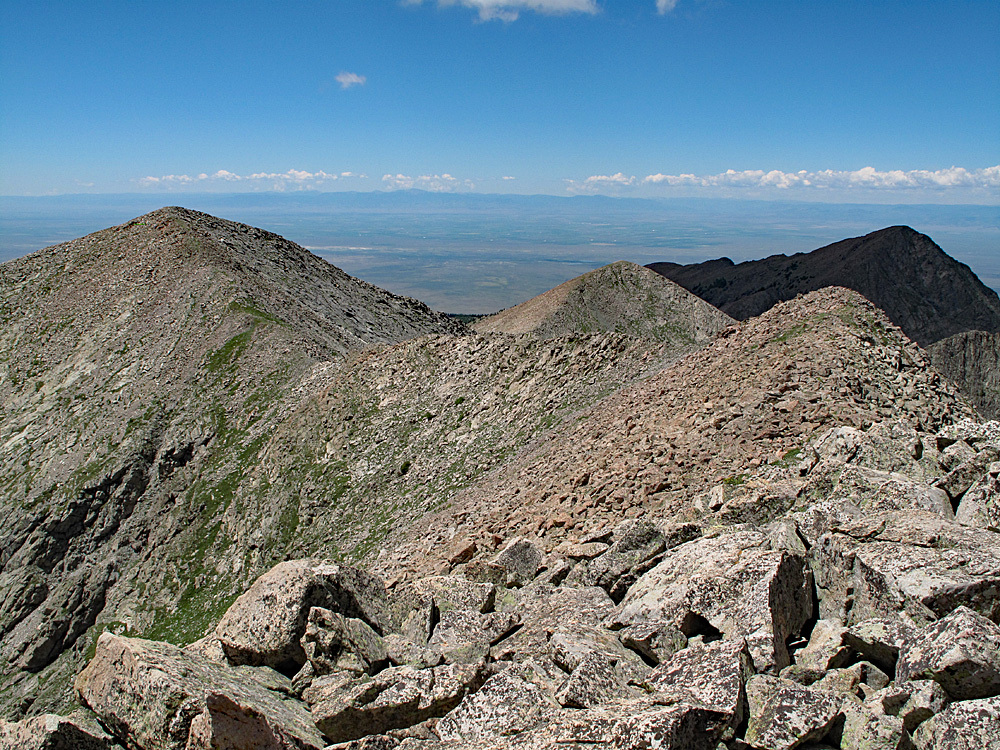
From the small lake, we had first assumed we would have to climb more directly south to the saddle between the 12,795 point and 12,989. But as we headed that direction, we found a series of tundra benches that led us upward, first SE, then east toward the ridge north of the 12,989 point. The benches led to some steep tundra ramps and higher up the tundra finally gave way to rubbly rock. Once on the main ridge, easily walk NE, then east over broken rocks and rubble to the summit. Enjoy an amazing view of the Crestones, Crestolita, Pico Asilado, Music Mountain, etc. To return, basically reverse your route. Doing this summit alone will require nearly 4,600 feet in total elevation gain for the day. Combining with Broken Hand and/or Crestolita will possibly add another 1,000 ft.
Additional BETA
Links to other information, routes & trip reports for this peak that may be helpful. -