LoJ: #583 (Pre-LiDAR #595) / 13,082' UN 13082 Formerly UN 13070
Peak Summary
UN 13,082 is another Class 2 summit located at either the head of Pomeroy Gulch out of St. Elmo, Grizzly Gulch or the North Fork of the South Arkansas River and North Fork Reservoir. The old townsite of Hancock south of St. Elmo provides the only non-4WD access. All others require 4WD. We have sequenced UN 13,082 with Pomeroy Mountain with a trailhead start at the North Fork Reservoir. This provides for a very short & quick hike. UN 13,070 could also be combined with Grizzly Mountain for a much longer day from the same start. Lidar increased elevation by 12 feet.
UN 13,082 SW Ridge Route
-
-
North Fork Reservoir TH
From Poncha Springs and the intersection of US285 and US50, head west approximately 6.6 miles on US 50 to the little town of Maysville and turn north onto County Road 240 which will become FR240. It's easy driving to the Angel of Shavano Campground and the crossing of the Colorado Trail on pavement. Beyond there, the road begins to degrade and ultimately becomes a slow, rocky affair. For the next 1.3 miles, maps show it as passable for passenger vehicles, but don't count on it. Best to just bring the 4WD with better clearance that can handle the rocky surface. It's 4.7 miles from the campground to the old townsite of Shavano and a trail that heads up Cyclone Creek. This could become an exit point for a climb of Grizzly or an alternate route. The USGS map amd FS2016 show an old roadbed/trail that heads up Cyclone Creek here, but the Trails Illustrated and San Isabel NF map do not show it. It has been in disuse long enough that iot's difficult to spot any of it on Google Earth. From the old townsite area of Shavano, it's another 2.25 miles to the North Fork Reservoir Campground, on the east side of the reservoir. This is a very limited facility with only about 8 sites. We are using it for the "trailhead," though the actual start to Grizzly is farther up the road if continuing on to Billings Lake. 4WD can be driven all the way to there. The start for Grizzly we suggest is about 2/3rds of the way up to Billings Lake. Drive or hike from the campground north on the road and begin the climb after crossing an intermittent stream at these coordinates: N 38° 37' 11.27" W 106° 19' 26.82".
Camping
There are two national forest campgrounds: The Angel of Shavano and the North Fork Reservoir. Expect both to be full on weekends. Both are fairly small and the Angel of Shavano CG is a favorite launch point for those climbing the 14ers. Between the two campgrounds there are a number of primitive sites just off the road that can be used.
Campsite Locations
North Fork Reservoir CG › N 38° 36' 41.91", W 106° 19' 09.24"11,470 elevation
-
From Pomeroy Mountain
Click thumbnail to view full-size photo + caption
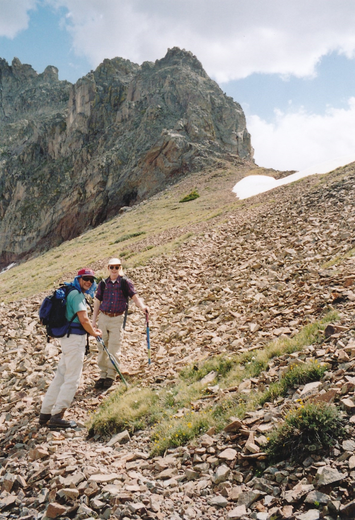
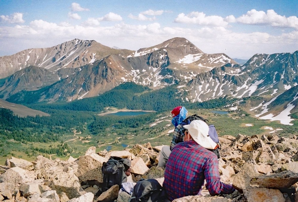
Open This Route in a New WindowFrom the North Fork Reservoir Campground, head back to the main road (FS240) and walk or drive up toward Billings Lake. Before reaching the lake, turn left onto a 4WD track at these coordinates: N 38° 37' 14.44" W 106° 19' 28.34". Follow the track across tundra, willows and past a few trees to an intersection with another 4WD track at these coordinates: N 38° 37' 01.69" W 106° 19' 48.70". You should be just north of a small, intermittent stream that drains down from the bowl east of the saddle between Pomeroy and Sewanee. Hike west toward the saddle, working through willows as best you can and staying on the north side of the creek/drainage. When the drainage makes a turn to the SW, keep hiking more to the west to avoid a large area of talus. There's a very old track that you may intersect that will cut diagonally SW to gain the saddle between Pomeroy and Sewanee. You may be able to find it at these coordinates: N 38° 37' 07.24" W 106° 20' 36.56". The track leads through the chiprock to the saddle. At the saddle, you'll be just below the rugged north cliffs of Sewanee. That summit is not ranked. From the saddle, turn north and hike the crest of the ridge to the summit of Pomeroy on mostly chiprock & rubble with no real difficulties. Pomeroy offers a nice view of the entire North Fork Basin as well as the Pomeroy Lakes to the north and Grizzly Gulch. We have sequenced Pomeroy with UN 13,070. Though that summit is even lower, it would make little sense to leave it hanging.
Click thumbnail to view full-size photo + captionRoute Description
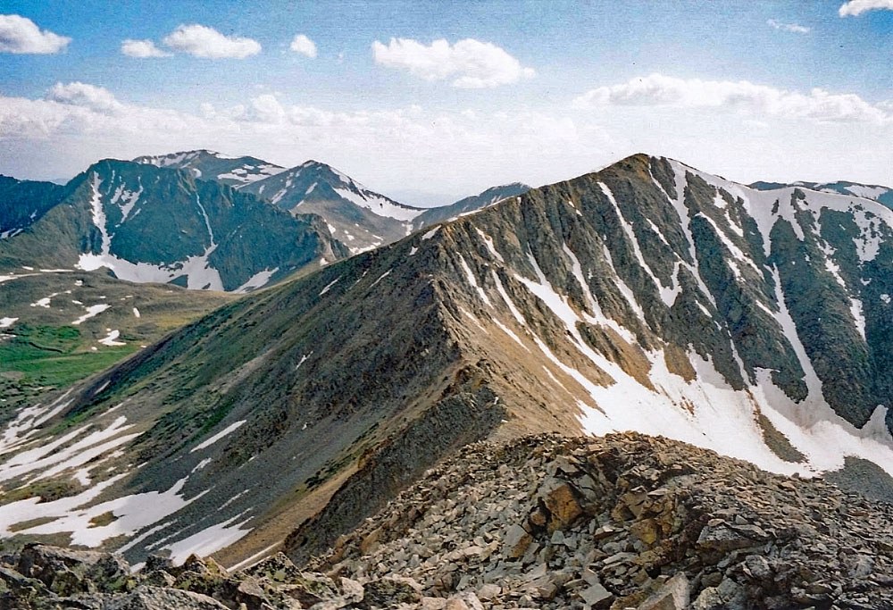
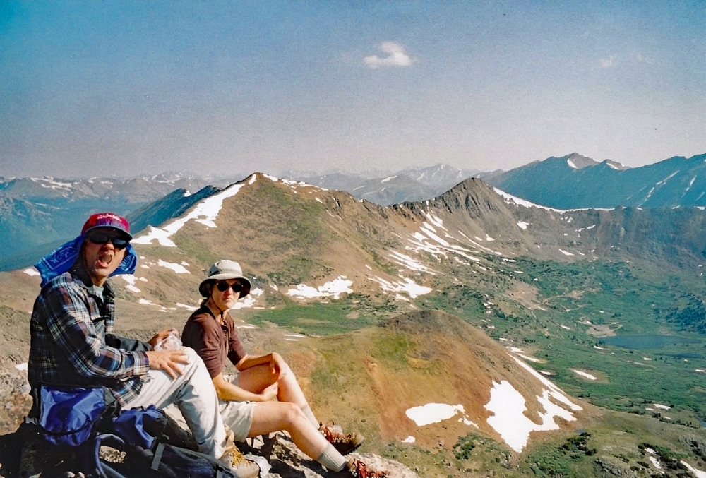
Year Climbed: 2005UN 13,082 is sequenced with Pomeroy Mountain. One-way mileage and elevation gain are measured from the summit of Pomeroy. Round-trip mileage and elevation gain assume completion of the sequence.From the summit of Pomeroy Mountain, descend the ridge heading NE toward UN 13,082, staying generally on the south side of the ridge crest. The first part of the descent will be on the chiprock & talus. About 230 feet down in elevation, after crossing an area of some tundra, the ridge gets rougher with several rocky ribs to cross. This is the Class 2+ section. Once you reach the saddle, continue along the ridge, now more on the north side of the crest where you should find a use trail. The remainder of the hike is concluded on similar chiprock/rubble/talus. The summit is medium-sized rubble. It offers a great view of three drainages: the NorthFork, Pomeroy Gulch and Grizzly Gulch.For the descent, continue SE along the ridge to a saddle just west of PT. 12,831. The trip down from the saddle can be very fast and aided by a snow and/or scree descent. Glissade on sandy scree (later season) into a rock field before picking up the remains of an old mining trail that will lead back to the road in the upper basin.
Additional BETA
Links to other information, routes & trip reports for this peak that may be helpful. -