LoJ: #586 (Pre-LiDAR #591) / 13,078' "West Tellurium" Formerly UN 13074

Peak Summary
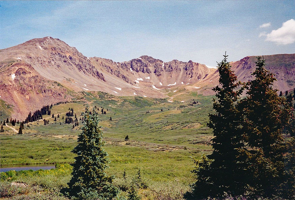
West Tellurium Peak (UN 13,078) is sequenced with Tellurium Peak (UN 13,311). While Tellurium is a Class 2+, we rate West Tellurium as a simple and direct Class 2, especially if done alone. The route begins from some beaver ponds at about 11,440 ft., well up Tellurium Creek. This access requires 4WD with good clearance. The 4WD road section is about 5 miles long. Main access to this road is from the Taylor Park Reservoir at the west end of the Cottonwood Pass Road. If looking for an easier access that does not require 4WD, there is none. The only other way into this summit and it's sister summit (Tellurium Peak) would be by the Lincoln Gulch Road that goes up to Grizzly Reservoir. That road is 4WD as well. The climb of both summits may be completed in about a half day from the suggested trailhead/campsite. Lidar increased elevation by 4 feet.
West Tellurium East Ridge Route
-
-
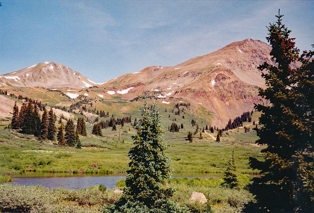
Tellurium Creek TH
From Gunnison: Drive north out of Gunnison on CO135 for 17.4 miles to Almont. Turn right onto CR/FR742 for Taylor Park Reservoir. Drive 16.7 miles to the Taylor Park Trading Post on pavement. Head north (left), continuing on CO/FR742 along the east side of the reservoir and continue for 14.9 miles to the turnoff on the right for FR584. This section of the drive is all on graded, gravel road, passable to passenger vehicles. This is the 4WD road that heads north up Tellurium Creek. Passenger vehicles will want to park here. If you have come to the Dorchester Campground, you have passed the turnoff. Go back appx. a mile.
From Buena Vista, drive west on CR306 to Cottonwood Pass. Continue west from the summit of the pass on the same road, but now signed CR209all the way down to the Taylor Park Reservoir. Turn right onto FR742 and drive to the same turnoff for Telluriium Creek as described above.
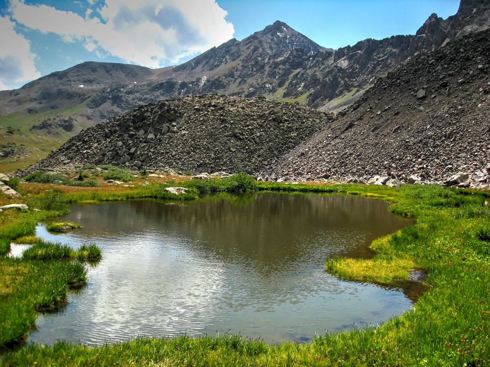
The first mile and a half of FR584 up Tellurium Creek is the roughest part. The road climbs steadily and is almost all rubble. Once the road begins to level off farther up, there will be flatter stretches that won't be so rocky and you can drive a little faster. It's about a five mile drive up this road to our suggested camp location which also becomes the "trailhead." The campsite is on the south side of the road and next to a group of tall conifers, a little south of the beaver ponds. See coordinates below. Overall, it took us about 45 minutes to drive this five mile stretch in a Toyota T-100.
Camping
There are several Forest Service campgrounds on the way to the Tellurium Creek road. These include: Dorchester (closest), Dinner Station, River's End and Lakeview. There are also numerous primitive sites in the area. The coordinates we provide for the "trailhead" are at a primitive site location. There's also a primitive site about 3.0 miles up the Tellurium. See coordinates.
Campsite Locations
Tellurium Peaks TH › N 39° 01' 22.62", W 106° 40' 07.72"Elevation 11,400 ft.Tellurium Creek › N 38° 59' 50.73", W 106° 39' 37.72"Elevation 10,725 ft.
-
From UN 13302
Click thumbnail to view full-size photo + caption
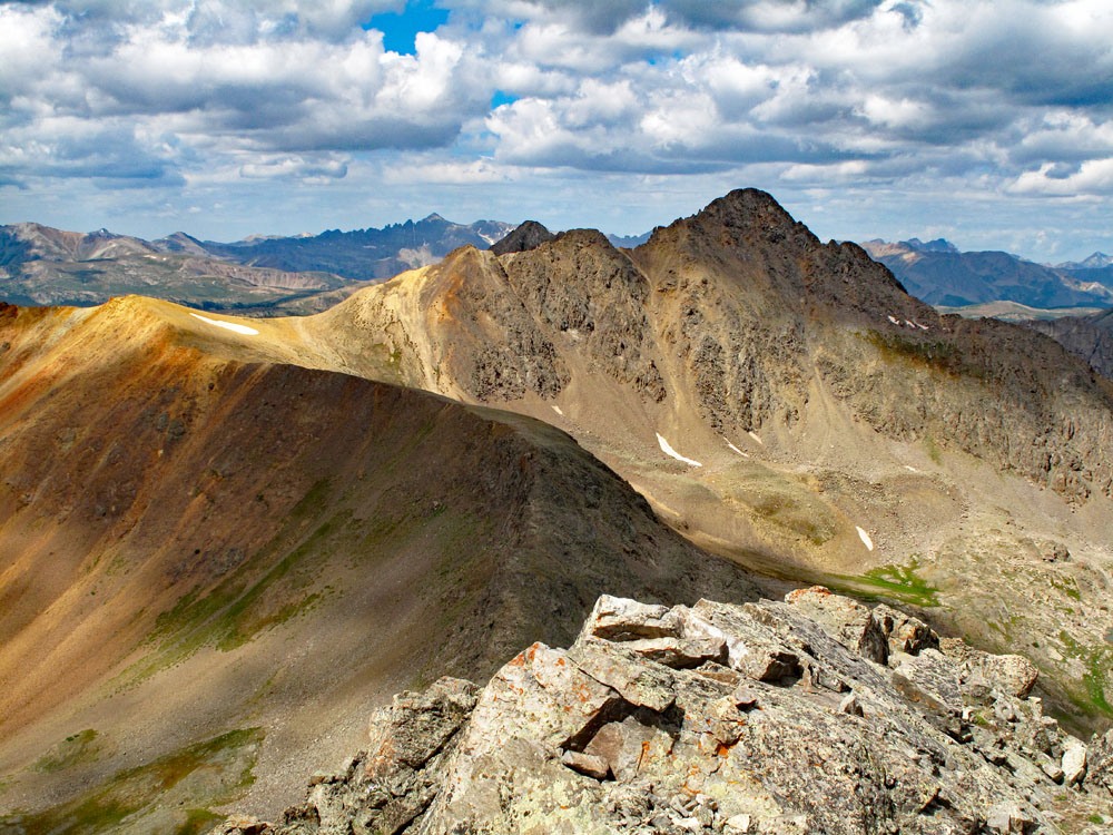
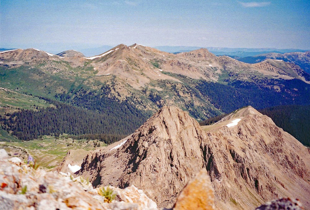
Open This Route in a New WindowFrom the trailhead/campsite, walk north up the road and stay east (right) where it forks at 11,600 ft. We found a small group of elk grazing in this area. This road leads nearly to the crest of a saddle along the southeast ridge of Tellurium Peak. It apparently plays out near an old mine up there. Getting to the saddle looked relatively easy, but following the ridge beyond there appeared to offer significant difficulties. The western ridge looked like it could pose some hidden problems as well. This we later discovered was not true. We also eyed one steep couloir that led up to the southwest ridge by first climbing up moderately grassy slopes that would give way to more difficult rock. Without any beta from other climbers we had no idea which of several routes would be best. So, we headed almost straight to the rugged south face of the peak and began ascending a steep, very rocky slope. Then we contoured into a similar couloir that plummeted down from just east of the summit. After laboring up this rock-filled gully, we then turned off to the left, working our way up a gray colored ramp of different rock that we had spotted from the bottom. This ramp brought us out on the summit ridge, just west of the summit. From here, it was a brief scramble to the top where we enjoyed a very fine view. More than likely, this way up was probably one of the most difficult ways to obtain the summit being a rugged Class 2+. Use your own judgement, but as mentioned before, we did find that the western ridge of the peak that connects over to West Tellurium did not pose any major difficulties.
Click thumbnail to view full-size photo + captionRoute Description
Year Climbed: 2003West Tellurium Peak (UN 13,074) is sequenced with Tellurium Peak and connected by ridge. One-way mileage and elevation gain are measured from the summit of Tellurium Peak. Round-trip mileage and elevation gain assume completion of the sequence.
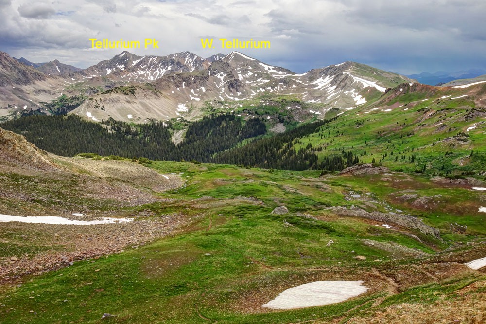
From the summit of Tellurium Peak, one may follow the west ridge of Tellurium all the way over to West Tellurium (UN 13,074). From a summit vantage point, the route will be clear to “go,” but there are a couple of sections that will provide some difficulty and slow progress a little. Hike southwest along the ridge over rocky, but manageable terrain. Along the way, we did encounter just a few, rocky outcrops that required a little attention to negotiate, but overall, we had no real problem along the entire section of ridge to the saddle just east of West Tellurium. At the saddle, climbers may desire to pause for a break and study the faint trail into Brooklyn Gulch to the north, looking for possible routes up some of the other peaks in that area. From the saddle begin the ascent to West Tellurium. This should go fairly easily with only moderate scrambling over loose rock and some tundra mixed in. It took us less than a half hour from the saddle to make this summit. The view here offers a good perspective of the many peaks located up Lincoln Creek and also Tabor Peak, Difficult BM and New York Peak. The main group of summits in the Elk Mountains are also visible, not too far west.
For the descent, return to the saddle east of the summit, or descend directly south along a south facing ridge line. Either way you can intercept trail/old roadbed. If you descend to the saddle, you should find an old trail/roadbed on the west side of Ptarmigan Lake. If you descend along the south ridge, you should intercept a trail that crosses the ridge at about 12,400 ft. Once on trail, drop past the west side of Ptarmigan Lake and follow the trail/roadbed back down to the beaver ponds and the trailhead/campsite. An early season descent can offer some nice glissading.
Additional BETA
Links to other information, routes & trip reports for this peak that may be helpful. -