LoJ: #579 (Pre-LiDAR #584) / 13,085' "North Traverse Peak" Formerly UN 13079
Range ›
Gore Range
Quadrangle ›
Willow Lakes
Summit Location ›
 N 39° 40' 15.65", W 106° 14' 21.67"
(Not Field Checked)
N 39° 40' 15.65", W 106° 14' 21.67"
(Not Field Checked)
Neighboring Peaks ›
"Mount Solitude" [Formerly UN 13090 B]
Keller Mountain
"Grand Traverse Peak" [Formerly UN 13041 B]
Peak Summary
North Traverse Peak is actually Point 13079 on the Willow Lakes Quad. It is the northern end of a ridge often referred to as "The Grand Traverse," which is a sought after route by climbers and peakbaggers seeking high altitude adventure. The 3/4 mile long traverse from North Traverse Peak to Grand Traverse Peak to the south is at least a Class 4 scramble, but North Traverse Peak, when accessed from Bighorn Creek is no more than a Class 2+ ascent. The Bighorn Creek trailhead is accessible to all passenger vehicles. North Traverse may be completed as a day hike from the Bighorn TH and even combined with Keller Mountain for a much longer day, but there's also a nice weekend backpacking opportunity by coming in from Bighorn Creek and that's how we climbed these two summits. Lidar has increased the elevation by 6 feet, but don't expect the quad to change that anytime soon.
North Traverse North Ridge Route
Class 2+

Backpack + Medium Day
Climbed with
Keller Mountain
RT From Bighorn Creek:
14.1 mi / 5,715'
RT From
Old Cabin 10,810 ft.
with
Keller Mountain:
6.5 mi / 3,515'
From Keller Mountain:
1.70 mi / 740' (One-Way)
-
-
Bighorn Creek TH
From either direction on I-70, take exit 180 about 4 miles east of the main town exit for Vail. As you exit, go south and onto Bighorn Road. Drive east on that road .8 mile and turn left onto Columbine Drive. This road is easy to miss and climbs steeply uphill, goes back under the interstate and then comes to a very small trailhead parking area amid some condo units. There are only six parking slots. If unable to park here, you may need to go back to the Bighorn Road/Interstate interchange area where there's a parking lot on the south side of the interstate, just as Bighorn Road makes its turn to the SE.
Camping
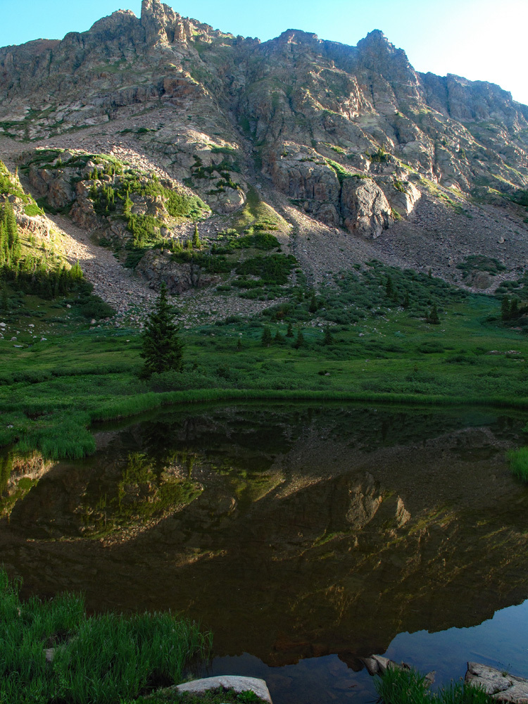
A few miles east of the trailhead parking back on Bighorn Road is the Gore Creek Campground, a National Forest Service fee area with vault toilets and water. Reservations may be made for campsites at www.reserveamerica.com. Other than that, there is virtually no other place close by with at-large/primitive camping. Your best bet may be to go up to the summit of Vail Pass and drive down the Black Lakes Road where there is a pullout parking area right where the road is barred from vehicular traffic and becomes the Vail Pass bike trail, east end. This is not a primitive camp location but you may be able to sleep in your vehicle.
Campsite Locations
Gore Creek CG › N 39° 37' 37.13", W 106° 16' 26.43"Elevation 8750 ft. National Forest Fee campground
-
From Bighorn Creek TH via Old Cabin 10,810 ft. & Keller Mountain:
-
Keller Mtn. South Ridge Class 2+ / 2.8 mi / 2,775’ One-Way
Click thumbnail to view full-size photo + caption
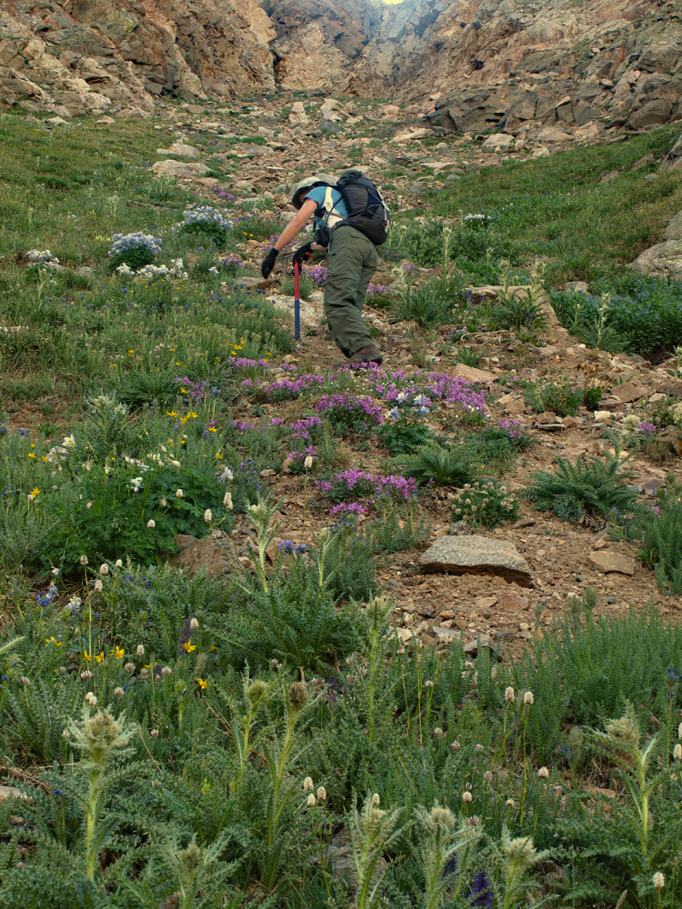
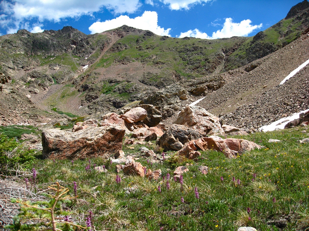
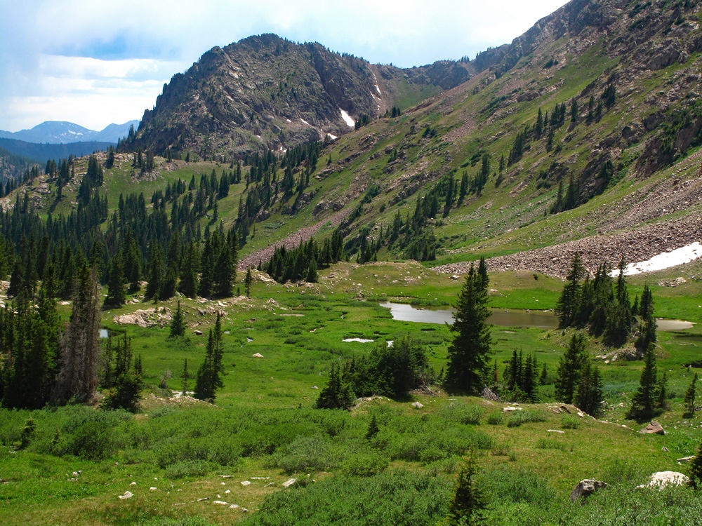
Open This Route in a New WindowFrom the old cabin at 10,810 ft., head up valley to a pass on the ridge connecting Keller with N. Traverse. The trail to the cabin continues beyond it for about ¼ mile before playing out in open meadow filled with flowers. Continue up the center of the drainage encountering more trail remnants from time to time and perhaps pass a campsite with an old fire ring. Sometimes you may see some cairns. There are some nice grassy meadows and open tree areas. At about 11,300 to 11,400 feet, there's a more marshy area with ponds that may not show on the USGS map. In about one hour, you should arrive at the head of the basin and will have to make an ascent choice; climb directly to the saddle up a rough couloir filled with loose rubble or ascend on the left side of the gully and then veer left farther up onto a mostly tundra slope that will intersect the ridge to Keller a couple hundred feet above the Keller-N. Traverse saddle.
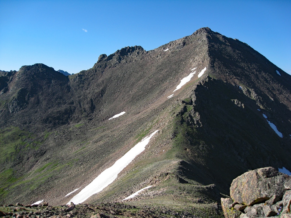
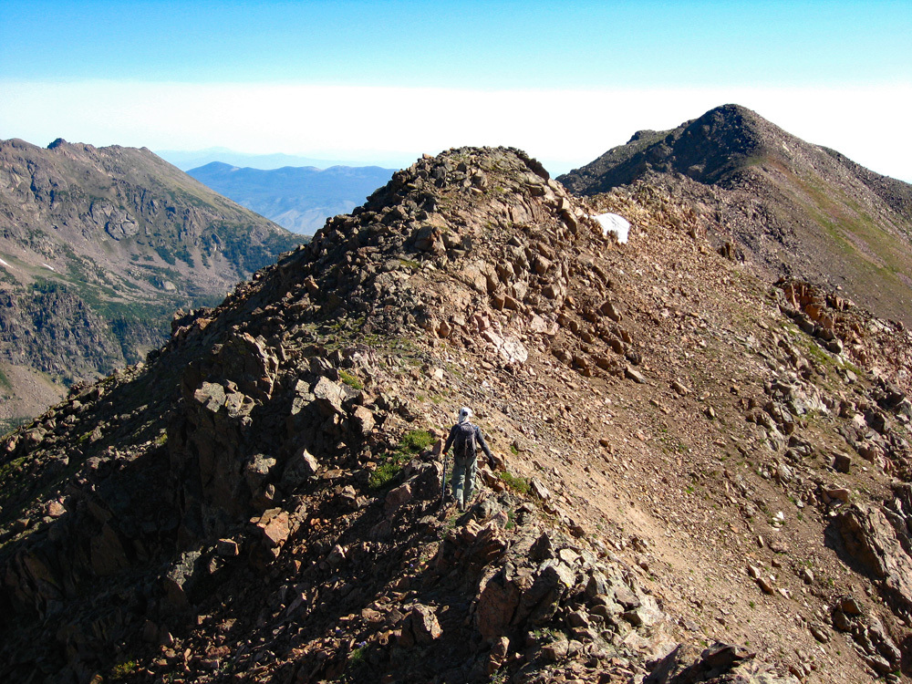
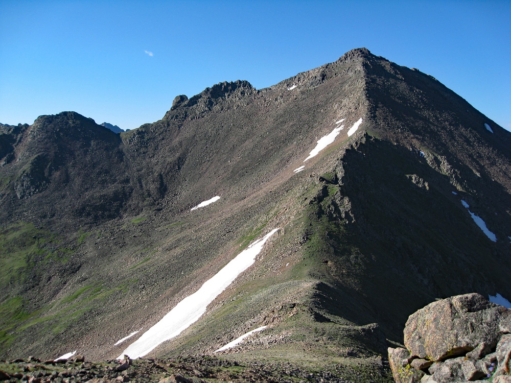
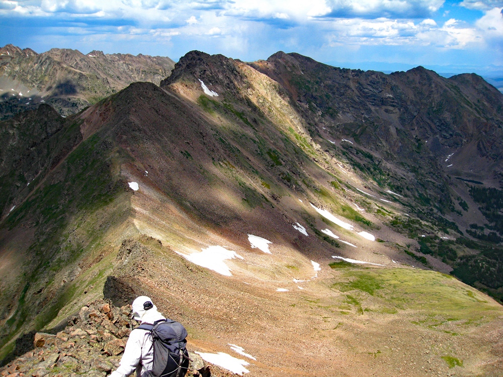
Continue on to the first false summit – a no counter that we contoured around on the south & east side. The next mile of ridge is mainly intermittent tundra & rock. Intersecting the ridge further on as it turned more easterly after that first false summit, continue hiking as much as possible on the ridge crest. We encountered several rocky crossings & sections that slowed progress, but there was never anything above a little hard, one-hand-down class 2+ scrambling at a couple of drops. Descend to another saddle, climb back up and cross a section of sloping slabs and a short, knife-like edge. Then comes the final pull to the summit which is easier. The two summits of nearly equal height are about 5 minutes apart. The eastern one appears as high so we climbed both, but the western summit is higher. From the first false summit, it's .9 mile to the true summit - and will take longer than expected. Some people may consider a few spots along the ridge to be 3rd class, depending on exact route selection. Any such spots are very brief and minimal exposure.
For the return, go back as you came. If including North Traverse, just follow the connecting ridgeline to the saddle and over.
-
Click thumbnail to view full-size photo + captionRoute Description
Year Climbed: 2012In the statistics provided, we have sequenced North Traverse with Keller. One-way mileage and elevation gain are measured from the summit of Keller to North Traverse. Round-trip mileage and elevation gain assume completion of the sequence. To make this traverse from Keller to N. Traverse, simply follow the connecting ridge between the two summits. The description below is written as though you were climbing N. Traverse first from the cabin at the end of the backpacking approach. It will provide details regarding the section of ridge up to N. Traverse.
From the old cabin at 10,810 ft., head up valley to a pass on the ridge connecting Keller with N. Traverse. The trail to the cabin continues beyond it for about ¼ mile before playing out in open meadow filled with flowers. Continue up the center of the drainage encountering more trail remnants from time to time and perhaps pass a campsite with an old fire ring. Sometimes you may see some cairns. There are some nice grassy meadows and open tree areas. At about 11,300 to 11,400 feet, there's a more marshy area with ponds that may not show on the USGS map. In about one hour, you should arrive at the head of the basin and will have to make an ascent choice; climb directly to the saddle up a rough couloir filled with loose rubble or ascend on the right hand side.
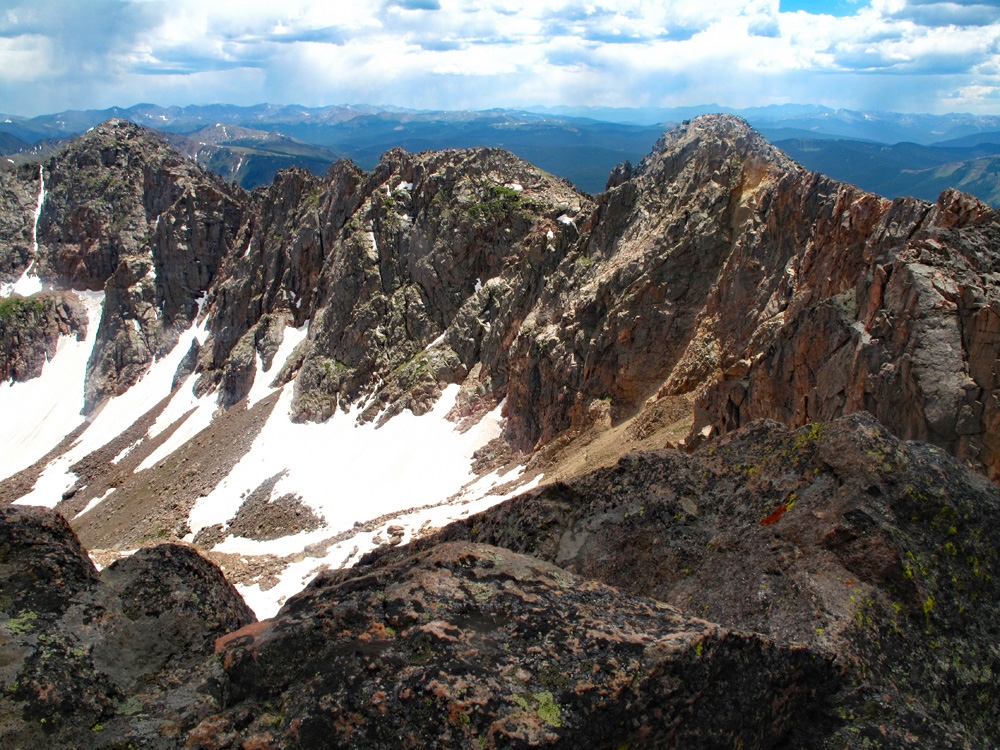
If heading off to the right and more toward an upper section of the ridge north of N. Traverse, for a while, you'll be able to amble up on steepening tundra after crossing some scree, but the tundra eventually gives way to more scree and rubble as you head for the ridge. We intersected the ridge about 200 – 300 feet up from the saddle. Beyond this point, the remaining ridge to the summit consists of rocky blocks. It was hard class 2 with what some may regard as a few, very brief class 3 moves thrown in to keep it a little more entertaining. It will take only a short time to arrive at the very rocky summit. From your summit vantage point, enjoy an excellent view of the “Grand Traverse" route. There are no ranked 13,000 foot summits along that ridge until you get to "Grand Traverse Peak," UN13,063. Return as you came if not doing the traverse, or head on over to Keller if you've not done it already.
Additional BETA
Links to other information, routes & trip reports for this peak that may be helpful. -
"Fear is such a powerful emotion for humans that when we allow it to take us over, it drives compassion right out of our hearts." Thomas Aquinas
Warning!
Climbing peaks can be dangerous! By using this site and the information contained herein, you're agreeing to use common sense, good judgement, and to not hold us liable nor sue us for any reason. Legal Notice & Terms of Use.