LoJ: #576 (Pre-LiDAR #581) / 13,089' "Ribbed Peak" Formerly UN 13085 A

Peak Summary
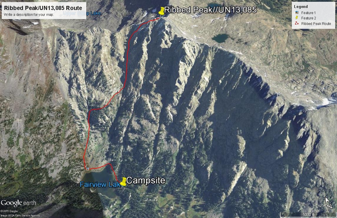
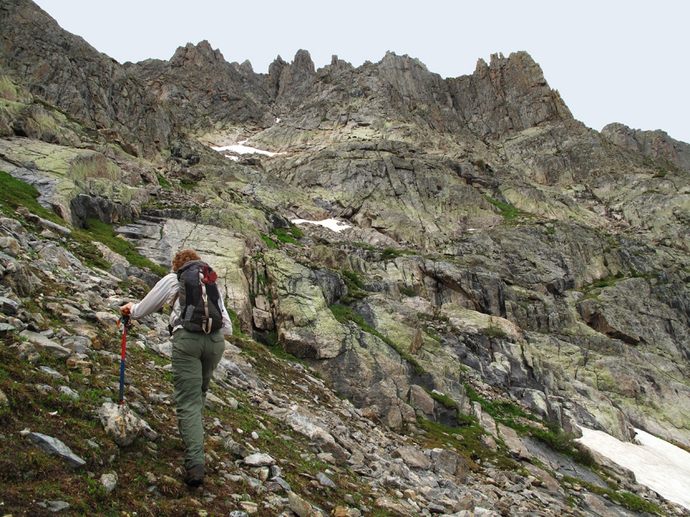
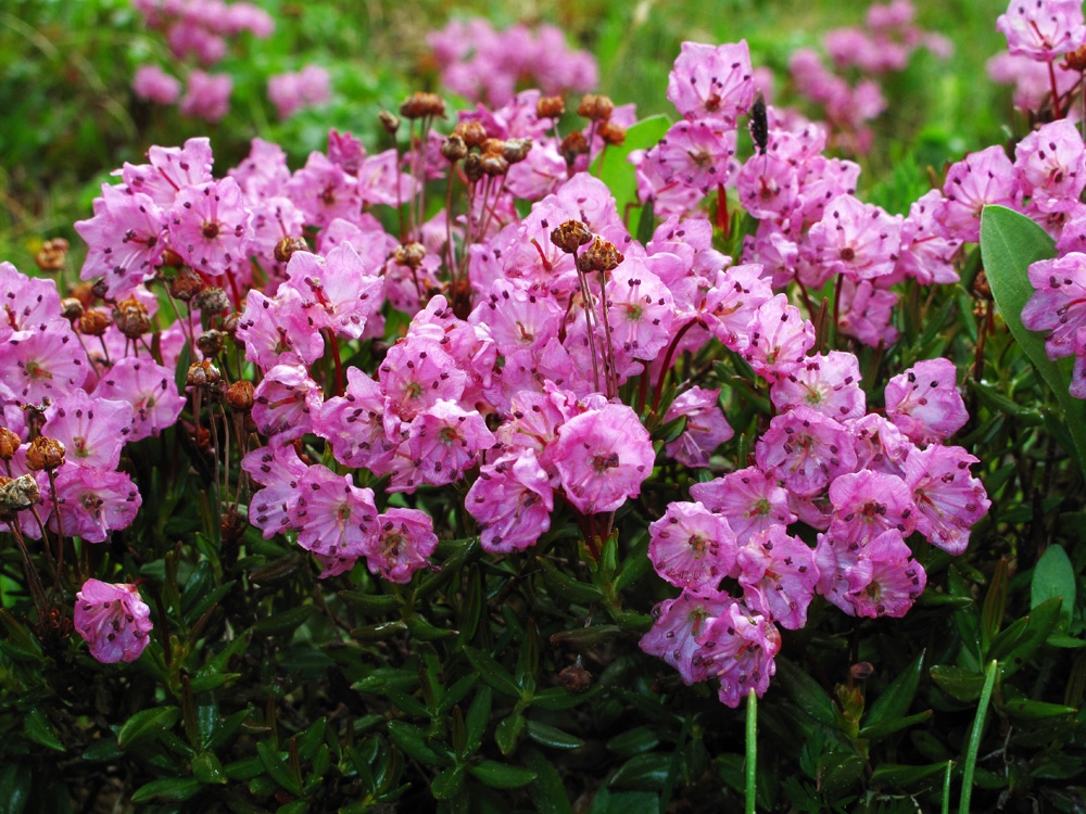
We think Ribbed Peak is destined to become a Colorado "classic" climb. This is either a very long day climb or a 2 day, overnight backpack. Beautiful campsite possibilities abound and abundant wildflowers. As a backpack, the trail into Fairview Lake is not too difficult and can be done in about 4 - 5 hours, but see more below. Beyond Eagle Lake, (and getting around that lake can be difficult) the trail becomes difficult to follow at times. Avalanche debris has obscured the trail in recent years and made the trek far more obscured and difficult. Climbing the peak from Fairview Lake is not as difficult and intimidating as it looks. It's mostly stiff 2nd class with some modest 3rd class as you approach the main summit area. Highly photogenic hike. Lidar increased elevation by 4 feet.
Southwest Face Route
-
-
Eagle Lake - Lime Creek TH
From Basalt, drive west toward Ruedi Reservoir on CR 104. Drive on around the reservoir and continue east to Thomasville where you'll turn north onto CR 4A.4. This road leads over Crooked Creek Pass to Sylvan Lake State Park and eventually to Eagle. Turning north on the Crooked Creek Pass road, you'll gain lots of altitude on the steep, graded dirt road. About 7 miles up, turn right onto FR 507. Drive 1.6 miles to the trailhead parking for Eagle Lake. The parking area is limited in size and is less than a half mile short of Wood's Lake, which is on private property. This last 1.6 mile section is where a passenger vehicle with better than average clearance is desirable.
You can also drive to the trailhead from Eagle. Exit the interstate for Eagle and drive south into town through the traffic circles. Watch for signs indicating the turn to Sylvan Lake, which is on CR 307. Drive south through town, then SE and back to the south. Pavement ends in about 10 miles. Continue on good quality graded dirt road to Sylvan Lake, staying right at an intersection about 10 miles out of town. You'll then be on FR400. Follow it for another 4 - 5 miles to Sylvan Lake. Continue past the lake, still on FR400. The road becomes rougher now as you drive another 4 miles to the summit of Crooked Creek Pass, then down the other side another 2.5 miles (appx.) to the turnoff for FR 507 to Woods Lake and the Eagle Lake TH. A climbing companion of ours made it across the pass in a passenger vehicle, carefully driven, but you'll likely be more comfortable driving over the pass in a a vehicle with better clearance.
Camping
There is no good camping right at the trailhead, however, a short distance before the trailhead, there are a few spots right off the road. There is a very nice camping spot two miles in on the trail after you have passed the private property around Wood's Lake. The next good camping is at Eagle Lake on the north shore and a nice campsite exists on the SE end (inlet area) of Fairview Lake, as well as several other possibilities on the hike to Fairview. Much further away, there are several campgrounds back at Ruedi Reservoir.
-
From Eagle Lake - Lime Creek TH via Fairview Lake
Ribbed Peak can be combined with UN13,100B as a very full and long day hike. The traverse from UN13,100 to Ribbed may take from 2 - 3 hours. You can read more about that traverse under UN13,100B. For those who may like to backpack in as far as Fairview Lake, we offer this little bit of "approach" information.
From the trailhead parking, a well-marked and used trail #1915 heads out NE across open meadows before entering aspen forest. In later June, the wildflowers in this meadow and throughout the lower elevation forest are amazing. The trail exists to skirt the private property around Wood's Lake, so it gradually gains nearly 400 feet in elevation for the first mile before losing much of that elevation to drop back down to and reconnect with the road that exits the property at its east end and continues to an old building and a sturdy bridge across Lime Creek. There's a great campsite shortly before that crossing.
Once across the bridge, there's a Wilderness Registration where you can obtain your permit for overnight camping. Immediately after, the trail climbs up steeply and then quickly levels to wind its way east back to Eagle Lake. It gains elevation in pitches with intervening level areas. There's a waterfall on Lime Creek along the way.
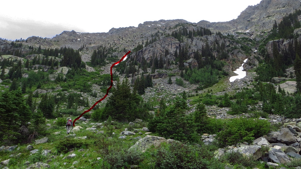
When you arrive at Eagle Lake, (about 1:45 from the TH) you must cross the western outlet on a log jam mass to resume the trail along the north shore of the lake. Not long after crossing are some "designated" campsites. Midway along the north shore is another good camping area near where a promontory juts into the lake. Beyond the lake, the trail heads into forest, crosses into an open area which is the bottom of an avalanche chute that you use to access UN13,100B, then re-enters forest. There is an area of downed timber that makes following the trail difficult. Beyond Eagle Lake, we don't think the trail receives maintenance anyhow. Do the best you can to follow it to Halfmoon Lake and beyond there, the trail becomes a little more evident, except for where it crosses an open, grassy meadow. A little bit before Fairview Lake, the trail gains elevation steeply and then crosses a small rise to offer a splendid view looking down onto the lake. Walk around the north shore of the lake to the eastern an excellent and large campsite.
Camping
Best camping spots on the approach are: 1. Just past the eastern end of the Wood's Lake private property where the bypass trail joins back in with the old roadbed; 2. At the designated sites along the northern shore of Eagle Lake; and 3. The eastern end of Fairview Lake above the inlet maybe 50 - 100 yards in some trees. This site could accommodate several tents. Trout abound in the nearby stream & there's a small double waterfall & pool.
Campsite Locations
E. Woods Lake Cmpsite N 39° 25' 59.18", W 106° 37' 00.12"Elevation 9,475Fairview Lake Campsite N 39° 25' 30.14", W 106° 34' 13.48"Elevation 10,730
Open This Approach in a New Window
Click thumbnail to view full-size photo + captionRoute Description
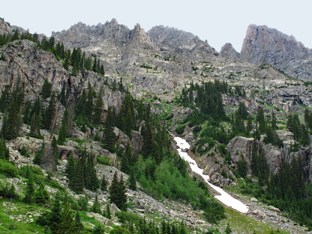
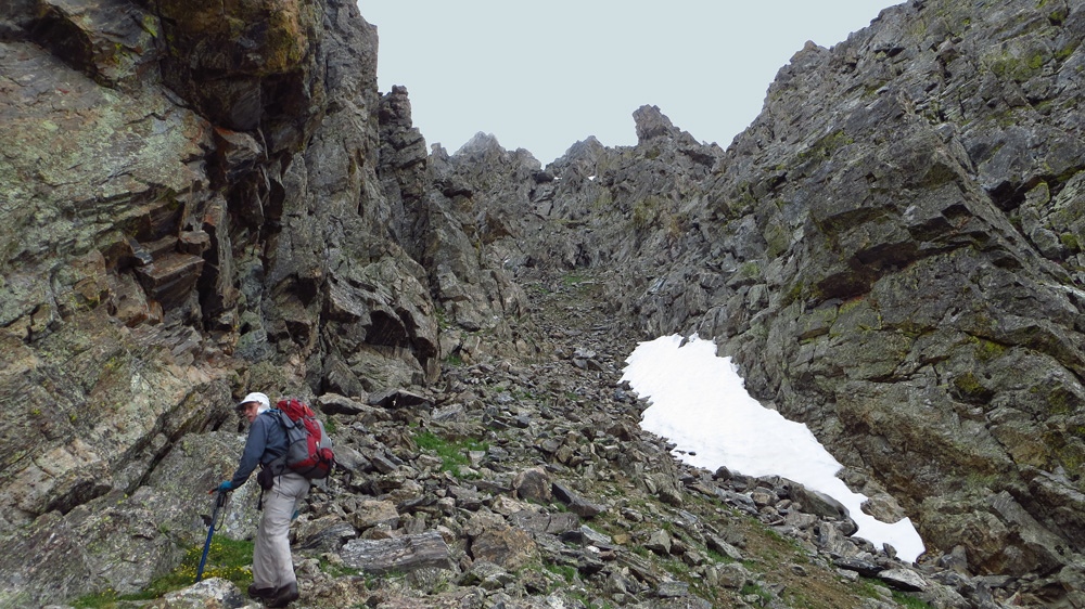
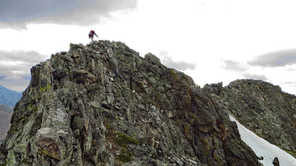
Year Climbed: 2013From Fairview Lake, there are 3 "ribs" that descend to the lake from near the summit of the peak. Head up the drainage that is the western most that drops toward the lake at its western end. Hike mostly on tundra for a short while. When the drainage splits, we stayed in the west fork, but it may not matter a lot. Clamber over boulders and continue up drainage until you've gained to about 11,400 ft. Climb out of the increasingly entrenched gully, before it becomes too entrenched to escape, to the right (it can be rather difficult to find a good exit and may require some thrashing through low evergreens) and gain the rib in the tree line area. Continue up through thinning trees, tundra and sporadic boulders until you can begin to see the jagged summit area. Cross over and contour upward toward the next drainage to the east. This is the middle drainage that empties directly into Fairview Lake, now far below. Cross boulders and slabs to gain the drainage and then continue up the couloir on mostly boulder-type rubble. The couloir narrows and becomes filled with more rubble. Continue to the head where it drops precipitously to the north. Climb out to the east (right) and follow the ridge crest over a false summit to the true summit (some 3rd class and a little exposure.) This will take you along a narrow ridge crest for a short distance, but the rock is fairly stable. Most of the rock consists of large boulders. Time from Fairview camp to summit was just under 3 hours.
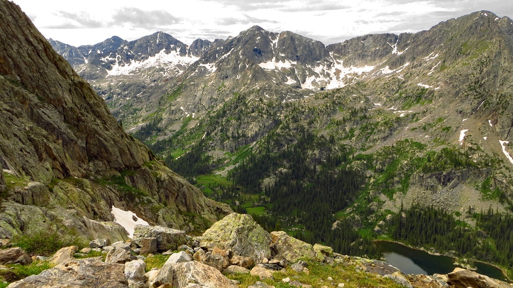
If you think you may ever want to climb some high 12ers, take a look around from the summit. This glacial valley is surrounded by high and rugged 12ers. You should be able to spot the Strawberry Lakes further up valley. For descent, reverse your route all the way back to Fairview Lake.
Additional BETA
Links to other information, routes & trip reports for this peak that may be helpful. -