LoJ: #537 (Pre-LiDAR #544) / 13,140' UN 13140 Formerly UN 13132
Peak Summary
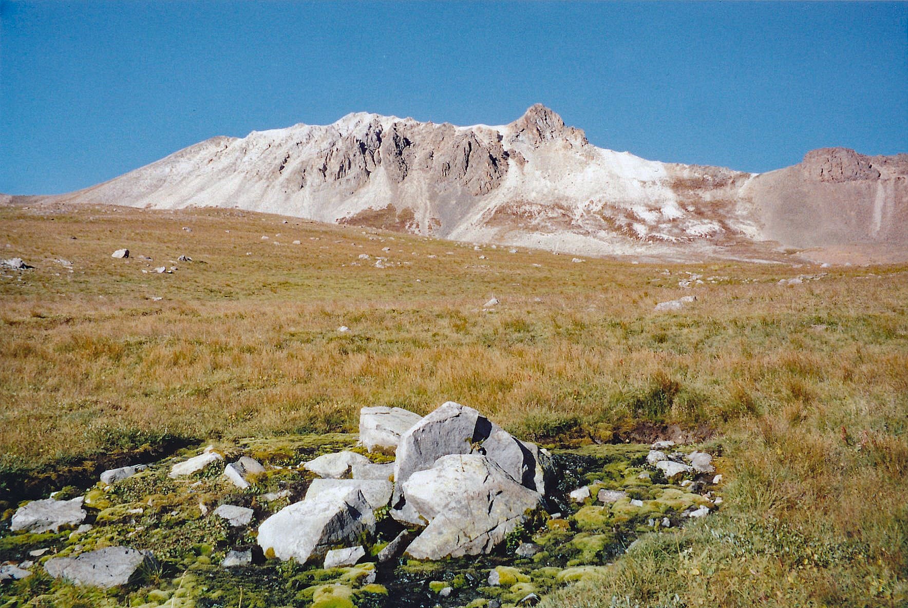
UN 13,140 is a Class 2 summit located north of Engineer Pass and the west side of American Flats. Access is from either Silverton or Lake City. From Silverton, 4WD is required. From Lake City, 4WD is highly advisable. This summit is sequenced with Darley Mountain and Cow Benchmark for a longer day of mostly tundra hiking at high altitudes. Lidar added 8 feet of elevation.
UN 13,140 SE Ridge Route
-
-
American Flats TH
There are two main access routes for the summits located around Engineer Pass and American Flats; one from Lake City, the other from Silverton.
These directions begin from Lake City. From Gunnison, go west on SH50 to the intersection near the beginning of Blue Mesa Reservoir with SH149 and turn south. From Montrose, drive east on SH50 to the east end of Blue Mesa Reservoir for the same turnoff on SH149. Drive west and south on 149 to Lake City, just over 45 miles from the previous intersection. Once in Lake City, watch for either 3rd or 2nd street. Turning west on either will take you to Bluff St. in two blocks and a left turn (south). 2nd St. is considered the "official" access to CR20 which heads west following Henson Creek, but if you take 3rd St., it passes by a nice city park with restroom and picnic tables for those who need a break before proceeding further.
Once on CR20, drive 9.1 miles west to Capitol City on a graded, gravel road passable to passenger vehicles. On the Gunnison National Forest map, this road is labelled as BLM3303. At 5.2 miles into this drive, you'll pass the Nellie Creek Road (FR877) which accesses Uncompahgre Peak and several 13ers located in that area. At Capitol City take the left fork which is the "Alpine Loop Road" that will lead over Engineer Pass, but you won't be driving quite that far. This is the continuation of BLM3303. On Google Earth, this is still CR20. Continue driving west past the "Rose Cabin" on the old USGS map. (Note: About 1500 feet east of the Rose Cabin is a solar powered vault toilet on the south side of the road, frequently used by visitors to this area.) From that vault toilet pullout, it's about another 3.6 miles west (appx.) to our suggested parking spot and trailhead for American Flats, which is nothing more than a pullout at the coordinates provided. The main goal is to locate the start of the trial that heads north across American Flats and park off the road enough to avoid blocking the frequent 4WD, ATV and ORV traffic. If you come to a beautiful log cabin perched on an overlook of the valley with a foot bridge leading over the creek to the cabin, then you still have another 1.75 miles. The parking is above treeline.
From Silverton: From the Town of Silverton, drive east on the main road through town to where the paved road splits one block past the courthouse and veer right onto the blue-signed County Road 2 (set odometer here) for 4.2 miles of nicely graded dirt road to Howardsville. (On Trails Illustrated map #141, this road is labeled #110. Pavement ends after 2 miles. This road is also known as "The Alpine Loop Road and BLM 4500.) From the Howardsville intersection, continue north another 4.3 miles to the old site of Eureka. The road will cross to the west side of the Animas River and continue up a steeper shelf section. The road begins to get a little more difficult and enters a more narrow section of the Animas River canyon. At about 10,740 ft., the valley begins to widen out again. In that location, another road heads off to the left for Picayne Gulch. It is possible to reach UN 13,075 and Hanson Peak by going up this way, but the lower section of this road is intensely steep, so only for lower gear ratio 4WD vehicles. For the American Flats TH, stay on CR2 and follow directions & road signs to Engineer Pass. This will REQUIRE 4WD. The 4WD track circles the west side of Engineer Mountain, crosses the pass and then begins its descent toward the upper reaches of Henson Creek. When you reach the summit of Engineer Pass, the proposed trailhead is only about 1,600 feet east of the pass.
Camping
There are several primitive sites to choose from all along CR20 when coming from Lake City, all the way up to our proposed trailhead, however, there are no National Forest campgrounds. At Capitol City, there is some limited camping there, but there's also private cabins & property so exercise some discretion and this area can be very popular on weekends. At the vault toilet near Rose Cabin, if you drive a short distance on a road there past the toilet, there's room for a couple vehicles. Just after Rose Cabin, where the main road veers right, there's a CR20X that stays down closer to the creek. There are several good primitive sites in there, but again, be aware of private claims. The only "facility" in all this area is the vault toilet at the coordinates provided below.
If coming from Silverton: There are no official Forest Service campgrounds in the upper Animas River valley and summer weekends can see a swarm of campers in this overall area. Something of an "RV" village tends to build up at a large flat area along the river opposite the Maggie Gulch turnoff and then at the ghost town of Eureka, there's a number of campsites east of the river. The best campsites we have found are along the spur road that leads to the trailhead for the South Fork of the Animas, aka: The"Boulder Gulch" trailhead. The road that heads into there has several primitive sites. One could also just camp at the switchback for the trailhead to Bonita. This location is open with no trees for shelter. None of these locations have facilities of any kind. Lastly, we spotted some reasonable sites in Picayne Gulch. If you turn off the main Alpine Loop Road where the Picayne Gulch Road first comes in a couple miles south of Animas Forks and drive up the CR9, there will be a branch road that heads off and climbs a ridge with trees on the south side of the gulch. Eventually that road rejoins the main Picayne Gulch Road at a switchback at 11,800 ft. We noticed some campsites along this spur road in the trees before it rejoins the main road.
Campsite Locations
Vault Toilet › N 37° 58' 34.23", W 107° 32' 03.52"Elevation 10,850 ft.
-
From Darley Mountain
Click thumbnail to view full-size photo + caption
Open This Route in a New WindowTo reach this first summit, begin by hiking north on the old roadbed/trail that heads out across American Flats, on the east side of Darley Mtn. After about a third of a mile, turn off this trail to the left, mount a small rise to another bench area and then begin hiking uphill to the NW up a moderate slope of tundra and some rock to a saddle at 13,000 ft., south of the Darley summit. Then, walk north along the ridge. As you near the rocky, pointed summit, pass to the left under the rocky little summit area on a use-trail and then scramble up to the summit from just north of it. It required just under an hour to do this at a sauntering pace. From this summit, we had an outstanding view of Engineer Pass area and the surrounding peaks including the dramatic Wildhorse Peak to the north. Either return as you came or continue north for UN 13,132.
Route Description
Year Climbed: 2006UN 13,140 is sequenced with Darley Mountain (UN 13,275) and Cow Benchmark. One-way mileage and elevation gain are measured from the summit of Darley Mtn. Round-trip mileage and elevation gain assume completion of the sequence.
Drop back off the summit of Darley to the north and contour through some scree on the west side of the peak and intersect the north ridge a little farther on. After a bit of descending along the ridge, drop down some scree on the east side of the ridge about 400 feet to a more level area that you can use to contour north. Cross a broad slope at 12,640 ft and then turn west to gain the ridge leading to the summit of UN13,140. As we headed up from a saddle, we passed through some unusual rocks formations. First there was a pinkish colored type rock and then a greenish colored rock. We had no idea what they were other than they appeared to be igneous or pyroclastic.
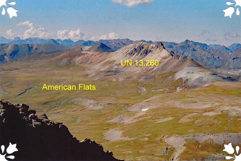
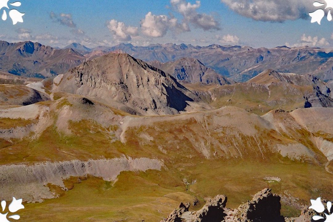
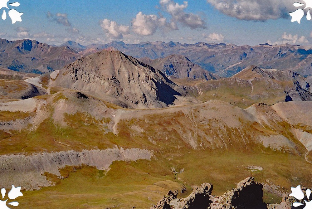
The ascent to this second summit is a little rockier as you follow something of a path that leads upward. It took us a little under an hour to make the hike from Darley to UN 13,140. There is a good view looking down into the upper reaches of the Bear Creek drainage to the west. Cow BM is the third peak in this sequence and is difficult to identify from this location on the summit of UN 13,140. It is over three miles away and even though most of the traverse is on tundra, it will still take a considerable amount of time to hike to it. It is a more isolated peak that sits above the amphitheater above Ouray. Cow BM lies along a somewhat complicated series of ridges from your present location on UN 13,140. Only attempt to continue if the weather is holding well and you have made an early start.
Additional BETA
Links to other information, routes & trip reports for this peak that may be helpful. -