LoJ: #519 (Pre-LiDAR #522) / 13,159' UN 13159 Formerly UN 13153 B
Range ›
Sangre de Cristo Range
Quadrangle ›
Horn Peak,
Crestone Peak
Summit Location ›
 N 38° 00' 46.87", W 105° 36' 53.34"
(Not Field Checked)
N 38° 00' 46.87", W 105° 36' 53.34"
(Not Field Checked)
Neighboring Peaks ›
Mount Adams
UN 13543 [Formerly UN 13580 B]
UN 13552 [Formerly UN 13,546]
UN 13543
Challenger Point
Kit Carson Mountain
Peak Summary
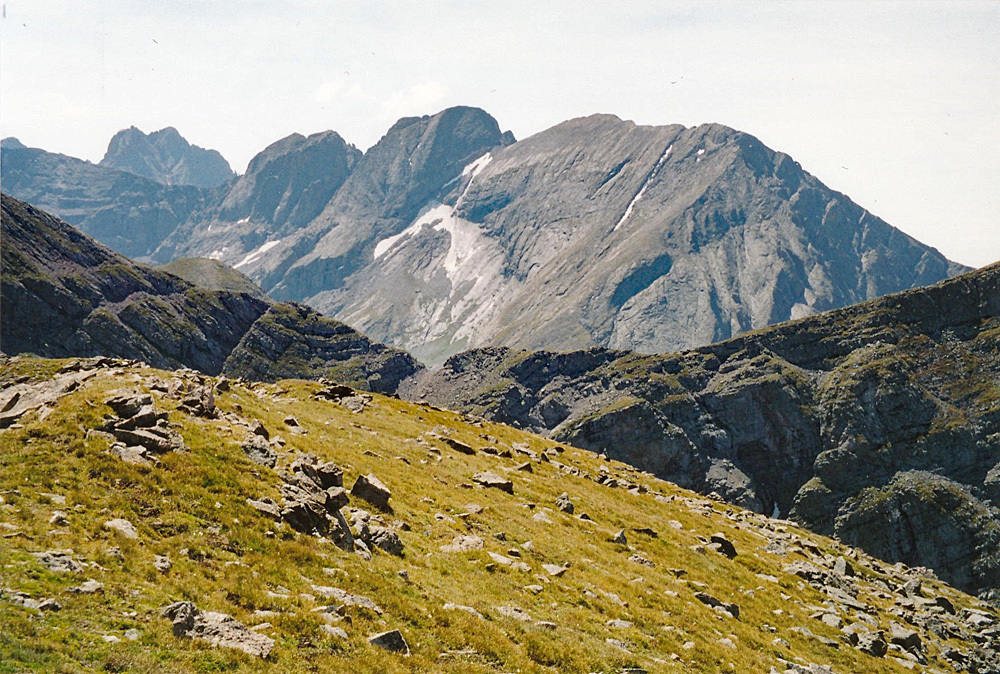
An easy, half-day summit when accessed from Willow Lake. Could also be accessed from North or South Crestone Lakes as well. Backpack in to Willow Lake and spend a few days climbing several higher neighboring peaks including two 14ers, Mt. Adams and three, tri-centennial 13ers. Trailhead accessible to higher clearance passenger vehicles. Lidar measurements increased elevation by 6 feet.
Willow Lake Access Route
Class 2

Backpack + Medium Day
Climbed with
UN 13552
RT From Willow Lake Trail #865:
11.95 mi / 5,720'
RT From
Willow Lake
with
"Formerly UN 13,546":
2.95 mi / 3,035'
From "Formerly UN 13,546":
1.20 mi / 655' (One-Way)
-
-
Willow Lake Trail #865 TH
The trailhead is located east of the small town of Crestone. Take US 285 south from Poncha Springs, over Poncha Pass for 21 miles and turn left onto CO17, another four miles south of Villa Grove. Drive another 13 miles to Moffat and turn left onto "T" Road, aka: Russel St. Drive about 13 miles east to Crestone. T Road will make a 90 degree jog right, then back left and a couple miles further will make a shorter jog left, then right. As the road enters the town, it will make a couple jogs again before you reach the center of town. From the town of Crestone, from the second stop sign, turn right on Galena. Follow the gravel road 1.5 miles to a location where 2WD vehicles can park. 4WD vehicles can proceed another .75 mile to the trailhead parking. South Crestone Lake trail #860 heads out straight ahead. Willow Lake trail # 865 veers to the right and crosses the creek.
If coming from Alamosa, head north out of town on CO 17 and continue north past both Mosca and Hooper to Moffat., appx. 29 miles. Turn right (east) onto "T" Road and follow directions as above.
Camping
Primitive sites are available along FR949 once you get on Forest land. Be careful about private property through here, especially on the south side of the road. Some limited car camping at the trailhead.
-
From Willow Lake Trail #865 TH via Willow Lake & "Formerly UN 13,546":
-
Southeast Basin and Ridge Class 2 / 1.2 mi / 1,980’ One-Way
Click thumbnail to view full-size photo + caption
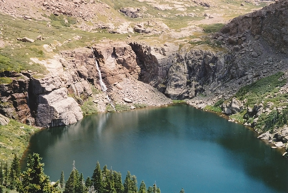
Open This Route in a New WindowFrom a campsite location in the vicinity of Willow Lake, follow the climbers trail around the north side of the lake and about 1/3rd of the distance around the lake, turn north and begin an ascent through trees that leads to a steep, south-facing slope covered with tall clumps of grass. You will likely pass some campsite locations above the lake on this side as you head up. After about 400 feet of gain, you should encounter the stream that drains the valley below UN13,552 and Mt. Adams. We found the best thing to do here to avoid willows was to go ahead and cross the creek and continue up valley on higher terrain above the willows. Gain approximately another 400 feet in elevation and then turn west up an east ridge. Gain another 800 feet on steep and grassy slopes to the south ridge of the peak, turn north and follow easy tundra to the summit. 2 hours from Willow Lake. We spotted Bighorn sheep in this area. Return as you came or continue to either MT. Adams, UN 13,153, or both. We have sequenced UN 13,552 with UN 13,153 only.
-
Route Description
Year Climbed: 2001UN 13,159 is sequenced with UN 13,552 (previously 13,546). One way mileage and elevation gai are measured from the summit of UN 13,552. Round-trip mileage and elevation gain assume completion of the sequence.
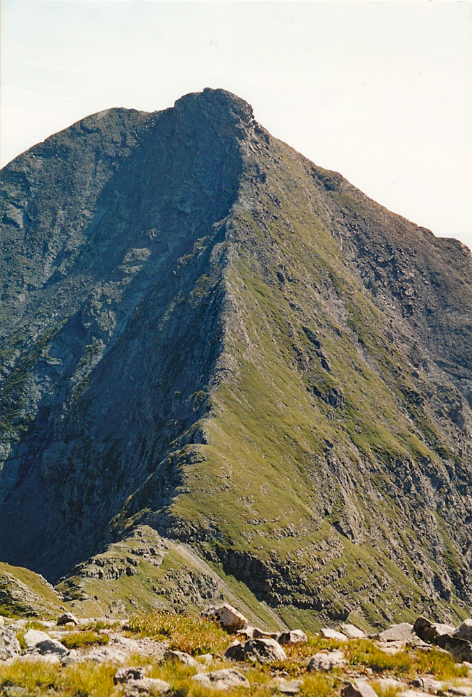
From the summit of UN 13,552, walk down along the ENE ridge that connects to Mt. Adams to the Mt. Adams/UN13,552 saddle. At the saddle, it's probably best to lose about 500 feet elevation as you continue hiking north, dropping into the basin above South Crestone Lake. This will keep you out of a huge rock field of loose boulders on the west face of Mt. Adams. In earlier season, some snowfields may expedite the descent with ice axe help and you may be able to contour north at a somewhat higher elevation.
Once down in the basin, continue north to the saddle between Mt. Adams and UN13,159 on mostly easy tundra. At the saddle, turn NW and follow the ridgeline to the summit, avoiding one minor rocky outcrop. Hiking will be mostly tundra, some small scree and a little rock. The summit area is a gently sloping tundra-covered area with great views of the Crestone Lakes to either side. Both lakes appeared to offer some nice camping. A scree slope from near the summit can be taken for a quick descent south back to the basin above South Crestone Lake From there, return to the UN 13,552/Mt. Adams saddle and descend south into the basin above Willow Lake. Watch for the best route through willows. Wildflowers are abundant here at the right time of the summer.
Additional BETA
Links to other information, routes & trip reports for this peak that may be helpful. -


"Politics is the art of looking for trouble, finding it everywhere, diagnosing it incorrectly and applying the wrong remedies." Groucho Marx
Warning!
Climbing peaks can be dangerous! By using this site and the information contained herein, you're agreeing to use common sense, good judgement, and to not hold us liable nor sue us for any reason. Legal Notice & Terms of Use.