LoJ: #456 (Pre-LiDAR #473) / 13,235' "Peak L" Formerly UN 13213 aka: "Necklace Peak"
Peak Summary
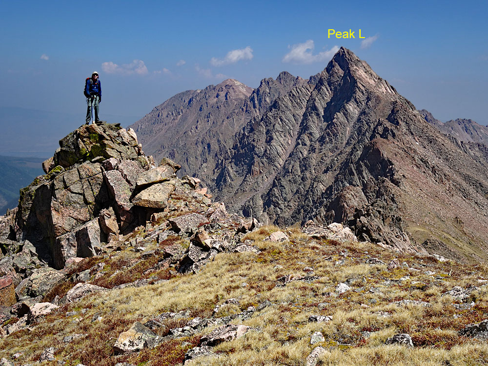
Of the various Gore 13ers, Peak L has the longest approach, requiring a backpack for many or an extremely long day from the nearest trailhead. But this entertaining summit is certainly worth the effort offering some fine Class 3/4 scrambling with dramatic views and some exposure. Our route requires a 4WD to reach the Brush Creek Trailhead with a ten+ mile backpack into Upper Slate Lake for a beautiful wilderness camp. A trip here also offers another approach for Peak Q and as long as you're in the neighborhood, you might want to consider Peak R, formerly coming in at 12,995 feet, now a ranked 13er at 13,000 ft. even, and Peaks K and S. With Lidar adding 22 feet of elevation to Peak L, it boosted its ranking significantly. This is one of the best scrambles anywhere in Colorado.
Peak L SW Ridge Route

-
-
Brush Creek Trailhead
The following directions are taken from the White River National Forest website, with some modifications: The trail starts in the Aspen trees on a hillside full of sagebrush that overlooks the Blue River Valley. This trail is used to access the Gore Range Trail and Lost Lake Trail in the Eagles Nest Wilderness Area. To access this trailhead you must have high clearance 4x4 vehicle.
Directions: From I-70 take Exit 205, Silverthorne/Dillon, and travel north on HWY 9. Travel north on HWY 9 for approximately 16.8 miles. Just after mile marker 118 turn left onto County Road 30 toward the town of Heeney. Follow County Road 30 for approximately 0.5 miles and turn right into the parking area at the old Grandview Cemetery on the right side of the road. Park here if you do not have high clearance 4WD. Across from the Grandview Cemetery Parking is the Brush Creek Road (FDR 1695) where motorized (4WD) access is allowed during the summer if you want to drive to the Brush Creek Trailhead. From the Cemetery parking lot up Brush Creek Road to the trailhead is 2.4 miles. About 1.75 mile up this road, it will fork. This does not show on the USGS map or the Trails Illustrated. Stay left at this fork.Our notes: If using the USGS Squaw Creek quad, the road up to the trailhead does not show as a road - only as a "pack trail." The White River National Forest map does show the road. At the cemetery mentioned above, there is a large open field just above the river that many seem to use for at-large camping. Camping is no longer allowed there. There are no facilities here. The initial climb up FR1695 (aka FR68) is the worst part of this drive. On our previous visit here in 2011, there were enormous, potholes which could be muddy after recent rains. This is where the high clearance is most useful. If you get past these, the road then switchbacks and climbs steadily across an open meadow hillside before switch-backing again to the south. This section is a little rocky and very steep but otherwise okay. The road then heads into a dry drainage and winds through beetle-kill forest to the trailhead, which is a small, undeveloped parking area in the midst of some aspen trees. The remainder of this drive is not too rough. There are a couple at-large campsites shortly before the trailhead. Earlier in the season, if no one has gone in with chainsaw, you may find the road blocked by deadfall. Be prepared to walk the 2.4 miles from the cemetery parking area. We visited here again in 2020 and the road at the beginning was in better shape than previously encountered. Many more beetle-killed trees have been cut down and removed so it is more open to the trailhead now.
Camping
The last quarter mile to the trailhead has a few at-large camping spots, otherwise there's not much else to choose from unless you utilize one of the Green Mountain Reservoir campgrounds or the following National Forest fee areas: Blue River CG (back toward Silverthorne), Prairie Point or McDonald Flats CG , a couple miles past the cemetery on the CR30, just before the Green Mountain Reservoir.
-
From Brush Creek TH via Upper Slate Lake
The east side of the Gore Range has access issues to National Forest land because of numerous private properties that block access. The two closest, legal trailheads are the Brush Creek to the north of Slate Creek and the Rock Creek, to the south of Slate Creek. Reaching the Brush Creek TH requires 4WD with good clearance. The Rock Creek TH can be reached by passenger vehicles. Mileage to Upper Slate Lake from the Brush Creek TH is 10.8. Mileage from the Rock Creek TH is about a half mile shorter. However, you do more minor up and down on the Gore Range trail from Rock Creek requiring a little more overall elevation gain that you do if coming in from Brush Creek.
Apparently, it's also possible to come into Slate Creek from a closer access along Boulder Creek. We met a couple here who had hiked in from Boulder Creek, a supposedly closed to public access trail, because the road passes through private property. There is no official trailhead there but according to some sources, you could drive up that road, drop off your packs, drive back down and park your car away from private property, then one person who drove back down could hike back up or ride a bike and stash it somewhere near the trail beginning. Use this at your own risk, which could involve having your vehicle towed or your bike stolen. A friend of ours had his bike cables cut. The ride is about 2.7 miles up with almost 1,000 feet of gain - a steep sucker!
Our proposed approach then has you starting from the Brush Creek TH. From the trailhead, the trail takes out following an old, unused diversion ditch that contours west back toward the Gore Range Trail, about .65 mile (15 minutes) in. At the intersection, turn left (south) and begin hiking the Gore Range trail. At this intersection, you immediately drop down and cross a flowing drainage, which is Brush Creek. There’s no bridge. Walking south on good trail, you will come to the next intersection with a sign post in about one mile. Continue past this trail that goes to Lost Lake and keep walking generally SE on the Gore Range Trail. Shortly after the Lost Lake trail turnoff, lose a little elevation to cross another fork of Brush Creek, then regain a little elevation to begin a mile long contour to Squaw Creek, where you will lose about 200 feet in elevation to cross this creek. On the other side, regain nearly 200 feet in elevation to cross a ridge at just above 9,000 ft., then drop some to cross Hay Camp Creek and a trail that follows that drainage. Watch carefully to remain on the Gore range trail here. There's one brief section where grasses may obscure the trail. From the crossing of Hay Camp Creek, the Gore Range trail gains over 300 feet in elevation to cross another ridge as the trail turns more to the south and then drops to Slate Creek where a wooden sign marks the trail intersection for the Slate Creek Trail and the Gore Range Trail. There are the remains of an old cabin nearby. At this intersection, you've covered 5.3 miles and have walked through miles of sadly, beetle-kill forest. Intersection coordinates are: N 39° 45' 47.48" W 106° 11' 40.30". 9075 ft. elevation. The devastation is amazing and portions of the forest are almost completely gone as of our visit in 2020, but along Slate Creek at this intersection, trees were still in good shape. We saw no good campsites until you come to where Slate Creek & the Gore Range Trail meet. From the trail intersection, walk south on the Gore Trail just a short distance toward Slate Creek and you'll see a very nice campsite location on your right, nestled in among conifers. Water is easily accessible here and there are numerous flat spots that could accommodate several tents. If coming from Rock Creek, there is no official bridge across Slate Creek. There are just some logs to balance your way across.
From the Gore Range trail, the Slate Creek trail initially passes through open meadows and small stands of aspen for the first mile and a half and gains minimal elevation. In fact, at the trail intersection, the elevation is just below 9,100 feet, which is only slightly higher than your beginning elevation at the Brush Creek TH. At some beaver ponds at 9,200 ft., nearly two miles up the drainage, you first begin to gain the elevation needed to get to Upper Slate Lake at 10,860 ft. So you have about 1,600 feet of gain in the last 2 miles. After those beaver ponds, the trail passes through some nicer forest and then crosses some marshy areas just before it begins the steeper ascent. That last forested area before the climb begins is your last chance for a campsite until arriving at Upper Slate Lake.
We took a break in the vicinity of the turnoff for the main Slate Lake at 9893 ft. We could not find an easy access across the creek here to get to that lower lake, other than to wade or dare to cross the rushing stream on fallen logs. The USGS map makes it appear that the main trail crosses the stream here then crosses back over after the lake. This is no longer the case. The trail remains on the north side of the stream. Continue on from there, to arrive at Upper Slate Lake with initially some more steep gain and several switchbacks that don't appear on the maps clearly before the trail begins to level out some, then does a minor drop as it nears the lake. Two things to note about this trail. First of all, older maps show the trail as delivering one to the lake outlet. The trail has since been re-routed so as to bring you out at a small peninsula that juts into the lake on the SE side, about midway along that shore. This peninsula is a rock outcrop, covered in trees with numerous small to large camp spots. It is at a point where the lake pinches down to its narrowest. The other shore is literally a stone’s throw away.
The second thing to note about the Slate trail is that the USGS Squaw Creek quad does not show a trail heading up the Slate drainage from the Gore-Slate intersection described earlier. The other two quads, (Willow Lakes & Vail East) however, do show this trail. In addition, the Trails Illustrated map for Green Mtn. Reservoir shows things correctly as well. On that map, if you’re coming in from the south along the Gore Range trail, you drop down and cross Slate Creek, gain a little elevation and then come to the Slate Creek trail intersection. It appears however, that an older branch of the trail on the south side of Slate Creek can still be followed to a crossing of Slate Creek and then joining in with the main trail on the north side later on.
Camping
As mentioned above, the main camping area now seems to be the rock peninsula on the SE shore of the lake, about mid-way along its length. There are numerous campsites here, all with tree coverage and access to either lake water or small rivulets nearby. Some backpackers may also still elect to camp close to the lake outlet. See coordinates below for the camp area we used.If you want to break up the backpack in, then there is an excellent campsite area on the north side of Slate Creek, where it meets the Gore Range Trail. See coordinates below. There's enough room here for multiple tents. There's also another campsite up along the Slate Creek trail just before the trail enters a forested section and before it starts making strong elevation gain. This may be a horse-packers camp. The turn off for this will be the only clear trail you see taking off to the right as you're heading upstream. Coordinates for the turnoff are: N 39° 44' 51.94" W 106° 13' 09.31".
Campsite Locations
Upper Slate Lake N 39° 44' 22.47", W 106° 15' 53.20"Elevation 10,900 ft.Slate Ck - Gore Range Trail Camp N 39° 45' 45.8", W 106° 11' 40.1"Elevation 9075 ft.Horse-packers Camp N 39° 44' 53.68", W 106° 13' 11.88"Elevation 9245 ft.
Open This Approach in a New Window
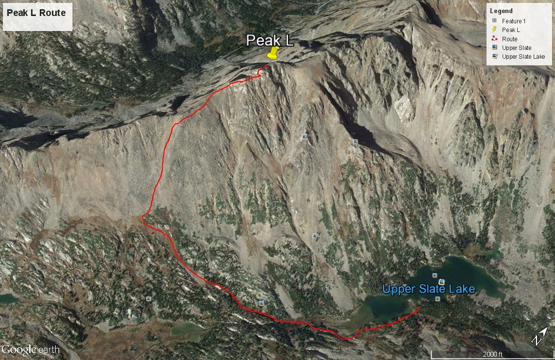
Click thumbnail to view full-size photo + captionRoute Description
Year Climbed: 2011Note: The round-trip elevation gain from the Brush Creek trailhead does not include an estimate for the return elevation gain on the Gore Range Trail, hence, overall elevation gain will be a few hundred feet greater than that shown.
Your immediate goal is to get to the SW end of the Upper Slate Lake and cross the stream somewhere above the inlet to begin your ascent. From our suggested campsite, walk out of the trees to the south of the campsite, away from the lake and follow a trail that crosses a small rivulet and then ascend through tall vegetation up by the base of a rock outcrop and gain the top of that outcrop via a short ledge that reverses your direction. Atop that bench, a trail is evident for a short while and leads further SW up the basin, well above the lake. It then drops down some and begins to become more difficult to follow as you head through forest and lush vegetation and brush that may be wet. We passed at least one tarn along the way. The farther we hiked, the less evident the trail, but we eventually found our way down to a crossing of the creek a little above the lake inlet and above the lowest waterfall, but below a second, higher one. A trail leads down to the creek at this point, veering off from the main trail. You will be crossing at the head of the lowest waterfall/cascade. Coordinates N 39° 44’ 05.7” W 106° 16’ 16.1”. This was field verified in 2020. During a re-visit to this area in 2020, we found the use trail to this point quite evident and easy to follow.
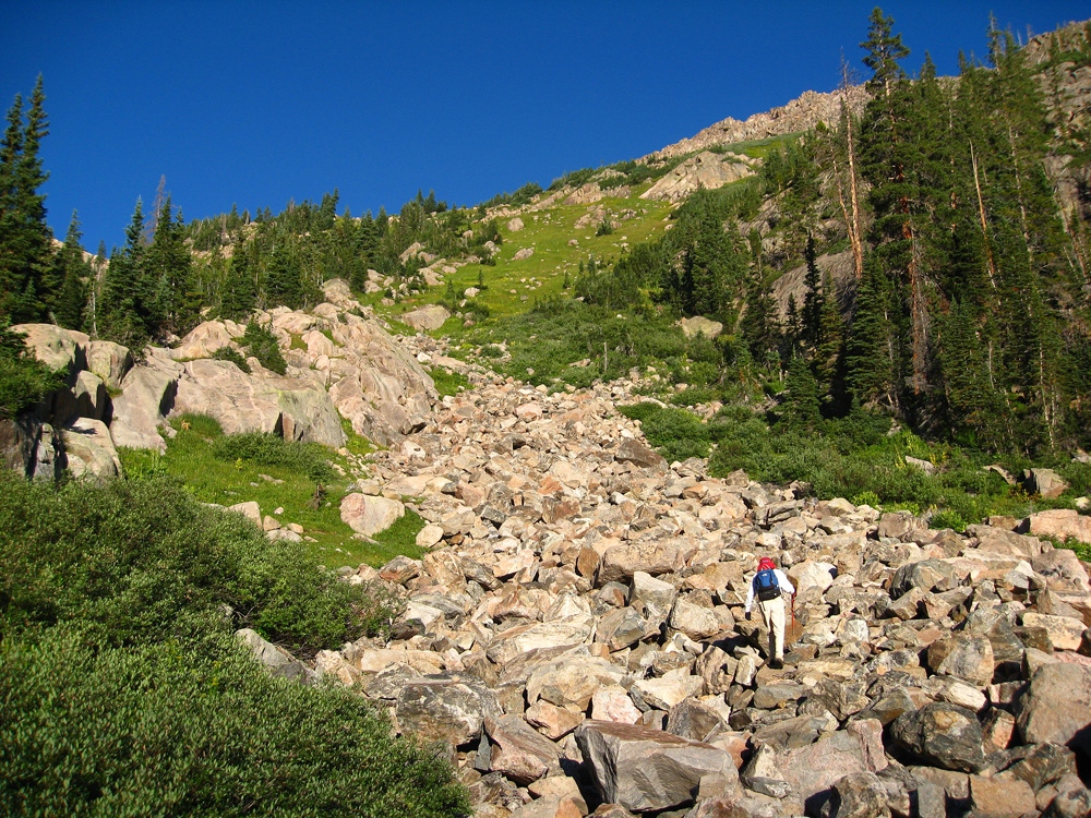
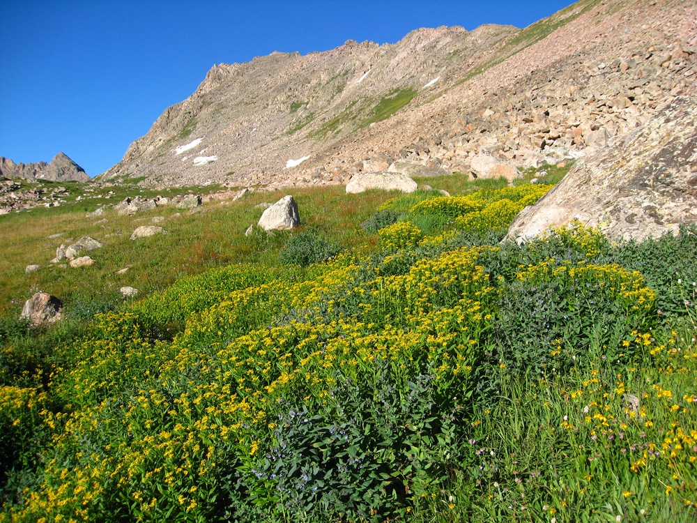
Once across the creek, which did not prove to be too difficult, walk somewhat parallel to the creek on the north side, following a rocky rib of sorts for a short way until you can veer right (more to the north) crossing another couple parallel rock outcrops and come to an avalanche chute at these coordinates. N 39° 44’ 03.1” W 106° 16' 31.1". We were attempting to duplicate a route used by Gerry & Jennifer Roach and Jack Dais and published on their website. Once in this vegetated gully of sorts, begin hiking uphill in a westerly direction, staying just left of a boulder strewn section and hiking all the way up to a bench-like area at 11,920 ft. with willows and lots of tall, yellow flowers. This bench is evident on the USGS map. The view of Upper Slate Lake from here is quite impressive. Here's another GPS point to aim for: N 39° 44' 04.6" W 106° 16' 47.4". These points could also be used for accessing Peak K.
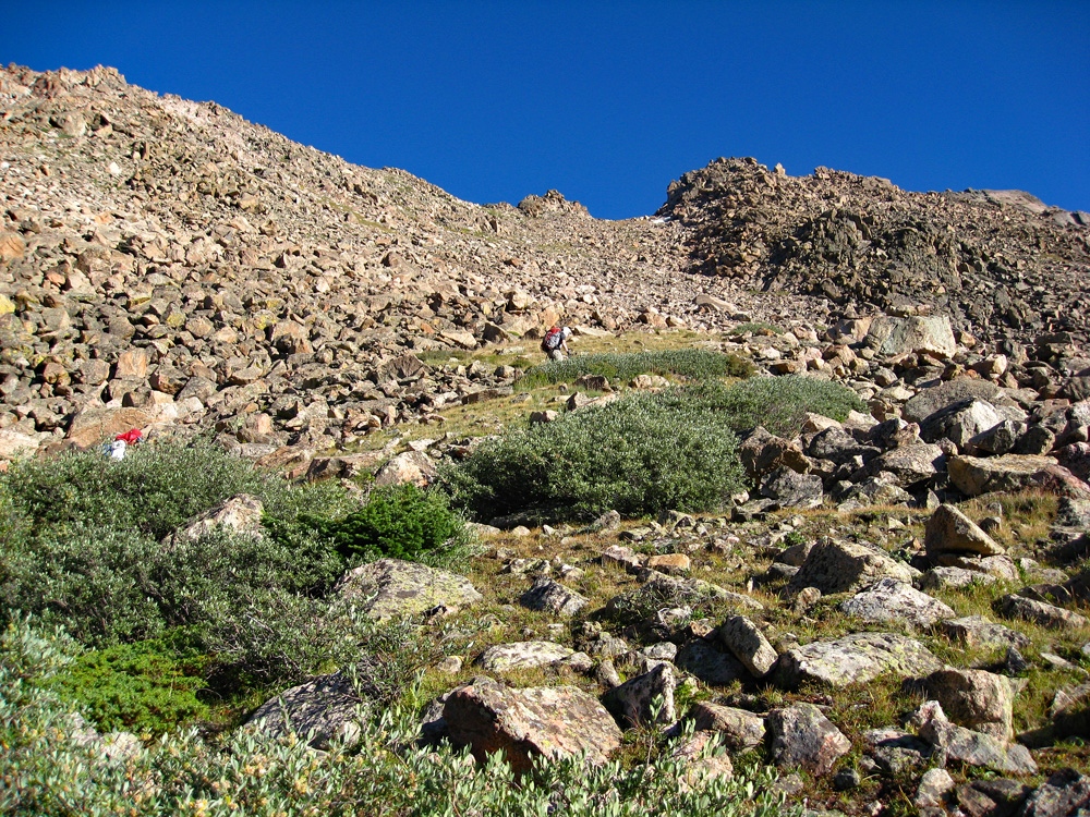
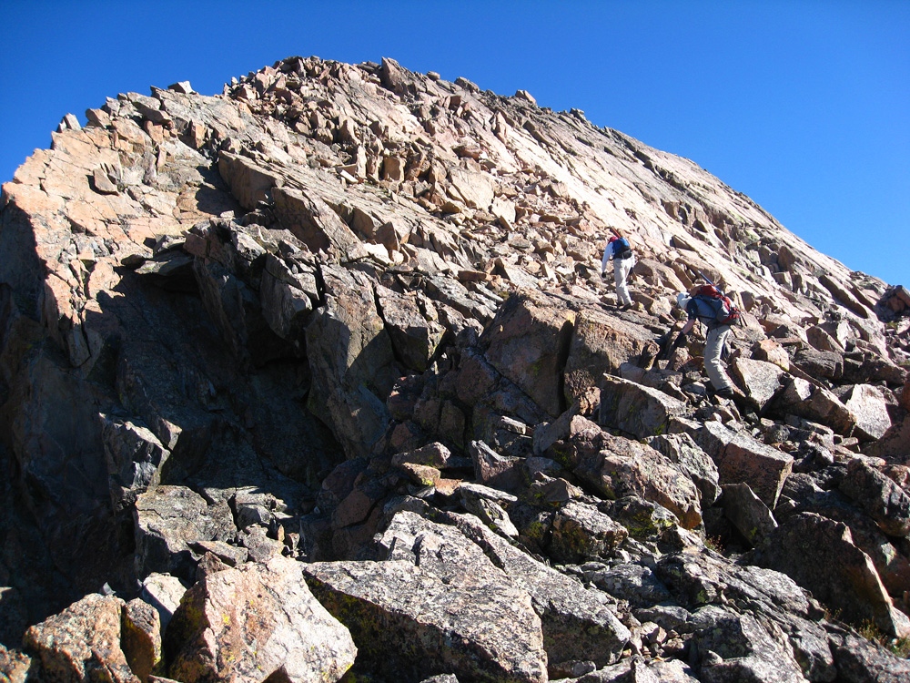
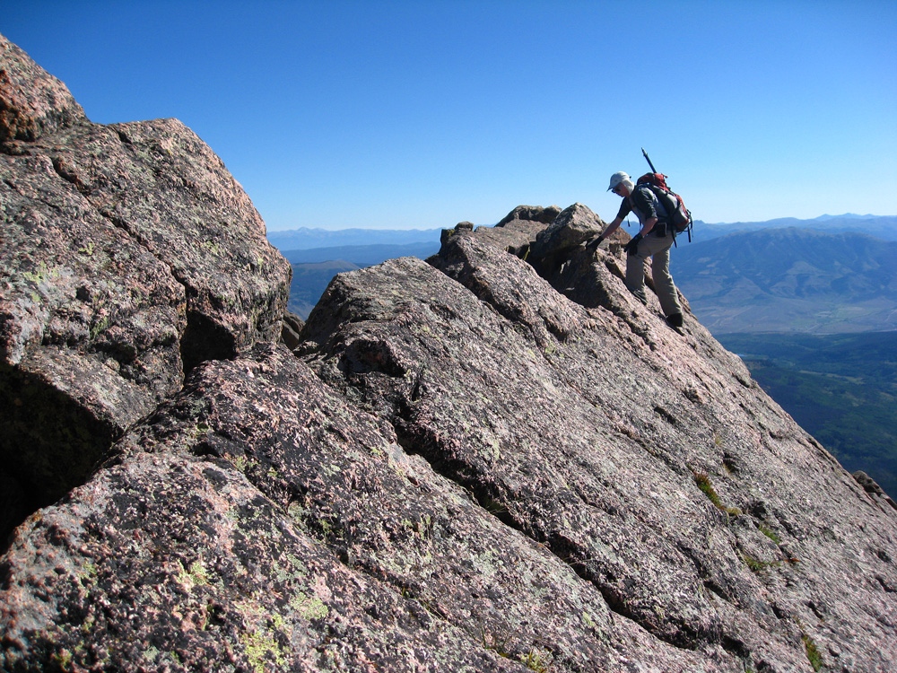
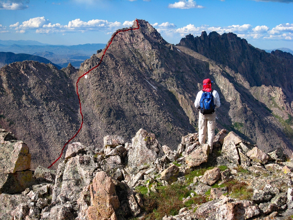
From the bench, turn north and begin ascending on mostly rubble and broken rock to a yellowish saddle above that’s at about 12,650 ft., but before arriving at that saddle, begin to veer right and scramble over boulders and large blocks of rock to work your way up below the ridge crest on the south side. This will bring you to a higher saddle. Follow the ridge a little further and cross some slabs and then come to the so-called knife edge ridge section. This turns out to be the crest of some south facing, solid slabs tilted at about 40 degrees(?). It is easy to just walk across the slabs utilizing some cracks and placing a hand occasionally down on the slabs for a hold if needed, but the scene is dramatic and has an exposed feeling. We had a lot of fun here utilizing camera angle to make this appear quite terrifying and took numerous photos of each other, but no rope was needed for this short section of perhaps 100 feet. The rock is quite solid and stable. At the end of the knife edge, there is a short, 3rd class downclimb of maybe 20 feet and then you walk across a short connecting ridge to the final summit block.
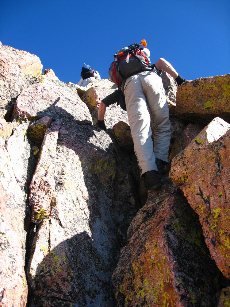
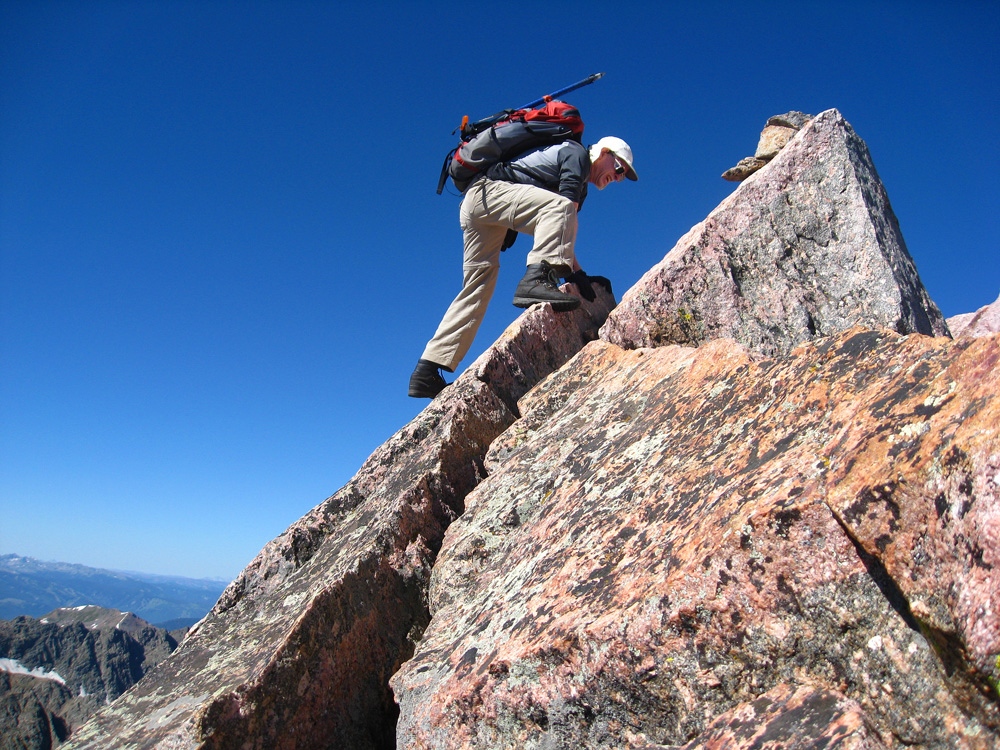
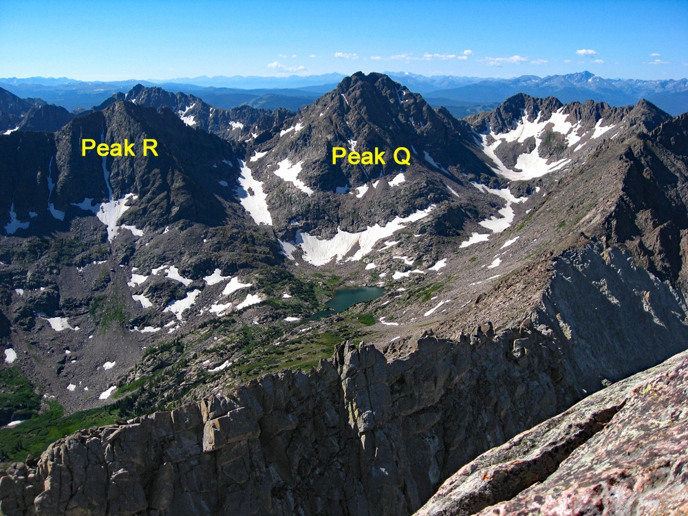
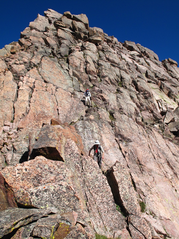
At the foot of the summit pyramid, you can look up and gaze across a maze of giant slabs and blocks that are crisscrossed with large fractures and cracks. One particular route did not appear any better or worse than any other so we just headed on up, working our way up with mostly 3rd class moves. There may have been a few brief 4th class sections, but we never roped up and never really felt all that exposed. We came out just east of the summit, which is itself, the tip of one of these giant slabs. That gave us yet another photo opportunity. We took carefully arranged shots of each other just below the summit and posed so as to appear like we were ascending a highly exposed rock slope. We arrived here three hours and forty five minutes from camp. The view in all directions is simply amazing and reaching this particular summit offers a degree of satisfaction in having accomplished something. Descend by the same route as you came, however you may want to consider heading over to Peaks Q and/or R. To do so, head back to the willow & flower-covered bench area at just below 12,000 ft., and then drop down to the unnamed lake at 11,540 ft. From there, plot your course to either summit. There is a useful route description of Peak R in Dave Coopers book on "50 Colorado Scrambles" or donators may contact us for more info.
A note to add here: This summit on Google Earth is not represented very well. It's missing about 125 feet of elevation and the apparent layout of the summit on GE does not correspond to reality, the highest point being well off to the NE. Use the summit coordinates we provide with skepticism since they are obtained from GE.
Bonus Points: Peak K can be reached from Peak L via the connecting ridge that will offer some difficulties. Peak K also has some 3rd and brief 4th class scrambling. You can also reach Peak K by following the Peak L route as far as the bench area at 11,920 ft., then heading west along the bench before turning up to gain the K-L ridge near a false summit east of K. Anyone interested in knowing more about this route can contact us through our "Contact Form" page.
Additional BETA
Links to other information, routes & trip reports for this peak that may be helpful. -