LoJ: #466 (Pre-LiDAR #471) / 13,223' "Hassell Peak" Formerly UN13215

Peak Summary
Hassell Peak by the route we suggest is accessible to passenger vehicles with better-than-average clearance. With another short Front Range drive, the Class 2 hike is half on trail, then the other half is mostly on tundra terrain with embedded rock. Plenty of wildflower viewing makes this hike more interesting and the route takes you by the small Hassell Lake. Front Range views abound. Lidar added 8 feet in elevation to previous height of 13,215 ft.
Hassell Peak ENE Ridge Route
-
-
Hassell Lake TH
From I-70, whether east or westbound, take the exit (232) for US 40 that goes over Berthoud Pass to Winter Park. Follow the highway to Empire, then to the small town of Berthoud Falls. From the center of Empire, it's about 11.9 miles to the turnoff on the left (south side of highway) that comes just before the first switchback that begins the climb on US 40 to Berthoud Pass. The road you're turning onto is CR 202 that goes to the Henderson Mine. Follow this paved road west for .6 mile and make a left turn onto FR146, also known as the Wood's Creek Road. On Google Earth this road is identified as FR 203. The road becomes graded gravel and will climb steeply in places to the trailhead. We measured the driving distance as 3.2 miles from the Henderson Mine Road. The Wood's Creek Road will take you by several evaporation ponds and two reservoirs. The upper one is called "Urad Reservoir." About half way up this road, the condition will deteriorate some and you'll encounter more potholes and cobble that slows driving, hence the recommendation for a higher clearance vehicle. For those accessing our suggested route for Engelmann Peak via Ruby Creek, park at these coordinates just a little north of where Ruby Creek crosses the road: N 39° 45' 13.58" W 105° 49' 29.75". For the Hassell Lake trail, parking can be found in the vicinity of the crossing of Woods Creek and primitive camping is available as well.
Camping
Primitive camping is available in the vicinity of the trailhead with several sites to choose from. The worst night we have ever experienced in the mountains was at this location. After climbing Hassell in the later afternoon, we returned to our vehicle and decided to spend a Friday night here. As the evening wore on, more and more vehicles poured into the trailhead area. All the possible campsites were quickly taken and others had to drive back down the road. Two different parties proceeded to engage in boistrous partying that continued on through most of the night. With no regard for other campers, they played loud music, shot off guns and talked and yelled loudly. One group continued doing this until 2:00 AM, the other until 4:00 AM. We needed to get up by 5:30 AM. We got all of an hour and a half of sleep that night and left swearing that we would never again camp at-large on the Front Range ever again. Moral of this story - camp here at your own risk.
There is a fee-type National Forest campground called "Mizpah" on the south side of US 40 just east of Berthoud Falls. This campground has 10 sites suitable for tent or RV, vault toilets and water by pump. The Arapaho National Forest website indicates the campground is currently closed because of culvert damage and associated road damage. You should check with the forest service before trying to utilize this spot. If you can camp here, you may at least get a better night's sleep.
Campsite Locations
Mizpah › N 39° 46' 34.09", W 105° 47' 33.31"9,660 feet elevation
Click thumbnail to view full-size photo + captionRoute Description
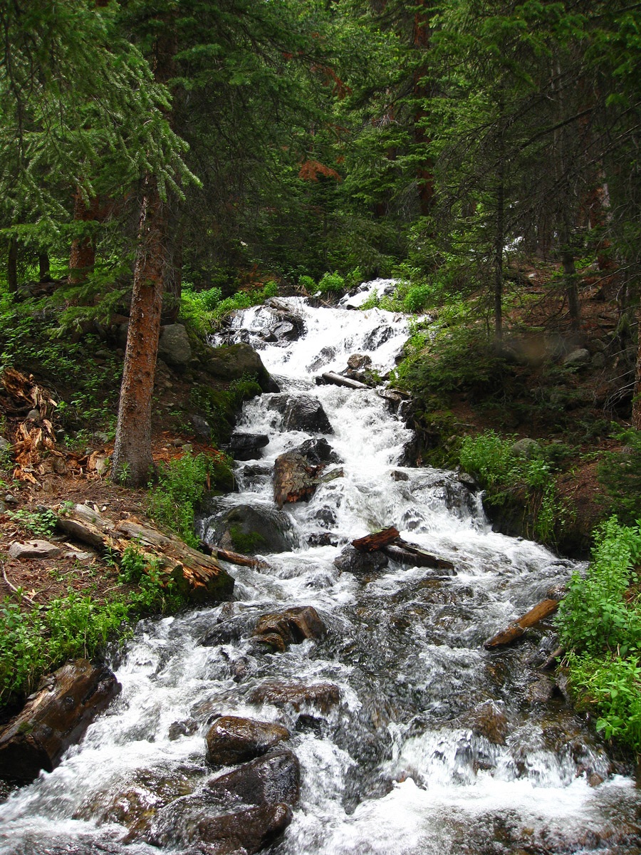
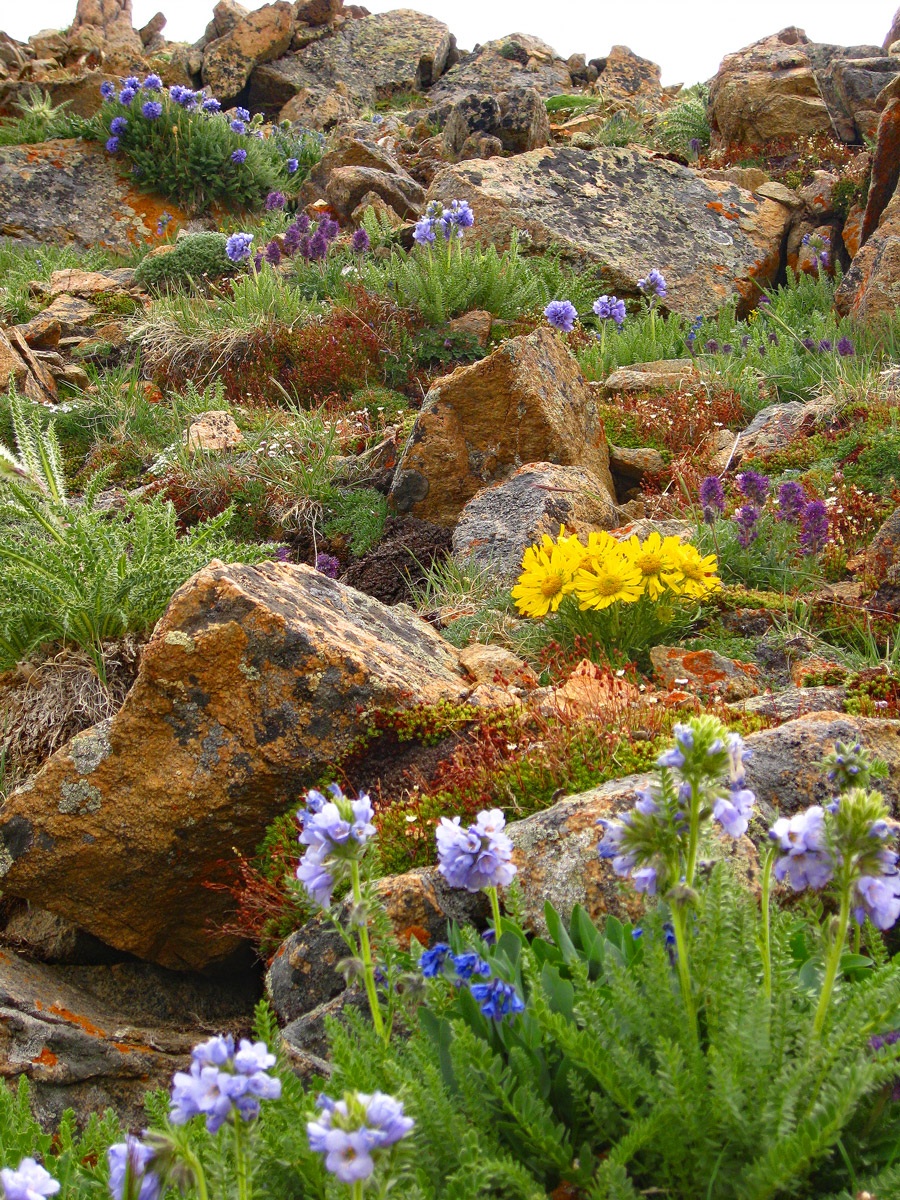
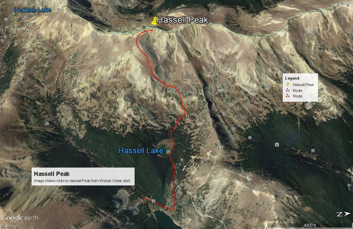
Year Climbed: 2008Neither the Grays Peak or Berthoud Pass quads from 1958 show the evaporation ponds or reservoirs or roads up Woods Creek to the trailhead, which is why we have used the FS Topomap 2016 version. From our suggested trailhead parking, walk up the road to the NE which will switchback after a couple hundred yards. The trail to Hassell Lake takes off from the vicinity of the switchback. The trail heads off through trees continuing in a NE direction. Do not be led down to the reservoir. The trail to Hassell Lake will emerge out of the trees and begin heading north across open slopes with willows. It will switchback a few times and then change direction to head west toward Hassell Lake.The trail gains about 600 feet elevation to the lake and is moderately steep. It took 35 minutes for us to reach the lake. From there, head around to the NW end of the lake and the area of the inlet stream. Work NW and west up a broad valley and in the direction of a saddle north of Hassell, and then change direction to work over to the ENE ridge of Hassell. To gain the upper part of this ridge, you'll need to ascend steeply on embedded rock and tundra covered slopes laden with wildflowers. We stopped numerous times for photos of the colorful display. Once you gain the ridge proper, it's relatively easy going to the summit.
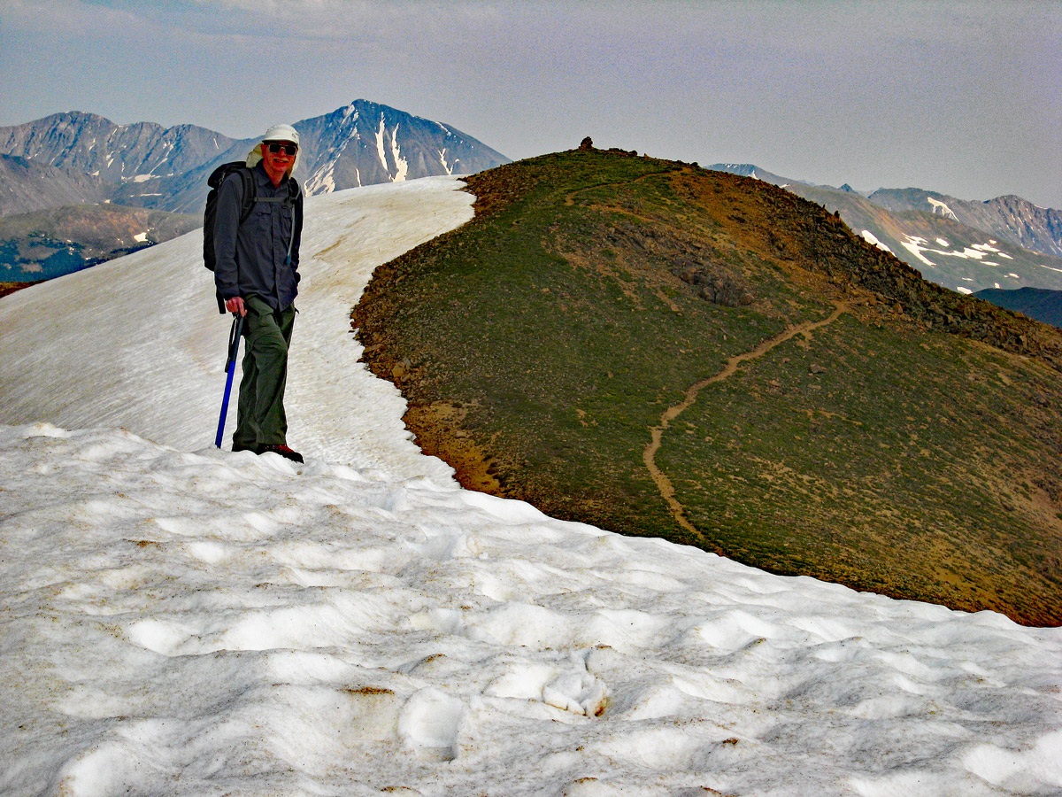
Evident on Google Earth and in our main photo, there is a trail that follows along the summit ridge in both directions. On GE, it's identified simply as "The Loop Trail." This is actually a section of the Continental Divide Trail.
For descent, either return as you came, or in earlier season, walk north along the ridge for a while and look for possible snow/glissade descents back to the east and into the basin above Hassell Lake.
Additional BETA
Links to other information, routes & trip reports for this peak that may be helpful. -