LoJ: #78 (Pre-LiDAR #77) / 13,867' Vestal Peak

Peak Summary
Vestal Peak South Face Route

-
-
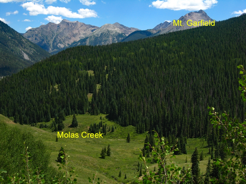
Molas Pass - Elk Park Trailhead
From the highway intersection just west of Silverton, CO, drive south on US550 in the direction of Molas Pass for 5.3 miles. About .6 mile, or at 5.3 miles total, after the turnoff for the Molas Lake there is a turnoff to the left into the trailhead parking area, accessible to 2WD vehicles. The dirt parking lot may be muddy at times and have a few potholes to avoid. There is usually plenty of room to park here, but can get a little full on weekends.
If coming from Durango, drive north on US550 over Coal Bank Pass and Molas Pass. After cresting Molas Pass, the turnoff for the trailhead will be 1.1 mile further north and on the right. The drive from Durango will take about an hour.
Camping
You can probably vehicle camp at the trailhead but there is no immediate toilet facility. You could also hike south along the trail a short distance from the TH and pitch a tent. There is a vault toilet back at the top of Molas Pass or at the turnoff for Molas Lake, you can drive down to the park and pay a fee to camp where there are not only vault toilets, but also hot showers for $5.00. There is also a fee campground at "Little Molas Lake," which is on a graded dirt road that turns off to the west, from the highway back towards Molas Pass. So overall, there are plenty of camping opportunities in the immediate vicinity.
Click thumbnail to view full-size photo + captionRoute Description
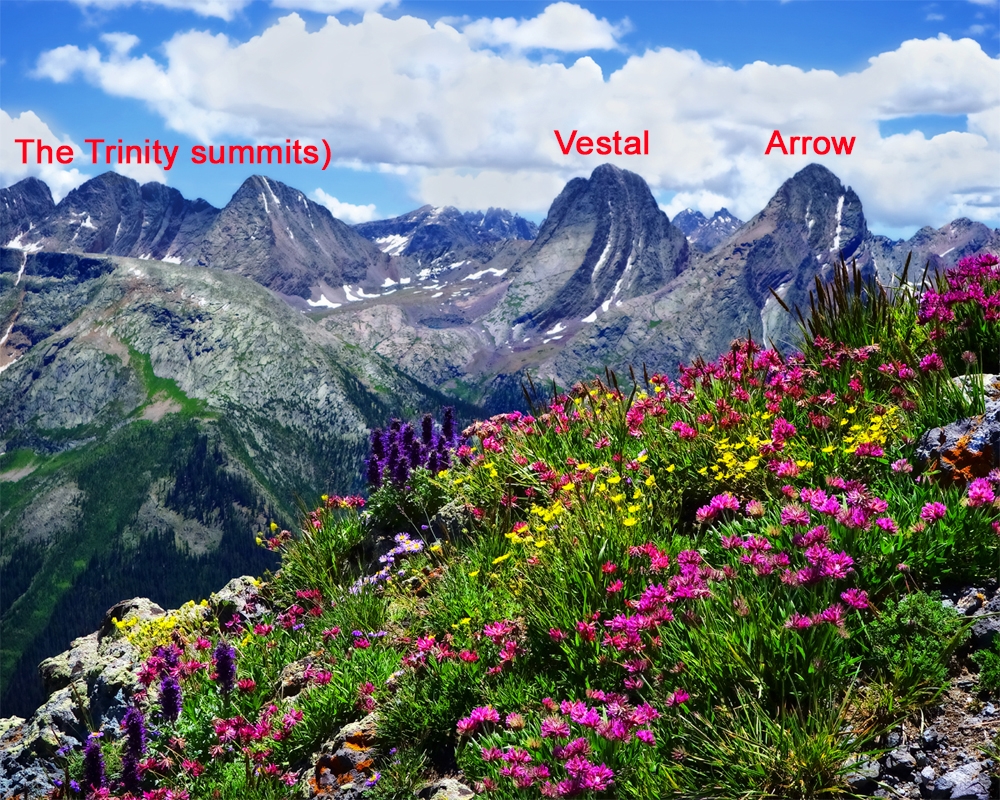
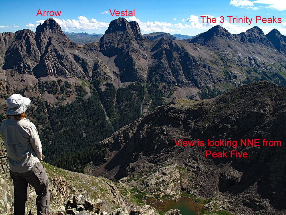
Year Climbed: 1992The following summary will apply to all the peaks accessible from Vestal Creek. These include: Peaks Two and Three, The Trinities, Vestal, Arrow, Electric, Graystone, Point Pun (unranked) and Garfield. In describing the routes for all these peaks, we have used the beaver ponds on the Elk Creek trail as the "base camp" starting point. Mileages and elevation gain are measured from there for each. However, for those with the strength and fortitude, you can continue the backpack portion of the trip by heading up the unmaintained and sometimes confusing Vestal Creek Trail. That hike will be included with each summit in this area as part of the "approach." Not only is the Vestal trail confusing at times with multiple tracks to follow, it is very steep and also harbors a large number of fallen logs to cross. The campsites in upper Vestal Creek are also known for their aggressive and camp-destroying marmots. Protect your food supply accordingly and even your gear as well. In 1992, we had marmots chew their way into our tent, then they both slept and defecated on our sleeping bags. In addition, they completely destroyed a pair of shorts we had left outside to air out, chewed on our packs and socks left out and they chewed through one of the tubes for our water filter. In short, they were attracted to anything that had salt on it.
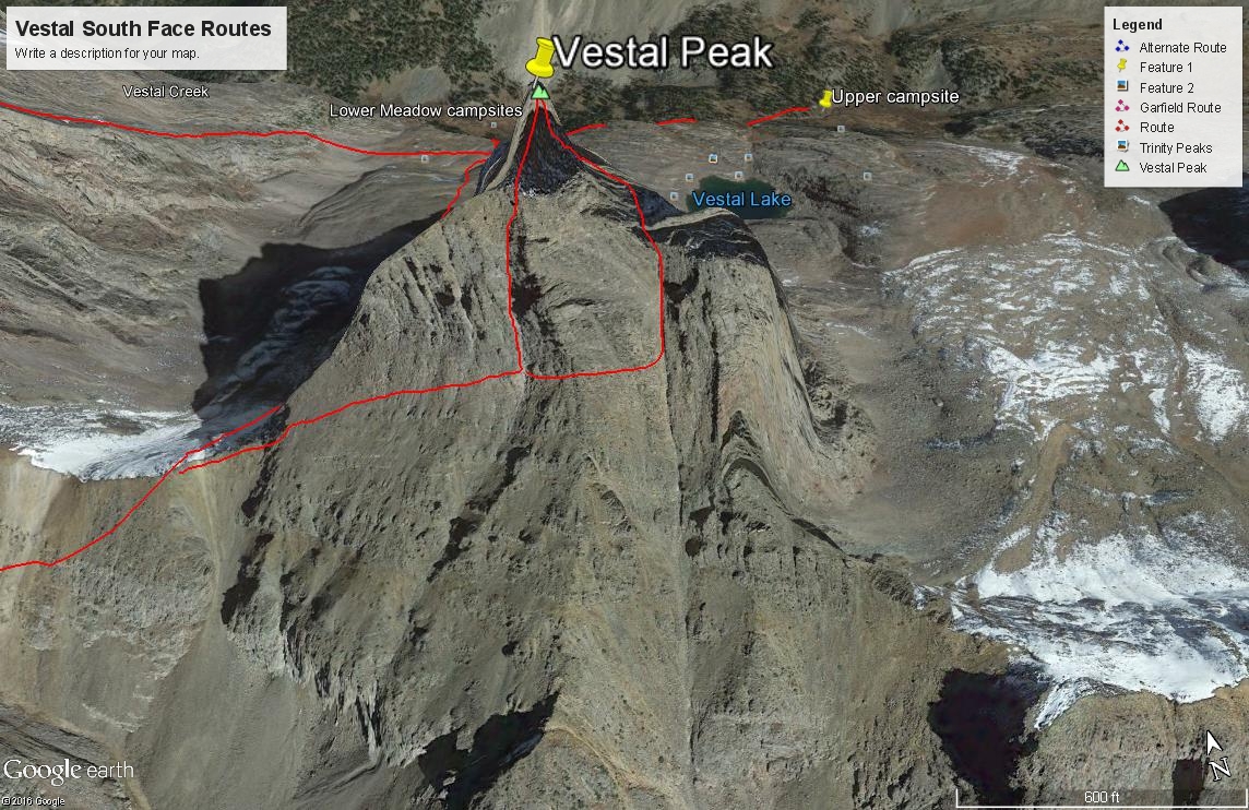
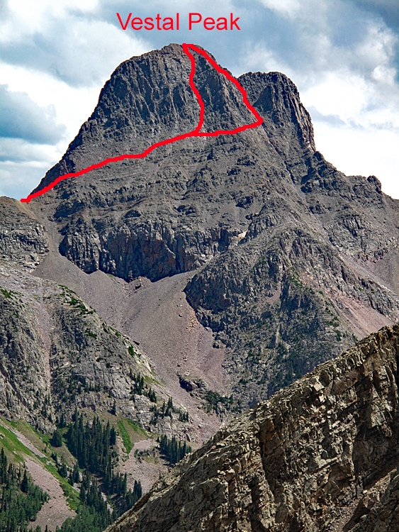
To climb Vestal, use the same description as the route for Graystone by beginning from either the "lower meadow" along Vestal Creek at 11,300 feet or from the higher camp at 11,760 ft. From the lower meadow camp, you'll need to ascend SSW steeply for 600 feet to gain the valley between Arrow and Vestal. At the time we did this in 1992, it was something of a bushwhack that will take you through trees, willows, rock benches and minor cliffs, and tundra. Roach describes a "strong climber's trail" heading into the basin now. In 1992, we saw no evidence of such. If coming from the higher camp, you'll need to contour back to the west across rock benches interspersed with tundra and grassy shelves to the same valley. Once in the valley between Arrow and Vestal, head SSW to the saddle that joins the two peaks. Most of this valley is occupied by a rock glacier with little tundra for reprieve from the relentless boulder hopping, etc. Obtaining the saddle will take you through talus & scree as well, or possibly snow earlier in the season. Ice axe would be handy then.
From the Arrow/Vestal saddle head east on a probable climber's trail with cairns that makes a contouring ascent along the lower west ridge and south face of Vestal. Stay below the cliffs at about 13,200 ft. At the time we climbed this, the only sources we used were Garratt and Martins book (and Rosebrough's book) which recommended contouring until directly south of the summit and then ascending up a shallow couloir. We found a substantial cairn in the vicinity of this couloir but were not sure if the cairn meant "head up here" or just "keep going, you're on the right path." The couloir was so shallow as to not really appear as one at this point, so we continued contouring east until we came to a very prominent couloir filled with snow (early July). This we felt was the recommended couloir in Rosebrough's "San Juan Mountains" book. Not having crampons for the steep snow, we decided to ascend here, staying on the west side of the couloir on mostly Class 2+ rock with perhaps a few minor Class 3 moves thrown in. Gaining the summit was no problem, but we did come out on a ridge a little east of the true summit. This confirmed to us that we had come up by the Rosebrough route, which is the great couloir on the SE face of the peak. In Roach's book, this is described as the "Vestal Peak - South Face route." Roach offers a few more details regarding this section than we, if you need more, but the route is really straightforward. When you arrive at the summit, you can break out in exaltation at having ascended the highest of the Grenadier peaks and at having climbed a Top 100 summit. Wander around a little to get a good view looking down the Wham Ridge. It is a sight to behold. Descend by the same route.
A note about the topography of Vestal Peak, noted by both G&M and Roach. The original 1964 USGS Storm King Peak survey map of this area had Vestal listed at 13,664 ft. with 200 feet of mountain missing from the contours. A "photo-inspected" version of the Storm King quad released in 1975 gave a corrected elevation of 13,864 ft. and then tried to cram in additional contour lines for that missing 200 feet of mountain. Examining the map gives the impression that the last 200 feet of mountain is extremely steep and possibly technical. In reality, the percent grade to the top is pretty much the same. This original error is recreated on the Trails Illustrated map which lists the incorrect elevation and does not show the missing contour lines. I've tried contacting their cartographers before about other map errors and have been ignored. What I find rather curious is how Google Earth shows this peak, for it seems to represent the last 200 feet as much steeper than the lower terrain. So in the Google Earth photo, take what you see with a grain of salt.
Additional BETA
Links to other information, routes & trip reports for this peak that may be helpful. -