LoJ: #329 (Pre-LiDAR #328) / 13,390' Williams Mountain
Peak Summary
Not to be confused with Williams Peak, Williams Mountain is the high point of the "Williams Mountains" sub-range in the Sawatch, on the west side of Independence Pass. The Lost Man trailhead is accessible by passenger car. Though it is possible to clean out all four, ranked, 13er summits in a long day, many may prefer to access this area by a short backpack of two or three days. Williams Mountain itself by the route we provide is a mostly Class 2+ with a smattering of some brief Class 3 scrambles along its north ridge. Lidar measurements added 8 feet of elevation.
Williams Mtn. North Ridge Route

-
-
Lost Man Trailhead
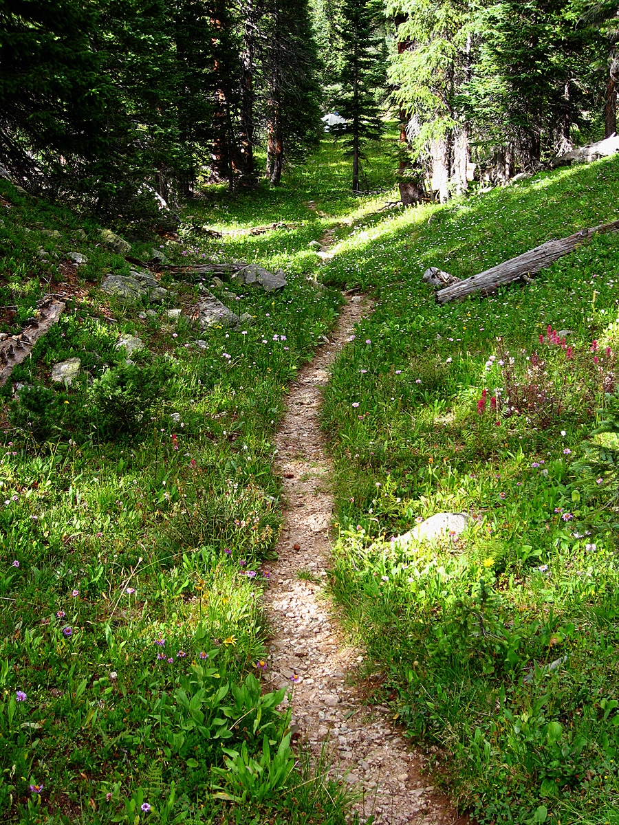
The name for trail #1996 is "The Lost Man" trail. It has two access points off Highway 82 out of Aspen. The first access is 14 miles east of Aspen and is a large parking area on the north side of the highway, across from the Lost Man Campground. This section of the trail leads up to South Fork Pass and Lost Man Lake. If accessing the Williams Mountains, this is the shortest and easiest access. Once across South Fork Pass, the trail number changes to 1940.
If coming from the Front Range, turn west off onto SH82 from US24 between Leadville and Buena Vista and drive past the Twin Lakes Reservoirs, through the small town of Twin Lakes and continue west up to the summit of Independence Pass. From the summit, continue driving west. At the first switchback heading down is what we are calling the "Roaring Fork River" trailhead. This is actually the other end of the Lost Man trail #1996. Drive on west past here, for another 4.3 miles to the Lost Man Campground and parking for the Lost Man trail on the north side of the highway. The parking lot is sizable.
Camping
On the west side of Independence Pass, at-large camping opportunities have all but been taken away. There are four designated, fee-type national forest campgrounds however beginning with Difficult Creek (four miles out of Aspen), Weller, Lincoln Gulch and Lost Man. All of these tend to fill on weekends. It may be possible to stay overnight in your vehicle at the Lost Man trailhead parking. Do this at your own risk of being run off.
-
From Lost Man TH via South Fork Pass Camps
This approach information is provided for those who would want to backpack in as far as South Fork Pass or beyond in order to climb the four Williams summits and possibly some other unnamed summits NE of the Williams group.
From the Lost Man trailhead, hike north to Lost Man Reservoir which is about one half mile in, gaining about 200 feet elevation. Before reaching the reservoir, a little over .3 mile from the TH, another trail turns off to the left. This is Forest Service trail #1993 to Midway Pass. Use this trail to climb UN13,033 (Williams South C) or if you want to attempt a traverse of all the Williams summits from the south. Otherwise, continue north from the reservoir on the Lost Man trail for about 4.5 miles total to South Fork Pass at 11,840 ft. The trail is fairly level most of the distance, with the steepest elevation gain just prior to the pass. At about 2.4 miles up the trail, or about .4 mile past the crossing of Jack Creek is a possible campsite that lies on the east side of the trail and overlooks a section of the creek that enters a shallow, rocky gorge. The campsite is not far off the trail. Try these coordinates: N 39° 09' 02.60" W 106° 36' 37.41". However, most would probably prefer to get further up the trail before camping. Overall, there was a lack of viable campsites along this trail all the way up to the pass.
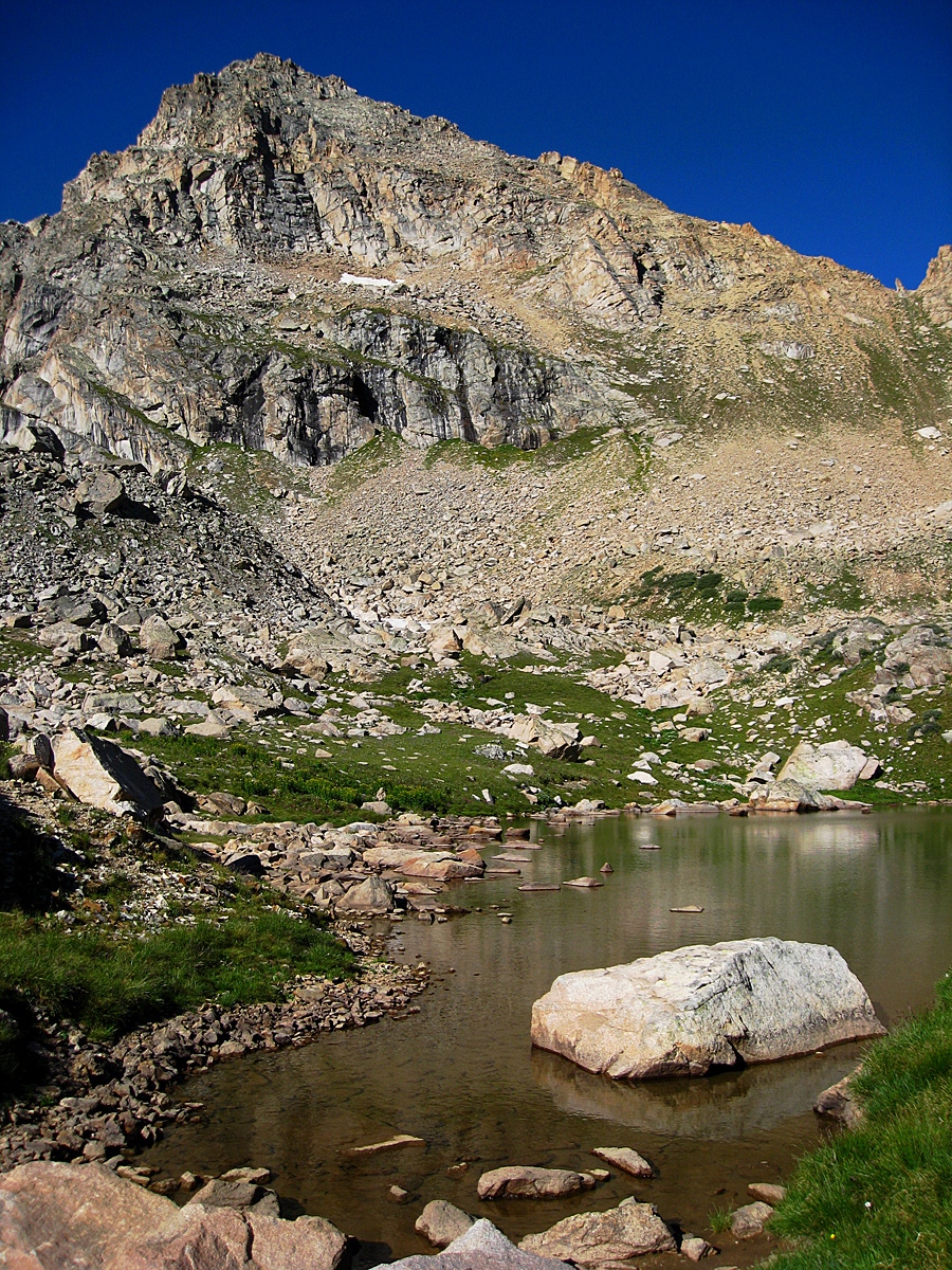
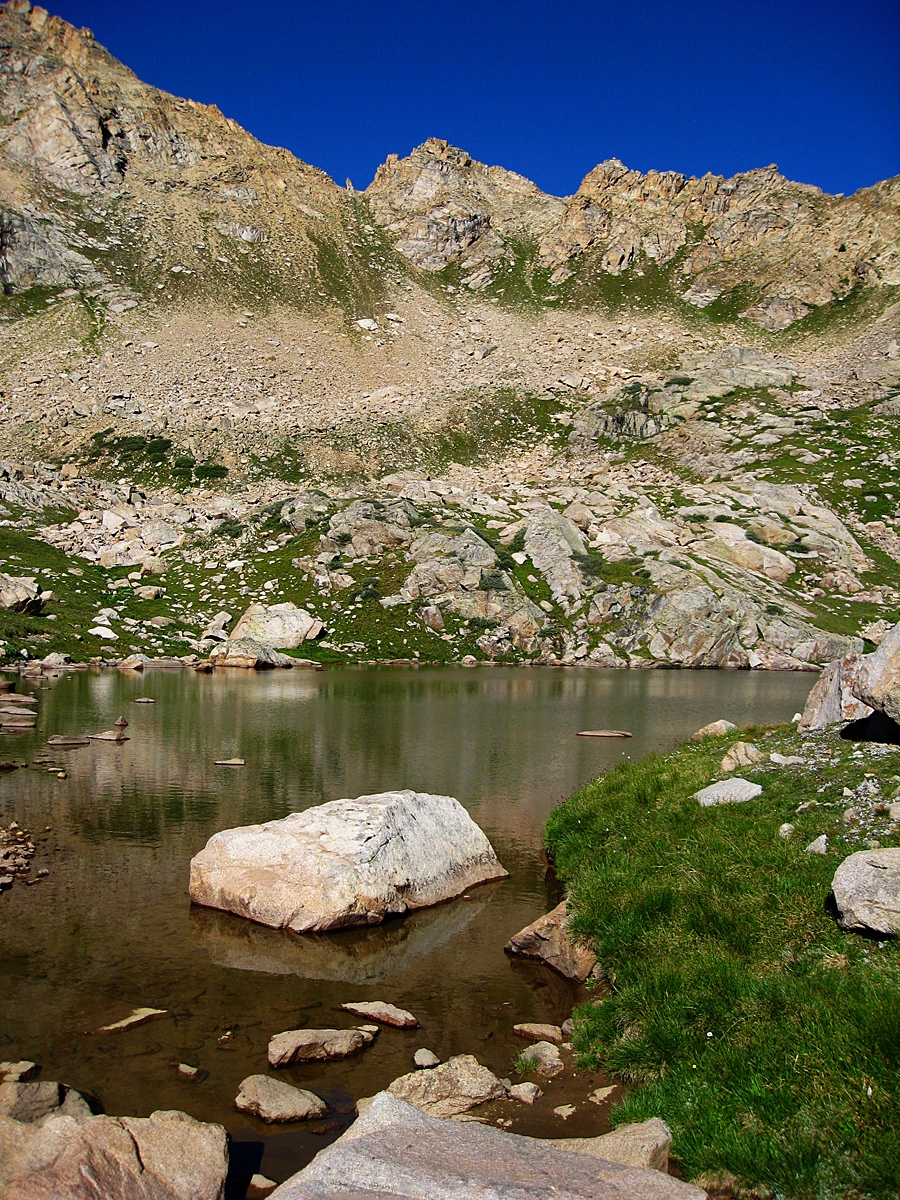
Before reaching South Fork Pass, the Lost Man trail actually turns off to the east to go up to Lost Man Lake. If interested in climbing the lowest 13er in the state, you could turn off here and hike up toward Lost Man Lake to ascend the peak. Otherwise, where the Lost Man trail turns off to the east, continue north to South Fork Pass, now just a short distance away. At the pass, if you explore over to the west of the trail, there's a very small pond with some camping possibilities at these coordinates: N 39° 10' 20.21' W 106° 35' 33.53". If you do not wish to camp here, this is the location that we used to launch off for UN13,203 (Williams South B) and also Williams Benchmark (13,312).
For Williams Mountain and UN13,108 (Williams North), continue packing north, down the trail now for about another .75 mile to a third possible campsite in the vicinity of these coordinates: N 39° 10' 44.21" W 106° 35' 01.91". This is only a very rough estimate of where we camped. The so-called campsite we used was on the west side of the trail and barely off the trail and overlooked the creek. On the east side of the trail, if you wandered up over some rock outcrops, there was evidence of a couple of other marginally used spots. This made a good location to launch off for Williams Mountain and UN13,108 (Williams North). If you access them the way we did, you will need to continue down the trail to Deadman Lake. The terrain around Deadman Lake we found to be rather flat and wet, but there may be a viable campsite around there.
Campsite Locations
Lost Man Campsite 1 N 39° 09' 02.60", W 106° 36' 37.41"Lost Man Campsite 2 N 39° 10' 20.21', W 106° 35' 33.53"Lost Man Campsite 3 N 39° 10' 44.21", W 106° 35' 01.91"
Open This Approach in a New Window
Click thumbnail to view full-size photo + captionRoute Description
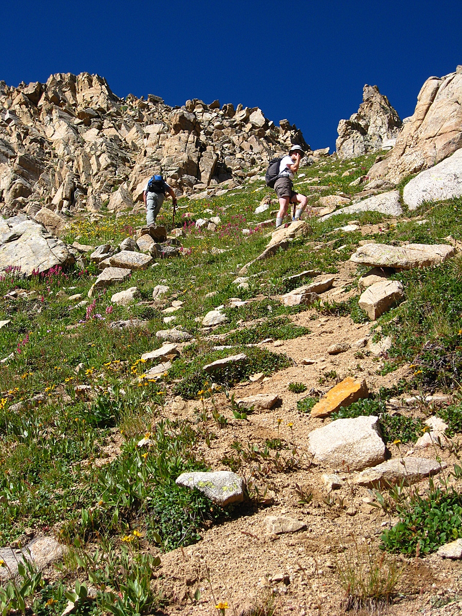
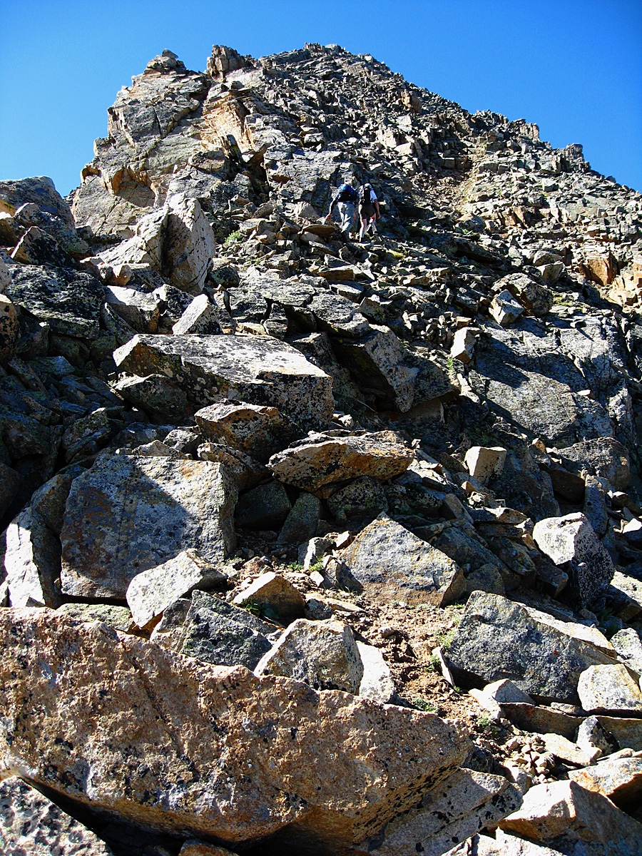
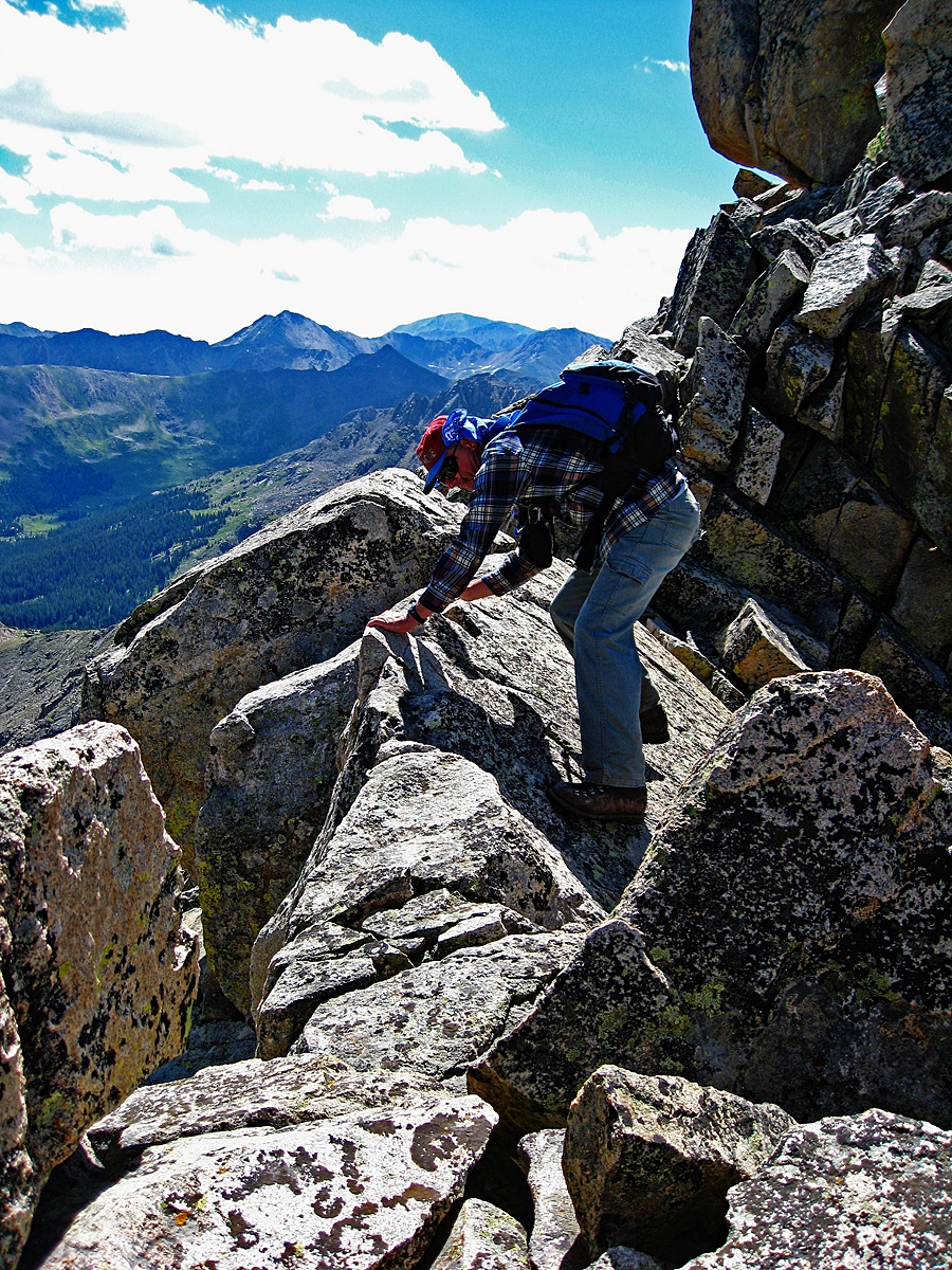
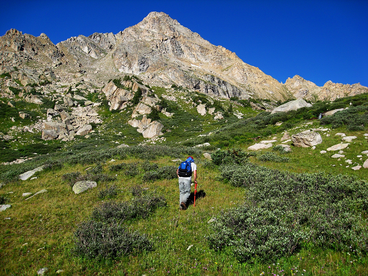
Year Climbed: 2007Our route to attempt Williams Mountain by it's north ridge was suggested by Gerry and Jennifer Roach who had themselves climbed it this way. Begin your day by hiking down from your campsite at either South Fork Pass or further down Deadman Gulch to the large and wet meadow by Deadman Lake. Once on the edge of the meadow, head northwest along the edge of the forest, and just west of the lake, tree-bashing your way over to the unnamed creek draining the northeast flank of Williams. Once you manage to work your way through the trees, it is fairly easy progress now in a SW direction along the creek following game trails. In the trees, there are numerous trails to follow that head up the creek. Near where the trees began to thin out, get on the north side of the creek and work your way up valley. (We found plentiful signs of elk up here.) At the small tarn at about 12,100 ft., head up toward the south end of the saddle that separates Williams from North Williams. The last few hundred feet to the saddle, skirt south and connect with the main ridge a little south of the low point. Much of this part of the ascent will be on mixed tundra and gravel amid larger rocks, with nice flowers thrown in. Once on the ridge, there's about 700 more feet to gain and it all goes rather quickly. The ridge was mostly upper class 2 rock and boulder rubble with a little bit of fun, 3rd class scrambling intermittently, and one spot that looked exposed, but really wasn't to any degree of danger.
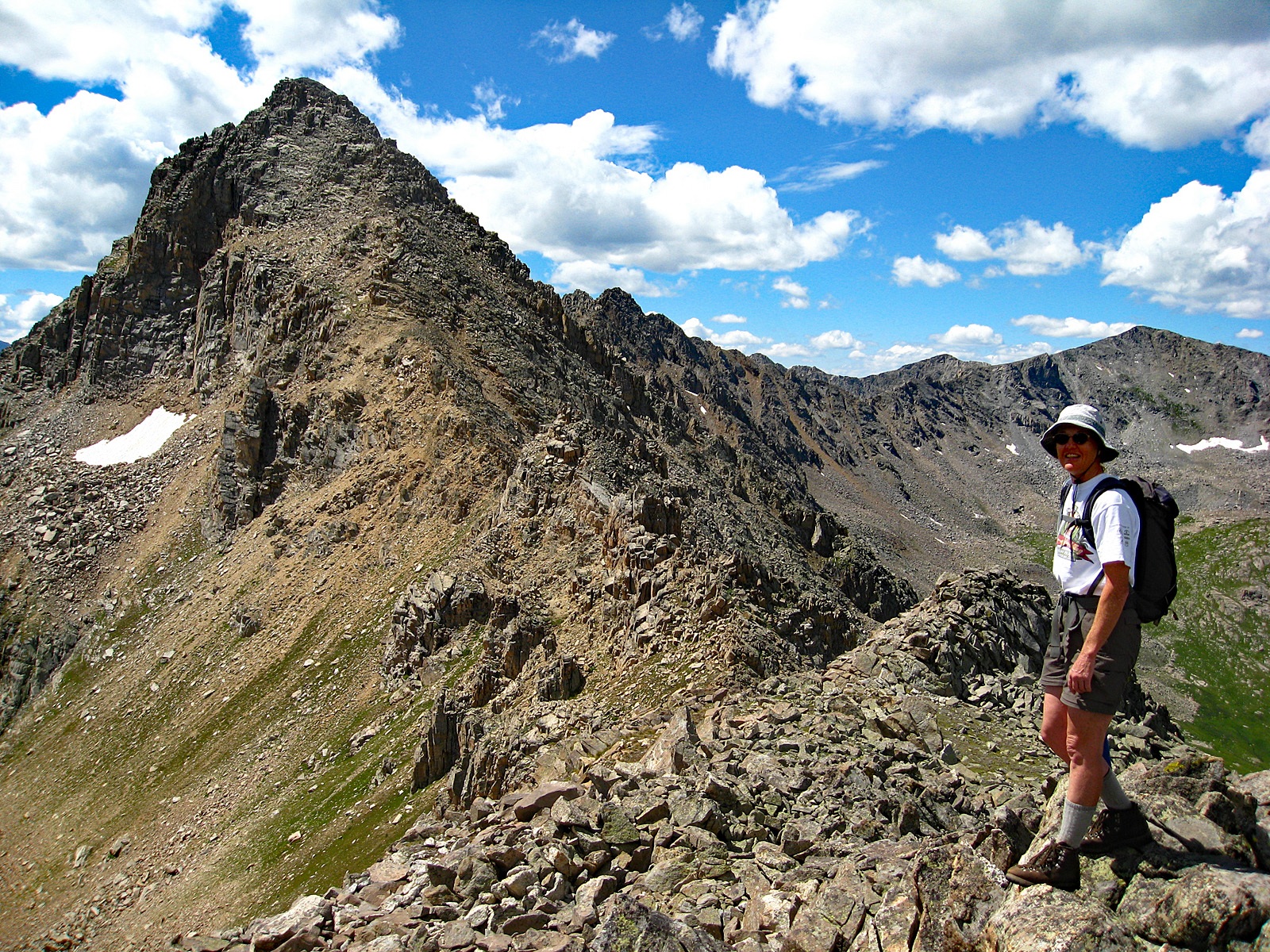
From the summit you can peruse the south connecting ridge over to Williams South B and also look north and study the connecting ridge over to Williams North. Either direction appears rather daunting. Our route took us over to the north summit for this day. See that peak for details.
Additional BETA
Links to other information, routes & trip reports for this peak that may be helpful. -