LoJ: #530 (Pre-LiDAR #514) / 13,145' UN 13145 Formerly UN 13159
Peak Summary
By itself, a Class 2+ summit situated above the beautiful and seldom visited Mill Creek Basin and Columbine Lake, SW of Red Mountain Pass. We have sequenced this summit however with Three Fingers and T.11 for a much longer day. 4WD is not required but useful and can shorten mileage. There is an additional route for accessing this peak alone from US550 south of Red Mountain Pass. Lidar reduced elevation of this summit by 14 feet.
UN13,145 West Ridge Route
-
-
Red Mountain Pass - Black Bear Pass Access TH
We're writing this trip up with the assumption that climbers do not have a 4WD vehicle available, hence, the trailhead for this peak, Trico Peak, T.10, Three Needles, T.11 and UN13,159 is just south of the Red Mountain Pass summit. From Ouray, drive south on US 550 to the summit of Red Mountain Pass and park just south of the actual summit on the west side of the road where the Black Bear Pass road takes out. (FR823) From Ouray, this will take about 20 - 25 minutes of driving.
From Durango, drive north on US 550 to the Red Mountain Pass summit. Park on the west side of the highway just south of the summit where the Black Bear Pass road begins. (FR823)
If you have 4WD with good clearance, you may drive to the summit of Black Bear Pass and reduce both the mileage and elevation gain for the day considerably, if climbing UN13,510, Trico or T.10. In 1996, we found the road up to the pass surprisingly good with no real clearance problems. It was just steep in spots. The more rugged and notorious sections of the Black Bear Pass road are apparently further down on the Telluride side. However, our son reports from trips in 2012 - 2014 that the switchback at about the 11,700 ft. level is deteriorating and becoming progressively more difficult to navigate due to increased use and no maintenance.
Camping
While there are no designated Forest Service campgrounds in the immediate vicinity, north or south of Red Mountain Pass, there are numerous at-large, primitive sites close by. One is located on a knoll, by driving up the Black Bear Pass road about 1 mile and taking a left fork of the road that leads over to Porphyry Basin. Drive up to the knoll no more than .3 mile from the intersection. The elevation is appx. 11,600 ft.
Another good primitive camp location(s) if coming from Ouray is located at the south end of Ironton Park on the east side of the highway, in the vicinity of the road for Corkscrew Pass. If coming from Durango/Silverton, your best bet will be up the South Mineral Creek road.
Route Description
Year Climbed: 1996Note: We climbed this summit as part of a three peak day that began with Three Needles, continued to T.11 and then finished with this summit. Total mileage and elevation gain reflect that overall trip which comes to 4,075 feet of gain and 12.5 miles. Mileage from T.11 is only about 1.75 with a mere 475 feet of elevation gain. But a start from Red Mountain Pass and including the other two summits makes this a long day. Some alternate starting points will be discussed later. We climbed this summit with Bob Alden on July 30, 1996. It was the last peak we ever climbed with him. He passed away Labor Day weekend the same year.
From the car park described in the trailhead description for Red Mountain Pass, walk or drive to Porphyry basin as described for Three Needles Peak. Use either FR823 or FR822 or a combination of both to access the area. Climb Three Needles as described, then traverse over to T.11 as described for that summit. Our route description for UN13,145 begins from the summit of T.11.
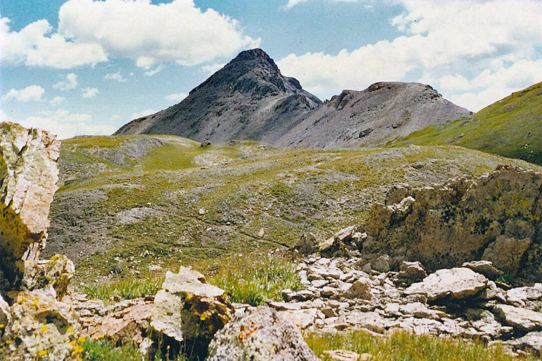
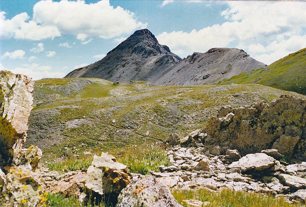
From T.11, the hike over to UN13,145 will take you through some of the most delightful high alpine area you'll ever have the pleasure of strolling through. Head SSW from the summit following the easy-sloping ridge down to the saddle that separates Bridal Veil Basin from Mill Creek Basin. Drop into the Mill Creek Basin and head toward Columbine Lake, a little over one half mile away, strolling through tundra interspersed with protruding granite boulders and outcrops. Pause at the lake and if it's a hot day, cool your feet or your entire body with a quick dip. The unique turquoise/blue color of the lake along with the rugged, multi-hued rocks of the Lookout Peak complex offers a color palette no photographer can resist. Alpine flowers abound.
From Columbine Lake, hike ESE to a flower-strewn saddle between UN13,145 and the unranked Pt.13,300. A magnificent view of the Grenadier Range opens up here. Then hike east along the ridge to the summit. The last portion will become rocky but not difficult with minor scrambling. Soak in the outstanding view and solitude from this seldom-visited summit.
For your return to the start, we dropped back along the west ridge back to the same saddle and then headed north into Mill Creek Basin, crossing the stream where the two main forks come together. There's a nice waterfall here and a prolific display of wildflowers. Continue north and gradually more eastward through a minor cliff band to a higher bench area below the spectacular rock buttress that protrudes off Pt.13,434. Veer east on mostly tundra to contour around the buttress. As you come around onto the north side of the buttress, descend some through rock and tundra to a rock glacier area. If you're fortunate, you may be able to spot an old trail that cuts through the rock debris. That trail will fade in the tundra afterwards as you continue contouring N and E through the basin. You may be able to pick up the same trail again as it heads uphill across a barren slope and crosses onto another bench at about 12,800 ft. Walk east and contour again around yet another prominent buttress that protrudes off Pt.13,375. There's another particularly nice, flower-laden slope here. The cliffs and spires of the buttress make a great background for the delicate flowers. Once you round the ridge, the descent back to Porphyry Basin is easy and you can pick up the trail near Bullion King Lake to hike on back to your vehicle. Time to climb all three peaks and return was 7 hours.
Alternate approaches to UN13,145: If you just want to climb UN13,145 alone, there are at least two possible ways to access this summit: 1. Take the Ophir Pass road (FR 679) from US550 and drive about 2.7 miles to where the USGS map shows an old 4WD track heads NW up into an isolated basin and an unnamed, small lake below the south face of UN13,145. Gain the saddle between UN13,145 and the unranked Pt.13,300 and follow the west ridge to the summit. 2. About one mile below the old townsite of Chattanooga along US550, there's an old mining road that goes up to the Imogene Mine. A trail heads west from the vicinity of the mine and climbs steeply into an isolated basin directly east of the UN13,145 summit. The same trail delivers you into the head of Mill Creek Basin. This trail still shows on the San Juan NF map and is called by some, the "Columbine Lake trail."
Additional BETA
Links to other information, routes & trip reports for this peak that may be helpful. -