#123 / 13,758' Bull Hill

Peak Summary
Bull Hill, climbed from the south off SH 82, is a Class 2 ascent on generally easy terrain. The summit offers an outstanding perspective of two 14ers - Mt. Elbert and La Plata Peak. The trailhead is just off pavement so it is accessible to passenger vehicles. Though there is fairly significant elevation gain, almost the entire hike is either on trail or an old mining road and suitable for a family excursion.
Bull Hill South Ridge Route
-
-
Echo Canyon - SH 82 TH
Access for the Echo Canyon TH is on SH 82 from either the east or west. On the east side, turn west onto SH 82 for Twin Lakes from US 24 between Leadville and Buena Vista. It's about a 12.5 mile drive to the trailhead which will be on the north side of the road. The TH is not marked and it's difficult to spot the turnoff from the highway. Drive slowly to spot it. It's easiest to use the coordinates we provide, but to help, the Echo Canyon TH is 3.0 miles west on SH 82 from the entrance to the Twin Peaks CG.
If approaching from the west, we're assuming hikers will be coming from/through Aspen. Take SH 82 east from Aspen all the way over Independence Pass. Drop on down the east side of the pass into the Lake Creek valley heading south, then east. From the turnoff for FR391 which leads to the La Plata TH, drive another 2.1 miles east to the Echo Canyon turnoff on the left (north) side of the highway. A cabin will be in view when you make the turn.
Once you've identified the correct turnoff, in a short distance, (about 100 yards) the road forks. You may either turn right, proceed a little further west or park. The old road heading north goes to the trail for Echo Canyon. If you park at this intersection, there's only room for a couple vehicles. 4WD could drive up this road to the creek crossing but it's hardly worth the effort on the very rough road.
Camping
There are three National Forest campgrounds east of the TH on SH 82. They include the Lake View, Parry Peak and Twin Peaks. Some additional at-large camping may be found west of the TH along SH 82, but private property abounds so be careful where you choose to camp and most of these spots are occupied on summer weekends. Our favorite and usually least crowded and easiest to access is the one where a diversion tunnel exits and empties a lot of water into Lake Creek. There's a trail here called the "Graham Gulch." See coordinates below. Use this link to obtain more information about the three national forest campgrounds: https://www.forestcamping.com/dow/rockymtn/siinfo.htm
Campsite Locations
Graham Gulch › N 39° 04' 54.05", W 106° 32' 13.06"10,500 ft. elevation
Click thumbnail to view full-size photo + captionRoute Description
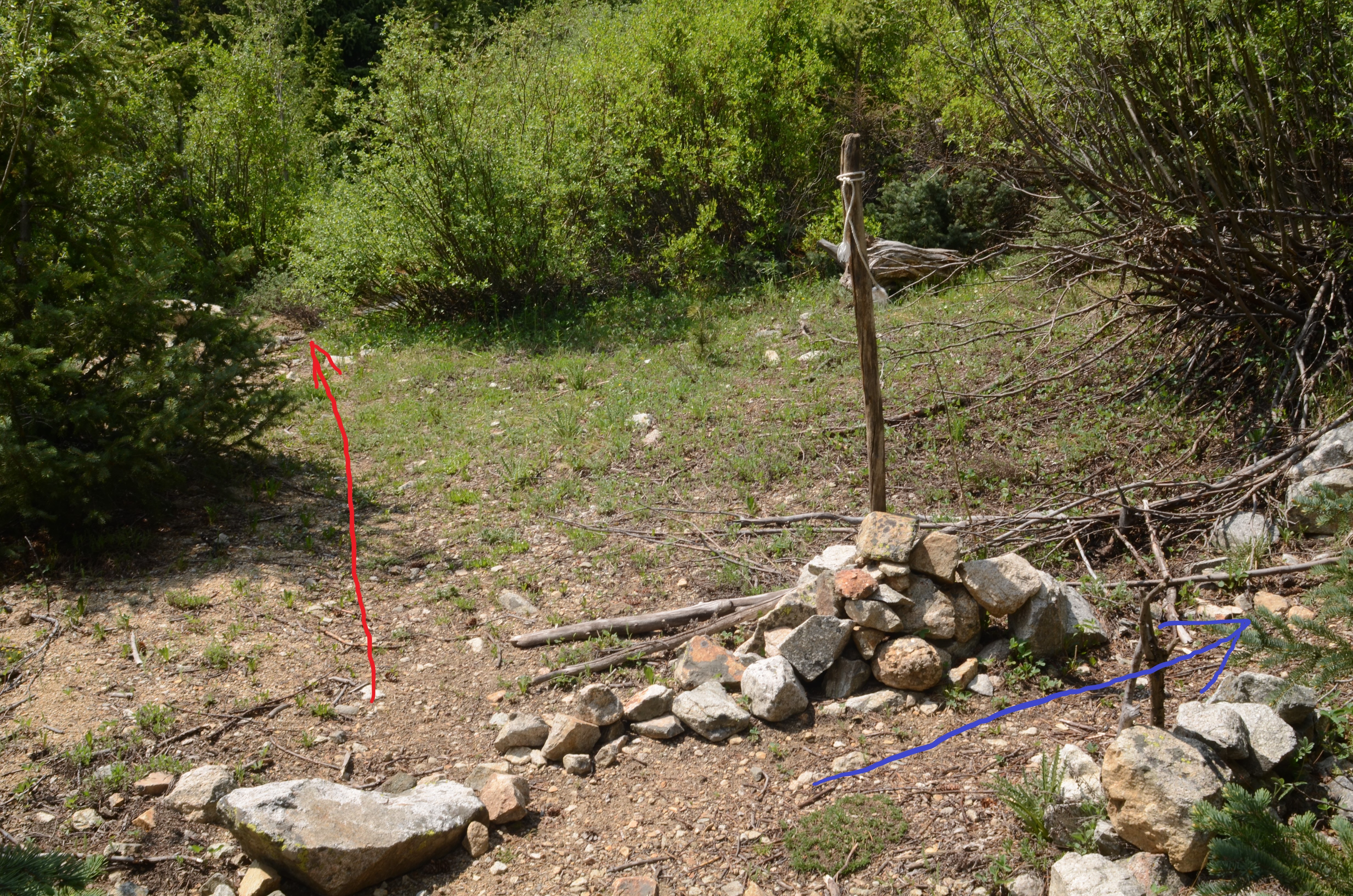
Year Climbed: 1992The trail up Echo Canyon begins by heading uphill to the north. After about a quarter mile, it comes to a creek crossing. 4WD could be driven to here if you have one, but there's little point in doing so. The rough road will not gain you much time. The road ends at an old building's concrete foundation, about 10,200 ft. The trail starts at a creek crossing which is east of and about 25 vertical feet below the foundation. At one point, there was a sign post here indicating that this is the start of the Echo Canyon trail, but a recent report indicated that sign is missing. A June crossing of the creek can be problematic and will likely require wading. A 2016 trip report from a reliable source says they found a log to cross on about 100 feet upstream. Do not follow the USGS map at this point which would have you believe that the trail stays on the west side of the creek and crosses to the east later. Once you cross the creek, the trail follows on the east side of the stream and remains there.
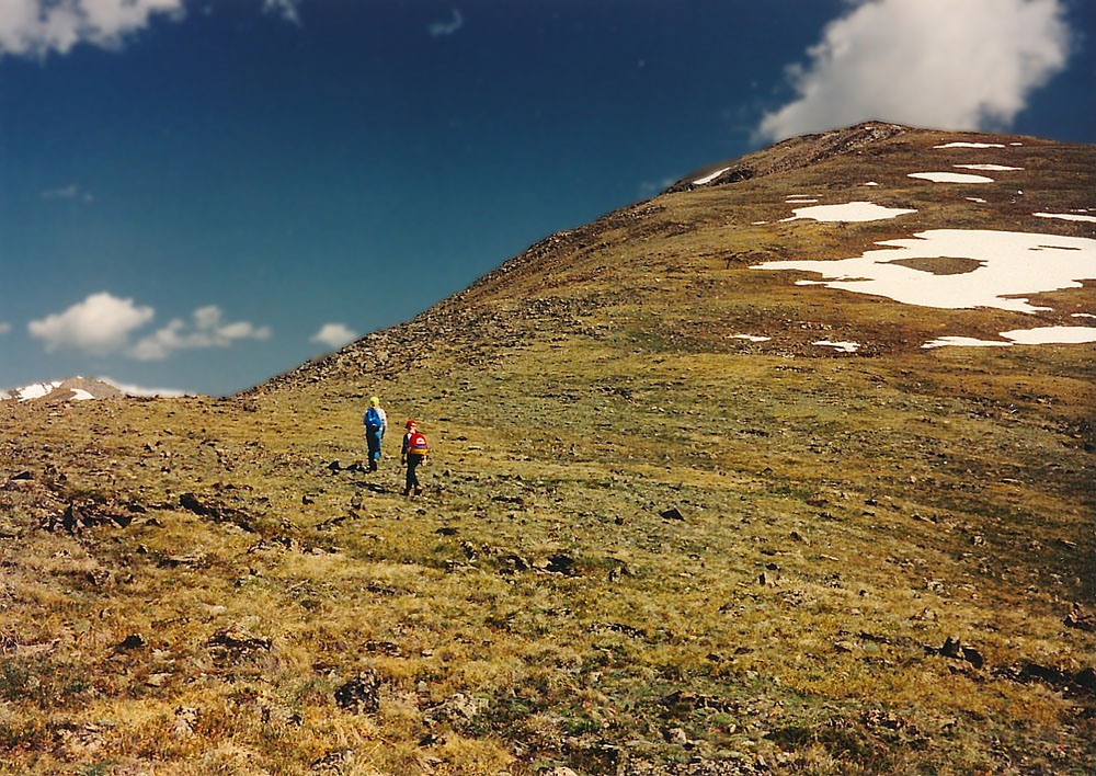
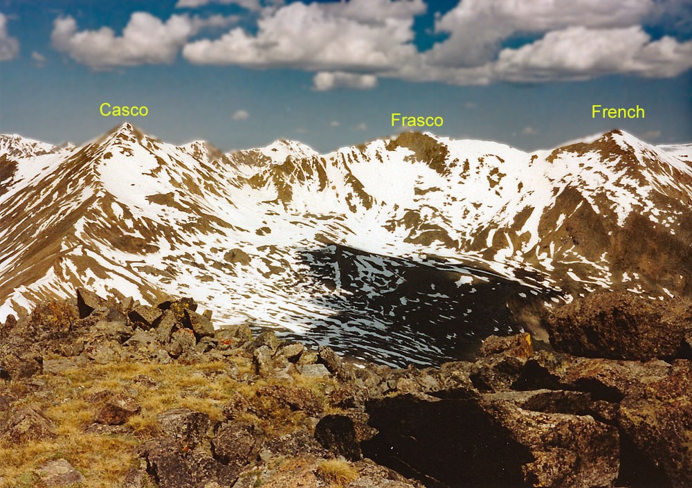
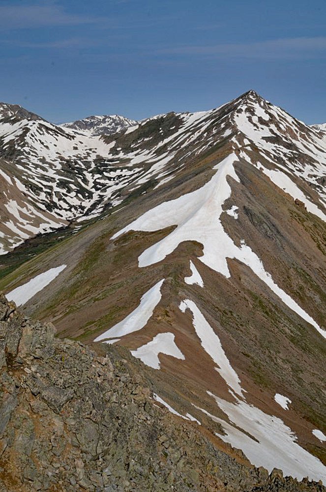
Continue on trail upstream and farther up, it will rejoin the old roadbed that goes to the mines. At 11,130 feet, there's the junction where you should continue on the old mining road which will begin switchbacking up the hillside to the right. Continuing to follow the trail along Echo Creek will take you to a basin south of Casco Peak. Approximate coordinates for this junction are: N 39° 04' 58.73" W 106° 28' 12.62". Usually this turnoff is cairn-marked. Head up the old roadbed which will switchback numerous times. The Last Chance Mine will come in about 1.25 mile. The Golden Fleece Mine will come in about another mile at about 12,700 ft. Continue Class 2 hiking up a steeper, rocky slope to gain the south ridge of Bull Hill. Once on the ridge, it's easy walking on grassy tundra with embedded rock to the summit. As you hike up, an impressive vista of the surrounding mountains will unfold.
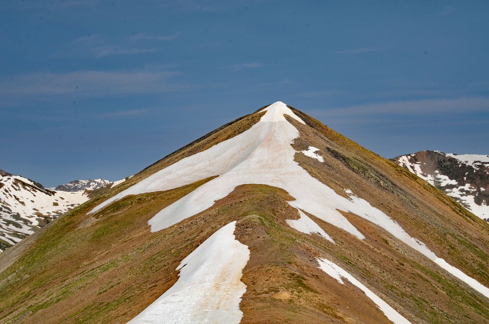
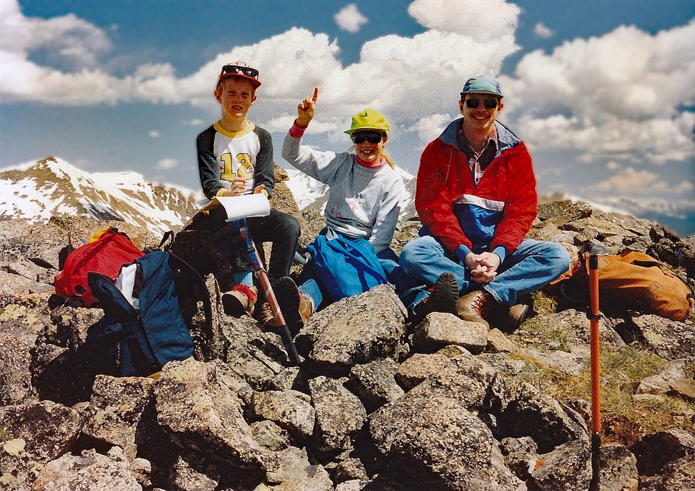
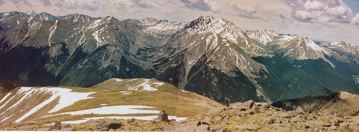
The summit, as mentioned before, offers an impressive view of Mt. Elbert to the NE and La Plata Peak to the SSW. You will likely see hikers on Elbert if it is a weekend, but there's a good chance you will have Bull Hill all to yourself. This is the highest "hill" in Colorado. Descend as you came and if you find the switchbacks on the old road to be tedious, there are places where you can expedite your descent on some scree slopes. With our later elementary-age children, we completed this hike in a very leisurely seven hours.
Alternate Route: Another route for Bull Hill was promoted by G&M in their book. The route utilizes the Black Cloud Creek Trail which is used by many for a southern approach to Mt. Elbert. The trailhead is .7 mile west on SH 82 of the Twin Peaks Campground entrance at these coordinates: N 39° 04' 08.18" W 106° 26' 01.42". Parking is just off the highway. Follow the trail up Black Cloud Creek to a trail junction at 11,000 ft. Take the left fork and hike up to the vicinity of the Fidelity Mine. Gain the SE ridge and continue to the summit of Bull Hill on mostly grassy tundra.
Alternate Route #2: Bull Hill can also be climbed from Casco Peak via the connecting, two-mile long ridge. Eddie Mack reported doing this traverse and rated it a Class 2 with no serious difficulties. It took his party about 2.5 hours to make the traverse. For the most part, stay on the south side of the ridge crest. They reported finding faint trail. From the summit of Bull Hill, you can "ski" on scree slopes back down into the South Halfmoon basin if that is your desired return route.
Additional BETA
Links to other information, routes & trip reports for this peak that may be helpful. -