LoJ: #553 (Pre-LiDAR #571) / 13,118' "Baldy Lejos" Formerly UN 13100 E
Peak Summary
For those with 4WD or higher clearance vehicles, Baldy Lejos (Formerly UN 13,100 E) makes an easy Class 1+, mostly tundra hike that may provide opportunity to view a moose in the wild. Climbers should consider combining this peak with UN 13,115 (most will go over this summit to reach Baldy Lejos) and UN 13,030 (unranked) for a longer day that's still mostly high alpine, tundra strolling.
Baldy Lejos South Ridge Route
-
-
West Willow CK - San Luis Pass - Creede TH
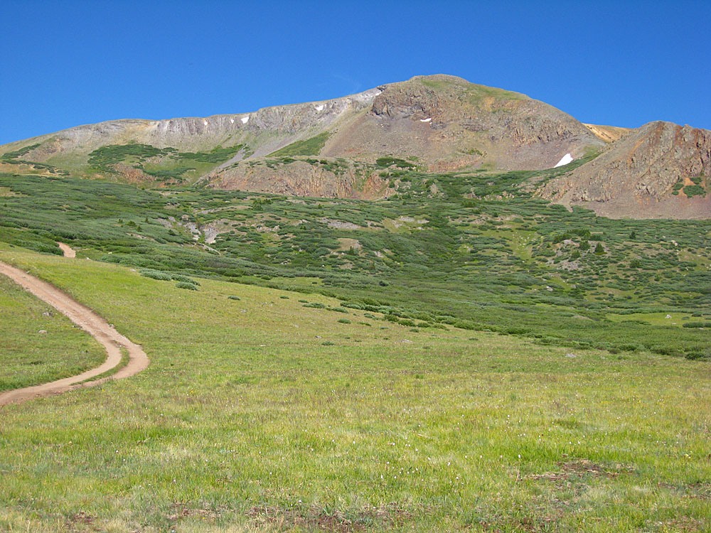
From the town of Creede and CO149, where the highway crosses the main stream in town, (Willow Creek) turn north and follow the Main St. north through the heart of town. Locate the Rio Grande Field Service Office on the right hand side of the street and measure from there. Continue north through town and begin the steep climb up the narrow canyon on a graded, gravel road. Beyond the town, this road becomes CR503. From the end of the pavement, we measured 6.7 miles to the Equity Mine, which is where the 2WD road terminates, or 7.2 from the Rio Grande Field Office. When the road forks at 1.2 miles, stay left to continue on CR503. At 5.0 miles, CR504 turns off to the left. Remain on CR503 to reach the parking area just outside the Equity Mine.
For those with 4WD and good clearance, FR503 continues north, veering off the County Road just shortly before the Equity Mine parking. The road climbs rather steeply at first, then progresses up valley and then drops back down some to cross West Willow Creek to the east side in about .6 mile from the turnoff just before the Equity Mine. The road continues north through open terrain and at 1.25 mile from the Equity Mine turnoff, it drops to the creek and crosses back over to the west bank. In 2019, we found the road blocked by the Forest Service at this crossing because of some serious road degradation further up and so we had to start walking from here, however, the local district office indicated this closure was expected to be temporary. If the road is open, drive another .6 mile to a place where the road turns sharply uphill. There is some limited parking here for just a few vehicles. Most stock SUV's should be able to drive to this point. The trail for San Luis Pass and the trail that splits off for San Luis Peak, over six miles away, heads north from this point. This makes a good location to begin hikes for the various 13ers located around this drainage, on either side. There is not any good camping at this site though. If your vehicle can make it, continue on up the short stretch of steep gain on the road and there is a large, flatter, open area where it's possible to camp, but no trees close by. Overall, the road to the trailhead and coordinates provided was not all that bad in 2019.
Camping
There are very limited, good camping opportunities along the West Willow Creek Road. A section of the road passes through privately owned land prior to reaching the Equity Mine. This property is fenced. Where FR504 turns off, there may be some camping possibility there, but you're right on the private property boundary from what we could tell. The best campsite we saw was 6.2 miles from the Field Office, or about one mile before reaching the Equity Mine. On the 4WD section of road, there were no primitive sites and only a couple spots that were level enough to provide a reasonable "car-camp" for the night. One was just after the first creek crossing, the other is just before the second creek crossing.
-
From Hancock Peak UN 13015
-
UN 13,115 South Ridge Class 1 / 2.6 mi / 1,610’ One-Way
Click thumbnail to view full-size photo + caption
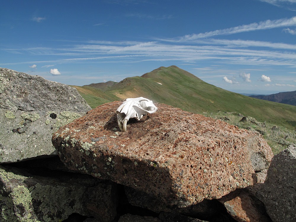
Open This Route in a New WindowTo begin this hike, follow west up the jeep track from the trailhead, which becomes quite bedeviled at a couple of points as it approaches an unnamed pass immediately south of UN 13,115. 4WD, ATV's, etc. have done quite a job at tearing up one section resulting in an alternate track with less gradient. From the pass, it is a tundra stroll to the easy summit. When we had first driven up into this area, we had spotted a group of elk that bolted south. They were not to be seen at this point but later, we would spot the same group, not far from us, but out of sight. On the way to the summit of UN 13,115, we found a little cairn fort with a small, Pika skull laying on the ground. We relocated the little skull and took some photos of it, then continued on. It took about an hour to reach this first summit. There were numerous Old-Man-on-the-Mountain to photograph. Also, on the drive to the trailhead along West Willow Creek, keep an eye out for moose.
While some rate this a Class 2 hike, we have chosen to keep it at the Class 1+ level. The hike up the 4WD track is perhaps the steepest and most "difficult" part of this otherwise tundra stroll.
-
UN 13,005 SE Ridge Class 1 / 1.5 mi / 420’ One-Way
Click thumbnail to view full-size photo + caption
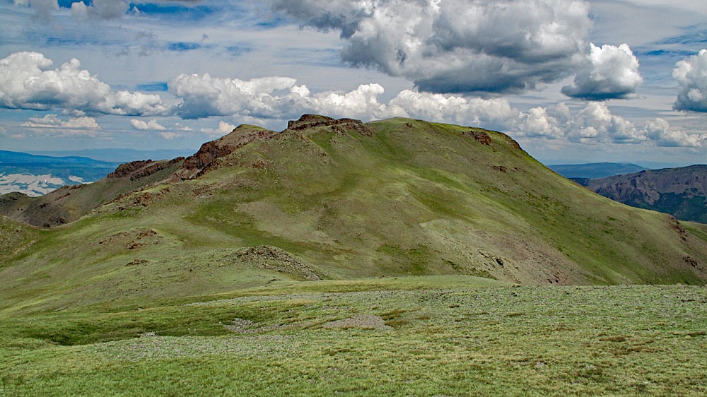
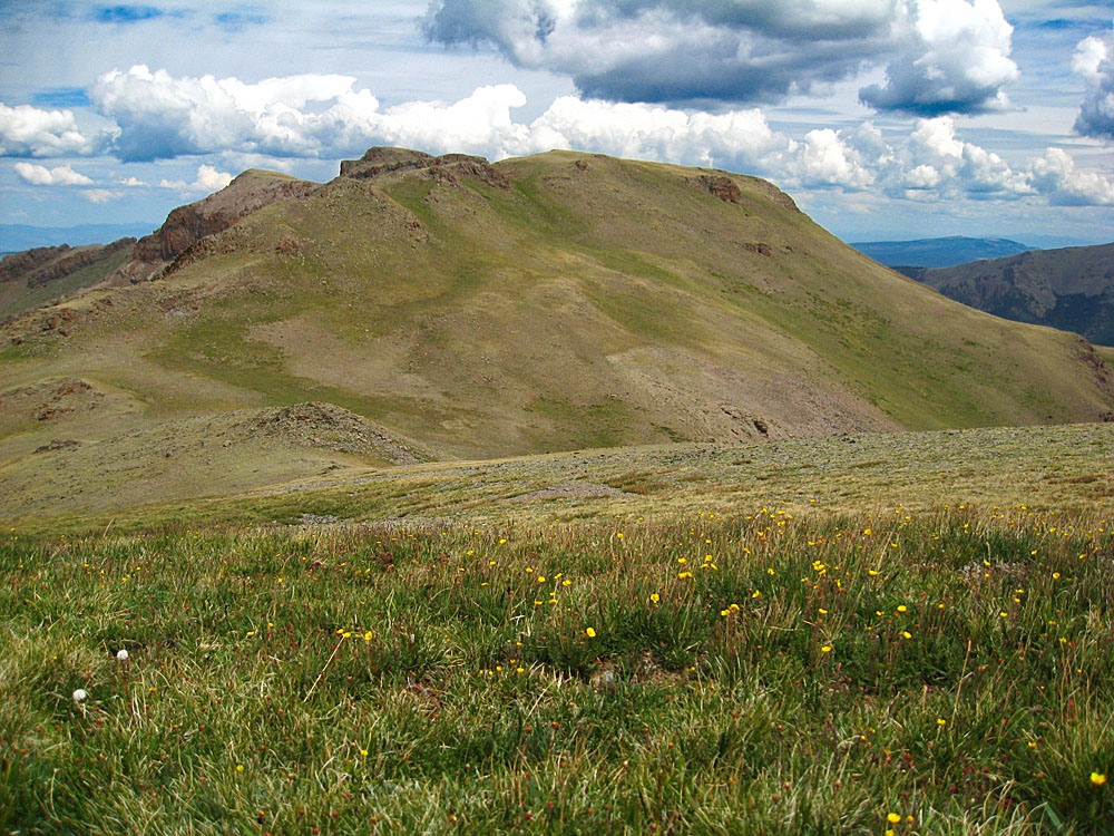
Open This Route in a New WindowUN 13,005 is sequenced with UN 13,115 and UN 13,118 (Baldy Lejos). One-way mileage and elevation gain is measured from the summit of UN 13,115. Round-trip mileage and elevation gain assume completion of the sequence. It should also be noted that UN13,005 was classified as a "soft-rank" summit. This means that if both the summit and the saddle were accurately measured it could qualify as a ranked 13er, however, the FS2016 Topo map does not show a closed 13,000 ft. contour line that would make this possible. That closed line only shows on the 1986 San Luis Peak quad. On Google Earth, the highest elevation we could obtain for this point was 13,015 ft. Lidar has given it an elevation of 13,005 and thus, with only 276 feet of prominence, removed any chance of it being considered a ranked summit.
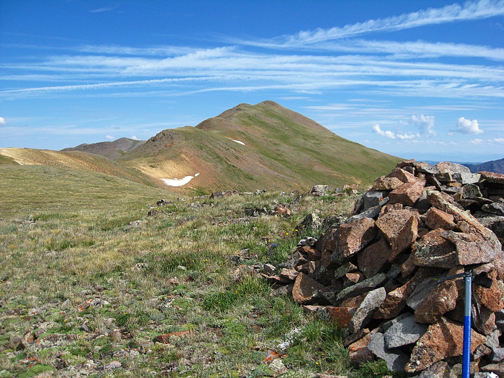
From UN 13,115, walk NNW following the broad, mostly tundra ridge in the direction of UN 13,005. There will be three minor bumps to cross over and one prominent saddle, just before Pt. 12,942. The first minor and somewhat rocky bump is soon after the UN 13,115 summit and can be easily bypassed. From the main saddle up to Pt. 12,942 is the only steeper and rockier section to contend with. Though UN 13,005 could be bypassed on the way to Baldy Lejos, one may as well go over this summit in case it is ever found/proven to qualify as a ranked 13er. The actual summit is more on the rocky side but not at all difficult.
-
Click thumbnail to view full-size photo + captionRoute Description
Year Climbed: 2010UN 13,100 (Baldy Lejos) is sequenced with UN 13,111 and soft-ranked 13,020. One-way mileage and elevation gain are measured from the summit of UN 13,020. Round-trip mileage and elevation gain assume completion of the sequence.
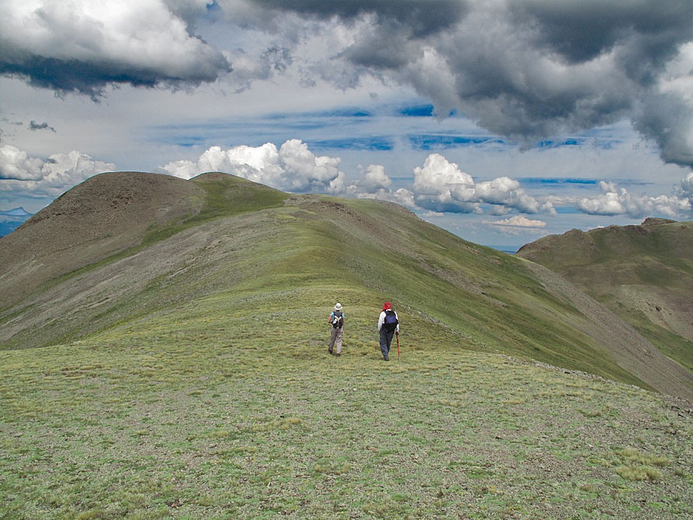
From soft-ranked 13,020, continue north to NNW, first dropping down to another saddle, then continuing on tundra ridge to Baldy Lejos. The entire remaining hike is nearly all on tundra or smaller tundra-embedded rock. This remaining mile should take under a half hour to cover. The summit of Baldy Lejos offers a great overview of the West Mineral Creek drainage to the west and the cascade Creek drainage to the east side, north of San Luis Pass. Beetle-kill has been heavy in this area in recent years. When we hiked here in 2010, those forests were in generally good condition. They may not be now. Wildflowers along this hike were abundant and you may be fortunate enough to spot some Ptarmigan as we did.
For the return hike, you can either follow the approach route back or, to avoid extra elevation gain, contour around some of the unnecessary high points. We have calculated an additional 200 feet of elevation gain on the return assuming most will want to contour.
Additional BETA
Links to other information, routes & trip reports for this peak that may be helpful. -