LoJ: #376 (Pre-LiDAR #368) / 13,322' De Anza Peak De Anza B
Peak Summary
De Anza Peak B as best we can tell may be considered to be on the private property of the Cielo Vista Ranch, and/or, the summit may be a dividing line for the Cielo Vista and Trinchera Blanca Ranch. De Anza Peak (B) is a mostly easy Class 1 & 2 hike along its southern ridge with an approach from Whiskey Pass, or a Class 2 hike along its northern ridge from Mariquita Peak. The hike from the car park below Whiskey Pass up to Whiskey Pass will be the toughest part coming in at perhaps Class 2+ depending on the exact route taken. Access from Whiskey Pass is the most likely way to reach De Anza legally, but the cost may be steep and a 4WD vehicle will be needed regardless of how you approach this summit. Lidar measurements reduced the elevation by 11 feet.
De Anza Peak B via Mt. Maxwell Route
-
-
Mt. Maxwell Trailhead
This trailhead could be primarily used for access to Trinchera and Cuatro summits along with Mt. Maxwell and possibly Mariquita Peak and De Anza B. From Walsenburg, drive west on US 160 and take the turnoff for La Veta, on SH12. Drive through the quaint, small town and continue south toward Cucharas Pass. This very pleasant road takes you through gambel oak terrain, into ponderosa forest and eventually more typical higher elevation aspen and conifers. If you do road bicycling, this is a great ride! Drive on through the little townsite of Cuchara, past the turnoff for the old Cuchara Valley Ski area and continue over Cucharas Pass. About 6 miles south of the pass, the highway makes a sharp turn back to the NW to get around North Lake. It then turns back south. After that turn to the south, watch for the turnoff for FR34 to the Purgatoire Campground on your right (west). There are actually two possible turns to this road in case you miss the first. Drive west and NW up the improved, graded dirt road. About .6 mile before the campground, or 3.75 miles from the highway, watch for the turnoff for FR437 to the left. Head up this 4WD road which will become increasingly rocky, but not too difficult. (Last time we were on it was 2004.) The road switchbacks relentlessly for most of its 3 mile length to gain elevation. There's a good campsite at about 11,500 feet we estimated and then towards the end of the road, it flattens out some for some other camping possibilities. FR34 ends at the Purgatoire campground.
Camping
As mentioned above, there's a good at-large spot on the side of FR437 at about 11,500 ft. or higher and then further up where the road levels out around treeline, there's some other possibilities. You can also camp at the Purgatoire Campground, which is a National Forest fee area. There are about two dozen campsites, some in forest and some in open meadow. The sites have tables & fire rings. There are vault toilets and a hand pump for water. This used to be called "The Potato Patch" campground. Campground elevation is 9,800 ft.
Campsite Locations
Purgatoire Campground › N 37° 15' 16.58", W 105° 06' 33.85"9,750 elevation
-
From Mount Maxwell Mariquita Peak
-
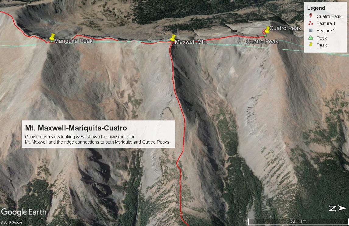
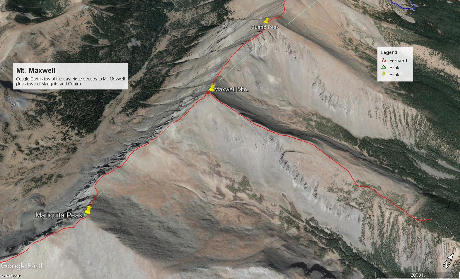
Mt. Maxwell East Ridge Class 2 / 1.3 mi / 1,735’ One-Way
Click thumbnail to view full-size photo + caption
Open This Route in a New WindowThe mileage and elevation gain estimates are based on assuming a start from 11,600 ft. With 4WD, you can actually drive a little farther than that. From wherever you manage to park, continue up the road until it ends, then work your way up west to a bench of dwarf trees that will then open to the broad, lower, east ridge of Maxwell. Follow the ridge upward. It will progressively narrow. Much of the hiking will be over grassy tundra, but that will give way to more of an embedded rock - tundra mix and finally chiprock as you near the summit. A couple hundred feet below the summit, there will be some rocky outcrops that can be easily avoided on the south side of the ridge. Nothing need exceed Class 2. Time from car park to summit was well under two hours. In 2004, there was a small summit cairn and the remnants of a forest service sign, probably intended to mark the terminus of Federal land. Hiking north from here will keep you within San Isabel NF. If you turn south from Maxwell, you will immediately be off national forest land and will be entering private property. Do so at your own risk. Provision of the following information is not to be construed as an endorsement to violate the private property rights of the landowners.
On the west side of the main ridge, that property is part of the Forbes - Trinchera Blanca Ranch which is held as a "conservation easement" and managed by Colorado Parks & Wildlife. We do not know who owns the land on the east side of the ridge. It appears to us that the only people welcome on the Trinchera Blanca Ranch are paying guests, such as hunters. No mention is made of hiking/climbing. If you wish to inquire about access try the following: [email protected] or 719-379-3263. (There is also a "north" unit of the Trinchera Ranch which apparently includes Blanca, Little Bear and Mt. Lindsey, or the border of this property reaches the summits of these peaks on the south and east sides.)
From Maxwell, it's .75 mile north on a connecting ridge to Cuatro. We have not done that ridge section so are unable to offer definitive information about the traverse. On GE, it appears that a descent to the connecting saddle will go easily and the first part of the upclimb to Cuatro will go at Class 2 on some tundra. But the upper part of the ridge is interrupted by a number of gullies and ribs that appear to offer some potential problems.
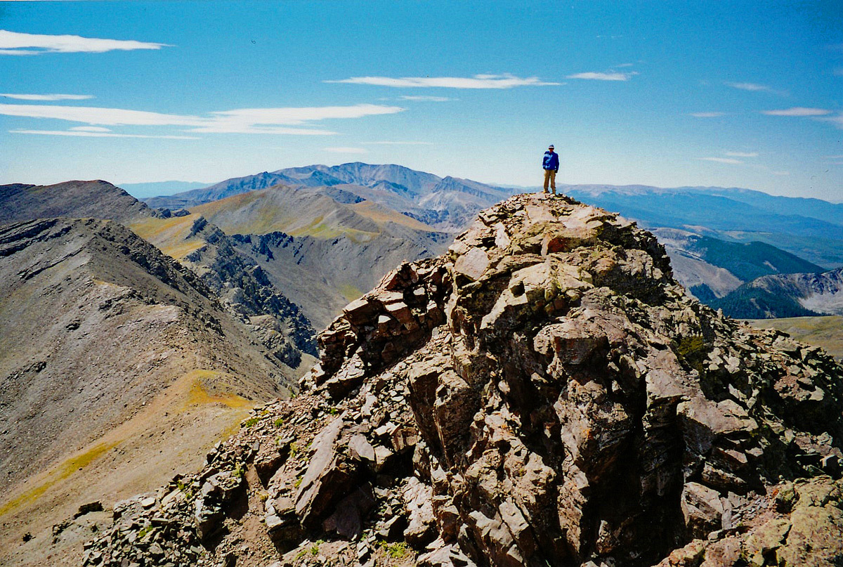
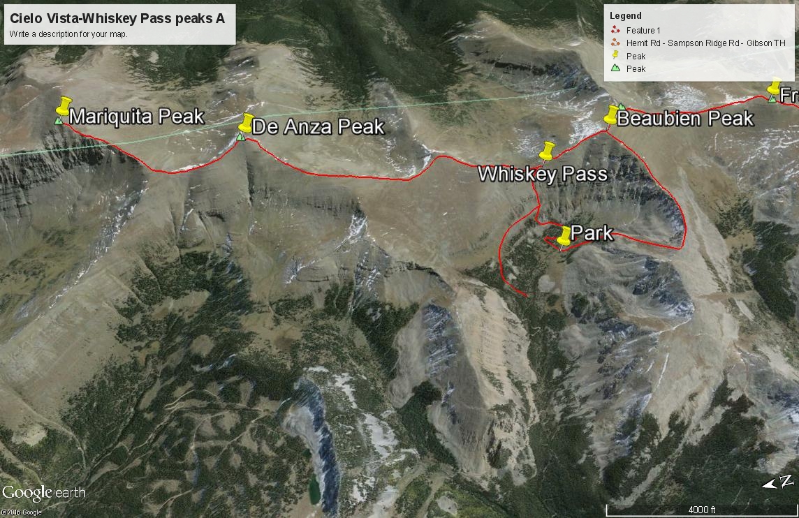
From Maxwell to Mariquita, it is a fairly rocky traverse, but it's still Class 2 and takes under an hour. De Anza is yet another 1.4 mile south on mostly rocky rubble down to the saddle and then changing over to sparse tundra and embedded small rocks to the summit. Still Class 2. De Anza may lie within the boundary of the Cielo Vista Ranch and as such, it may be possible to make arrangements with them to visit this area since at one time they were allowing climbers access to the west side of Whiskey Pass and the peaks along the central ridge located near the pass.
-
Route Description
Year Climbed: 2004De Anza Peak B as best we can tell is part of the vast Cielo Vista Ranch which is all private property. The ranch property line extends down the west side of the central ridge of summits that stretch all the way from De Anza Peak B in the north to State Line Peak in the south. You can download a Google Earth map of the property by going to this link and scrolling on the right down to the GE map link: https://www.mirrranchgroup.com/ranches/cielo-vista-ranch/. Permission must be obtained to access any of these peaks. For several decades now, the owners of this ranch property have been the only ones to allow access to these high peaks. CF&I Steel owns some of the land on the east side and has never agreed to any access and will prosecute trespassers. Policies by the ranch owners have varied in the past regarding access to which summits and routes to them are allowed. Before attempting any peaks, make sure you have a clear arrangement with the Cielo Vista Ranch owners/managers. See the "trailhead" description for more details. Reaching any of these summits near Whiskey Pass will likely involve a steep fee. If approached from Mt. Maxwell, which is the southern terminus of the San Isabel NF land, proceeding south along the main ridge to Mariquita and De Anza will be on private land. Proceed at your own risk. This route description is offered as an alternative to the Whiskey Pass approach in the hopes that at some point, it can be legally done with permission from the applicable property owners.
De Anza Peak B is sequenced with Mariquita Peak. One way mileage and elevation gain are measured from the summit of Mariquita. Round-trip mileage and elevation gain assume completion of the sequence as described. From the summit of Mariquita, descend SW along the main ridge toward Pt. 12,925. This first part will be mostly over rubble. As you acquire Pt. 12,925, the rocky terrain will give over to more sparse tundra and smaller embedded rock. Enjoy a stunning view of the spectacular cliffs on the west side of Mariquita here. On easier terrain, make the final 400 foot gain to the summit of De Anza, still Class 2. From this summit, you'll be able to look south down toward Whiskey Pass, which is the other possible and "legal" approach to this summit if allowed by the Cielo Vista Ranch. As with all of that ranch property, wildlife, especially elk are abundant. You may also encounter some Bighorn Sheep. Return as you came. Any further progress south will be on Cielo Vista Ranch Property.
Additional BETA
Links to other information, routes & trip reports for this peak that may be helpful. -