LoJ: #414 (Pre-LiDAR #415) / 13,282' "Tabor Peak" UN13282

Peak Summary
One of the most entertaining peaks on the New York Mountain quad with a short knife-edge section and a beautiful shelf lake. Class 2+. (Some will consider the exposed "knife edge" ridge as a Class 3, however, use of hands is not required to navigate that section of ridge.) 4WD access helpful but not required. Remote and seldom visited.
Tabor Peak North Ridge Route
-
-
Lincoln Gulch - Grizzly Reservoir TH #1
There are two possible trailhead/approaches to climb several of the Lincoln Creek summits - one from the east side of Independence Pass, the other from the west side. There are nine we climbed from the west side.
From the Town of Aspen, drive east up state highway 82 toward Independence Pass. A little past the Grottos TH, turn south (right) and drive down to the Lincoln Gulch Campground. If in a passenger car, you'll need to park here. 4WD or vehicles with better ground clearance may then continue ESE for Grizzly Reservoir. This road is identified as CR23 or FS107. Along the first 3 miles to the New York TH, there are numerous, designated, primitive campsites. The road tends to be slow going with potholes, etc., but no real major obstacles. It may take over a half hour to drive the 6 plus miles back to the reservoir. There is a small campground there with facilities called the "Portal" campground.
Just past the campground, in prior years, we have found a locked gate across the road as it continues south up the valley. Because there are some private holdings further up valley, we've seen some persons with a key to that gate. We've seen the Forest Service keep that gate closed past the 4th of July weekend, depending on snow melt and runoff conditions. The gate may also be closed again in early fall. If the gate is open and you have good 4WD clearance, you may continue to drive up valley as far as "Ruby," and the Ruby Mine, right around, 11,400 ft. If the gate is closed, be prepared to walk an extra 4 miles, or do as we did one time , and bring mountain bikes and ride up the road to Ruby. The bikes won't seem much faster than walking when going uphill, but will speed your return to the campground considerably.
UN 13,460 (#281 Rank) can be approached from the east side of Independence Pass as well. From HWY 24 between Leadville and Buena Vista, turn west onto HWY82 and drive 14.5 miles to the turnoff for the South Fork of Lake Creek (FS391 as discussed for the other UN13,460 or Sayres BM.) Cross the Lake Fork on a new bridge and drive back as far as the turnoff on FS391 for Sayres Gulch. Shortly after that intersection, the main road becomes more 4WD. Drive another .65 mile to an intersection with a road turning off to the right for McNasser Gulch to access Grizzly and Garfield Peaks from the east side. You will be able to drive 1.2 mile up before being stopped on this 4WD road.
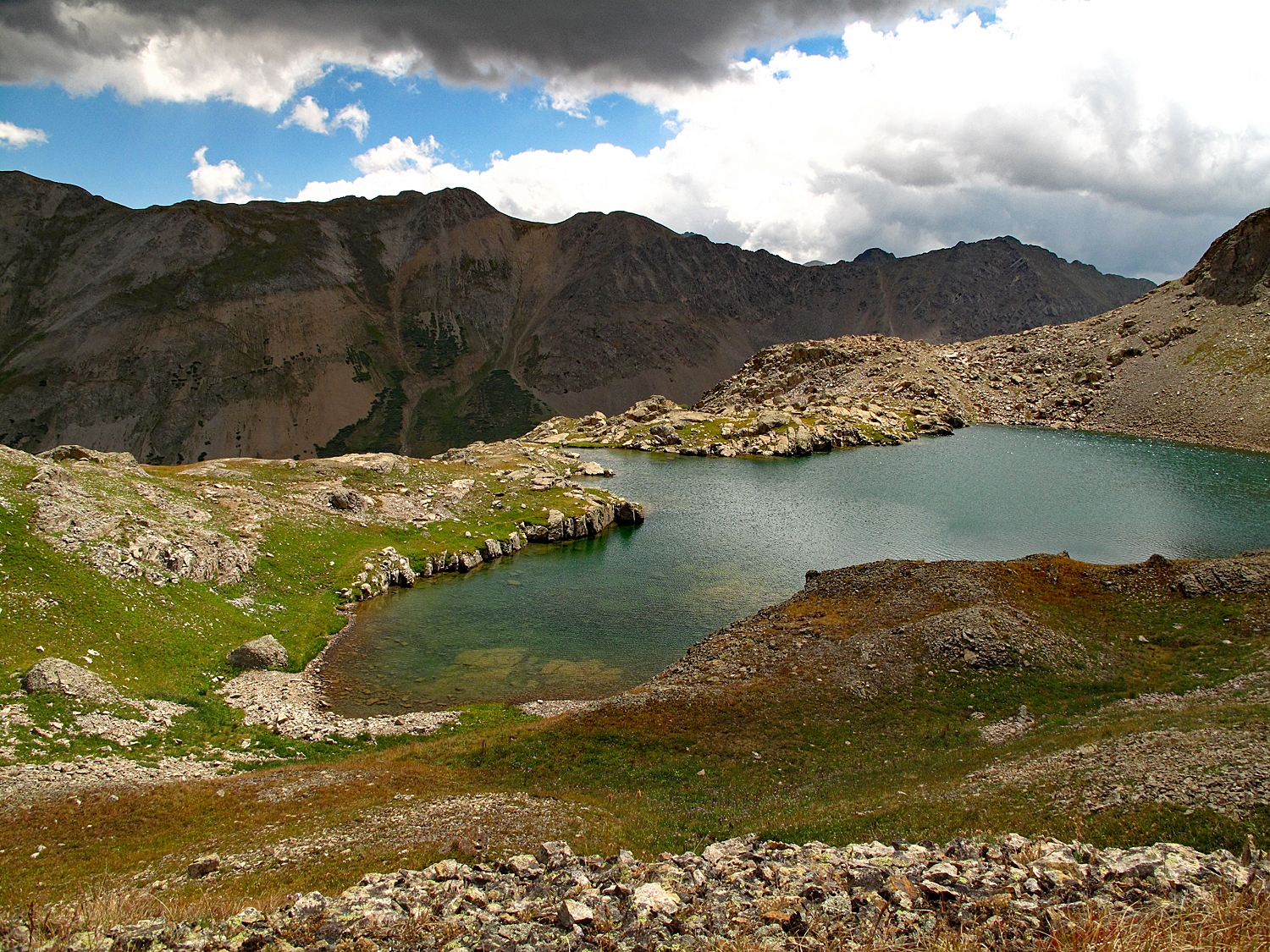
Back on the main road following the South Fork, continue by foot or 4WD up the South Fork to another intersection in 1.4 mile and then head up the right fork on the old road into Peekaboo Gulch until stopped by either the Wilderness Boundary or deteriorating road conditions. If coming from this direction, UN13,460 would combine easily with Middle Mountain; #327 - "Prize BM;" and #381 - "Booby Prize." Check out the Pieplant quad for details.
Camping
There is a designated forest service campground with facilities but no drinking water at Lincoln Gulch. Beyond there are many designated primitive sites that receive heavy summer weekend use and often fill completely. Then at Grizzly Reservoir, there's another small campground with toilets but no drinking water. This is called "The Portal" CG.
Click thumbnail to view full-size photo + captionRoute Description
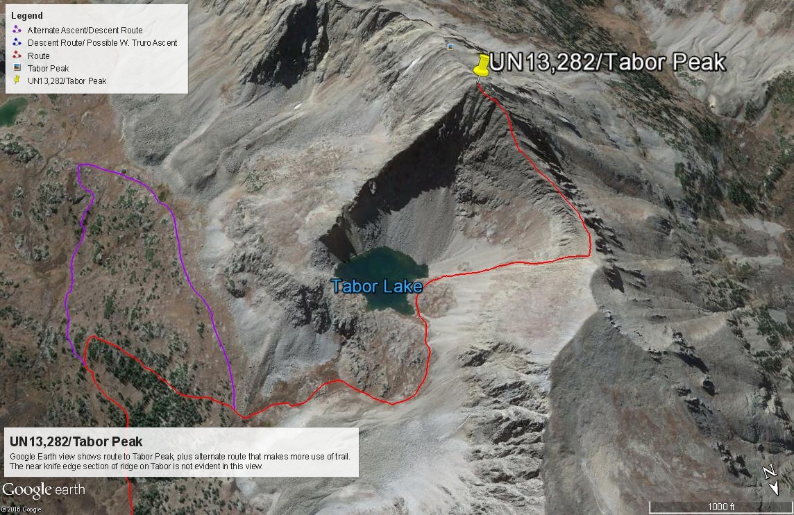
Year Climbed: 2009If you have 4WD, drive on the Lincoln Creek road past the Lincoln Gulch Campground as though heading for Grizzly Reservoir, but after about 3.9 miles, stop and park at a trailhead location for Tabor Creek. If you don't have 4WD or ATV, you'll either have to walk this extra distance or bring a mountain bike. Either choice will make your day significantly longer.
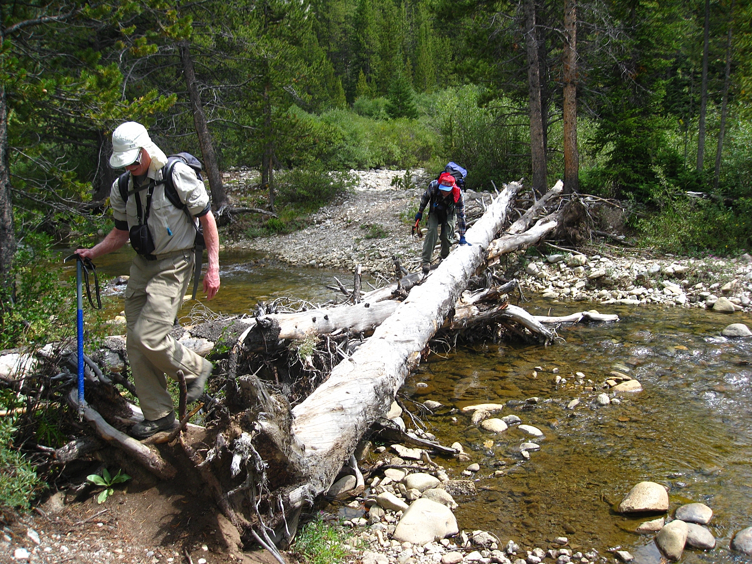
Find a way across Lincoln Creek. We used a series of fallen trees (See photo), but if they're no longer there, you may need to wade. In early season, this can be problematic with high runoff. Once across, head up on the trail which is found on the east side of Tabor Creek. In less than a half mile, you'll cross the New York Collection Canal, and shortly after that, the trail crosses to the west side of Tabor Creek, again posing a possible crossing problem.
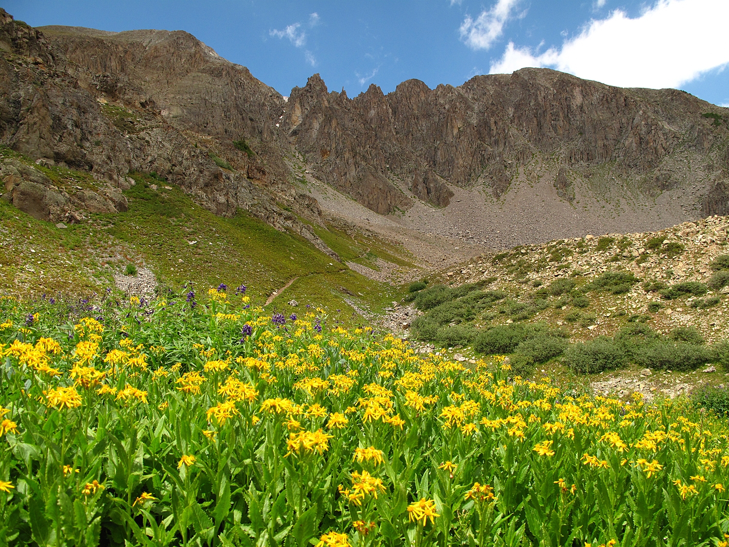
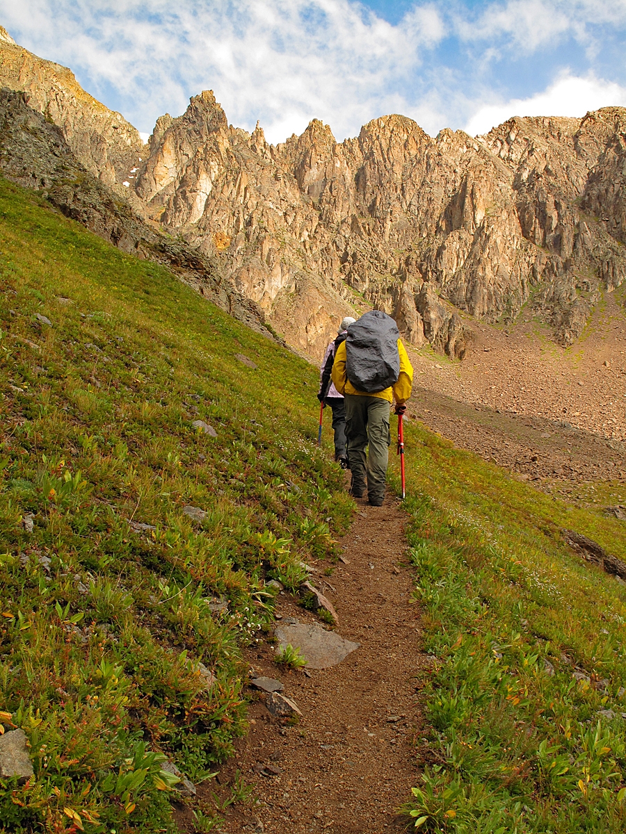
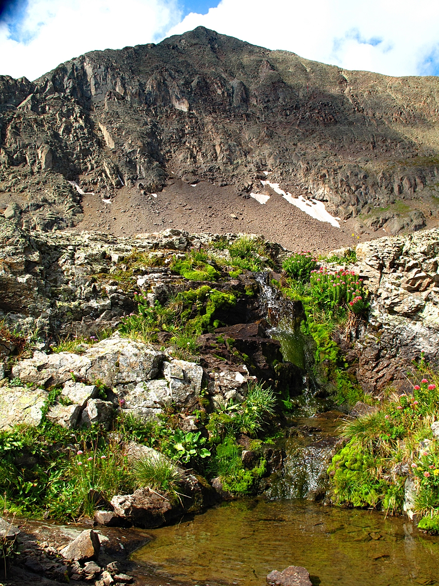
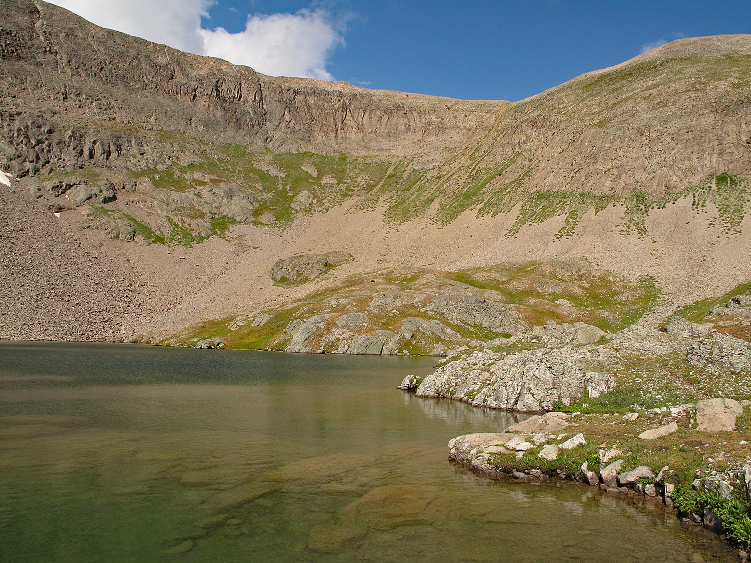
Once across, the good trail heads south, always staying on the west side of the drainage. Continue to the south side of a group of trees at about 11,600 feet elevation. Leave the trail and head NW, working your way up the steep slope and through open trees to a bench area below and directly east of Tabor Lake. In July, this bench has abundant wildflowers. The creek that drains Tabor Lake cascades down and passes across two large cave-like openings in the rocky cliff. At this bench location, you should be able to spot a trail coming in from the south. Join it and continue following the trail all the way up to Tabor Lake. The lake has a beautiful color and sits right on the edge of the shelf, offering opportunities for spectacular photos.
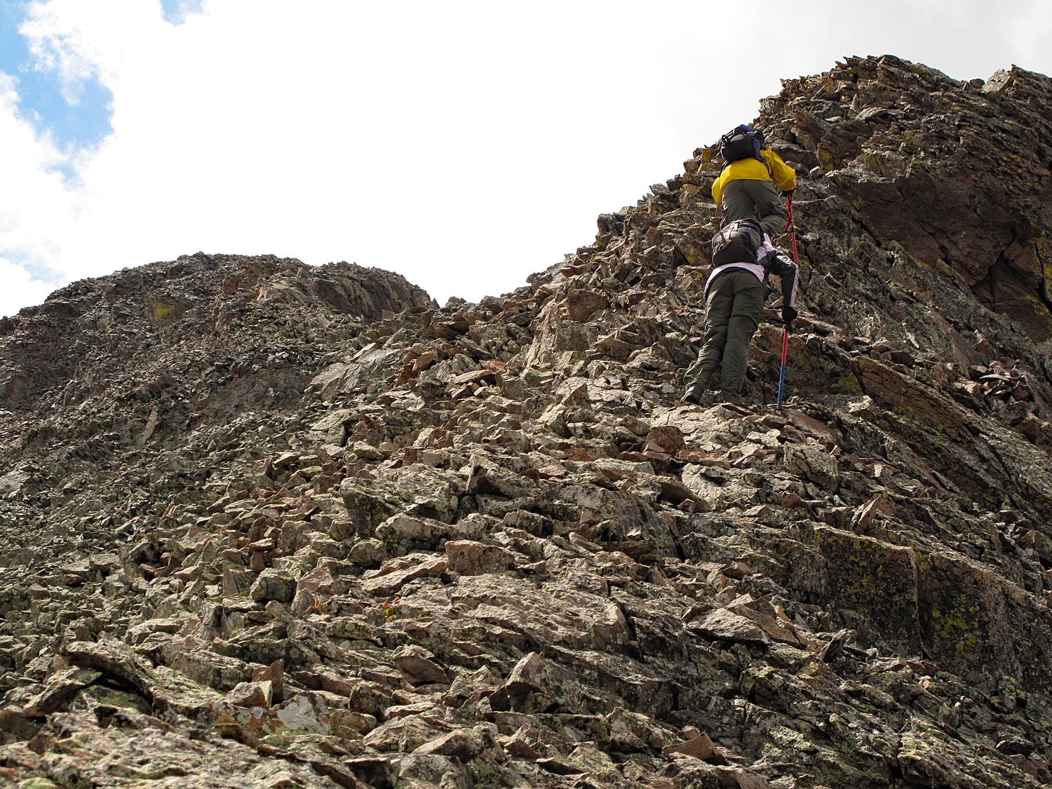
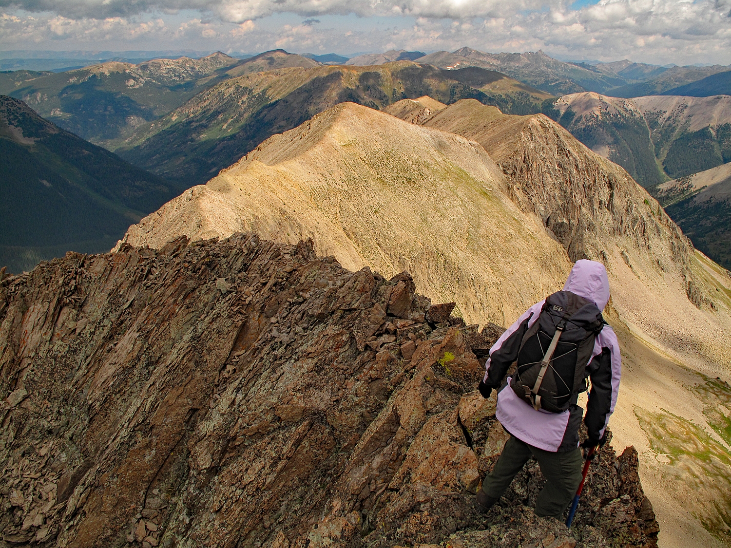
From the lake, head up an easy, shallow, tundra and scree type gully/slope west to the saddle between Tabor and Pt.13,026. We observed elk on this high ridge. At the saddle, head south again following the ridge crest. From this point on, you'll be on either broken rock or boulders. Remaining on the ridge crest is usually the best option, though at one point, we got over on the west side and just a little below the crest. There are a couple of sections where the ridge crest narrows to only a few feet wide. At one point, it's only about a foot wide. There is some exposure in these sections but the rock, though loose, is generally reliable. If the rock is wet, this could be a lot more intimidating. Most all of this is Class 2+ with perhaps a few 3rd class moves depending on your exact route. Continue to the rocky summit and peer back down to Tabor Lake, now far below. It took us about an hour from the lake to make the summit.
For the return trip, follow the same route back down to the lake. If time allows, linger at the lake and enjoy the view and wildflowers. Descend back down the trail to the bench below the lake. If you wish to continue on trail, follow it through the lush wildflowers and then contours along the bench south to a small tarn and then curves SE to intersect the main trail just a little below the small lake at 11,820 ft.
For an alternate route to Tabor, some hikers opt to gain the main north ridge a couple of miles north of the summit. See links provided for this route option.
Additional BETA
Links to other information, routes & trip reports for this peak that may be helpful.SummitPost › Tabor Peak North Ridge -