LoJ: #82 (Pre-LiDAR #81) / 13,861' Dyer Mountain

Peak Summary
While Dyer Mountain may easily be reached by a strolling, Class 2 ridge walk from Mount Sherman, a more interesting route exists on the west side of the range by driving in from Leadville. The West Ridge route to the summit offers some Class 3 scrambling and the start is still accessible to passenger vehicles. The overall route may still be completed in just a few hours since there is no lengthy approach hike. The overall mileage from the east side & hiking over Mt. Sherman will be significantly longer than the hike from the Leadville side. See both routes and separate trailheads below.
Dyer Mtn. W Ridge / SE Flank Circuit Route
-
-
Iowa Gulch - Leadville TH
From US 24 in downtown Leadville, turn east onto East 3rd St. This is closest to the south end of town. US 24 at this point is designated "Harrison Ave," which is just south of the Tabor Opera House. Go a few blocks east on E. 3rd, then turn south onto South Toledo St. which will become County Road 2. In about a tenth of a mile, you'll pass East Monroe St. coming in from the west (right). If you're arriving in Leadville from the south, you could use a right turn onto Monroe as a means of accessing CR 2. The paved CR 2 leads south and southeast up California Gulch, passing by both old and newer mining sites. At 4.4 miles from US 24 (Harrison Ave.) in Leadville, you'll come to an intersection. The right fork leads to an active mining operation (ASARCO). Take the left fork which continues east, staying well above the bottom of Iowa Gulch. This fork is CR 2B which becomes graded gravel. Continue east another 2.3 miles to a small pullout on the right hand side of the road. See trailhead coordinates. Most passenger vehicles should be able to make it to here. The road is in better shape than the San Isabel NF map would indicate. If unable to park here, just a little farther east on the road is a pullout on the north side that can accommodate several vehicles. Going beyond there, we would recommend a higher clearance vehicle.
Camping
There are so many old mining claims and active mining operations throughout California and Iowa Gulches, that we cannot recommend any at-large camping. Most anything you would try to camp on would likely be private property. On CR 2, where it crosses the ridge that divides California and Iowa Gulches, there appears to be a track leading west off into the trees from where the road curves back east from going south. Coordinates are: N 39° 13' 38.08" W 106° 15' 02.67".
The closest National Forest Campgrounds are located around Tuquoise Lake west of Leadville. Campgrounds include: May Queen, Silver Dollar, Molly Brown, Printer Boy, Belle of Colorado, Baby Doe, and Father Dyer. Consult your San Isabel National Forest map for more information on these. It may be possible to make reservations for some, but expect them to be full on summer weekends if you're hoping to just get lucky. From any of those campgrounds, you could easily drive to the Iowa Gulch TH for Dyer in about a half hour to 45 minutes.
Click thumbnail to view full-size photo + captionRoute Description
Year Climbed: 2016The following route description has been provided by Shaun Cooney who completed this route with Jon Bradshaw, July of 2016. All photos provided by Shaun Cooney.
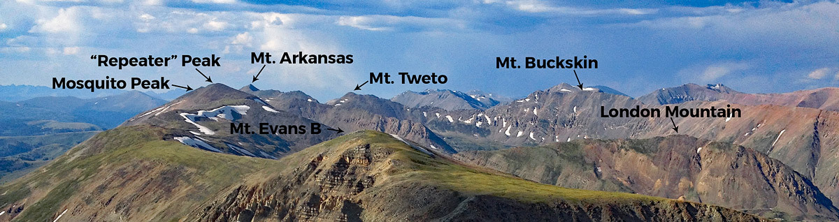
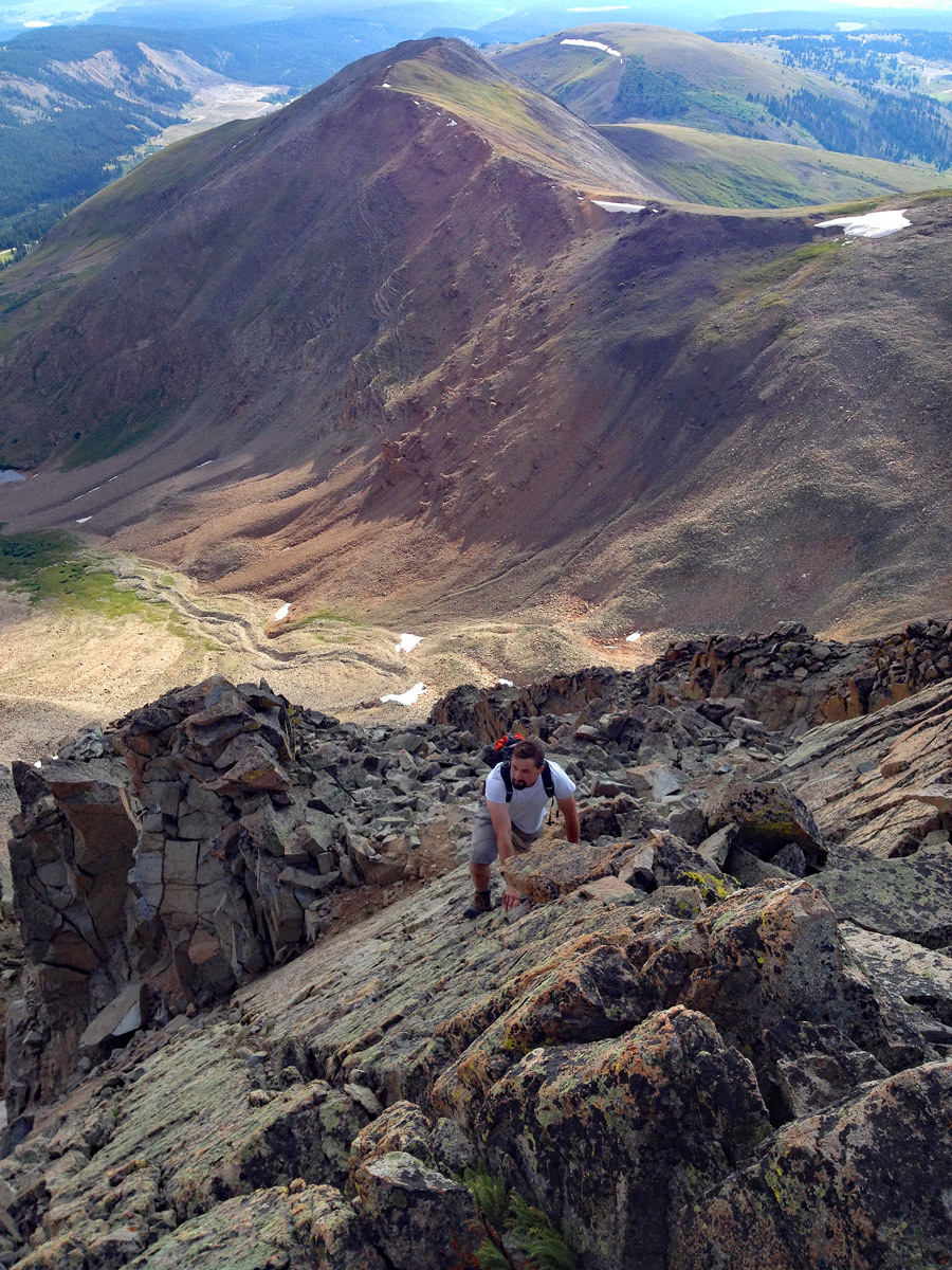
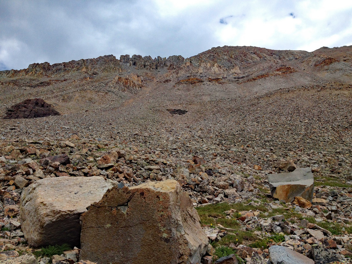
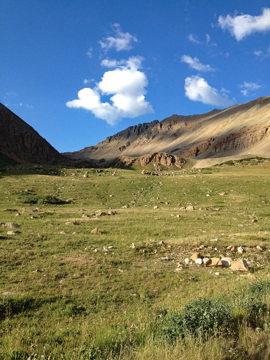
From your parking spot along CO Rte 2B @ 11,650' meander your way north into the basin SW of Dyer Peak's summit, commonly referred to as Dyer Amphitheater. Follow a faint trail up the basin until it gives way to rockier terrain above 12,000'. Continue on a general trajectory up the basin aiming for a point of your choosing somewhere between the saddle with West Dyer and the first major rocky obstacle on Dyer's west ridge. The view of Dyer's west ridge from your vantage point in this basin may appear intimidating and/or undesirable at times, but for peakbaggers comfortable with a little bit of scrambling and minor to moderate exposure, the route up the ridge is far more pleasant than it looks from here!
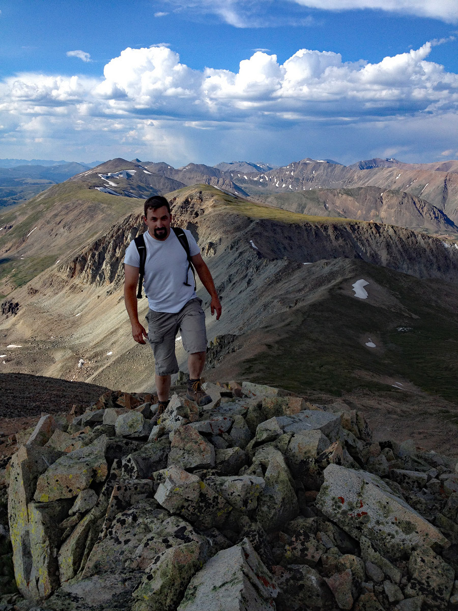
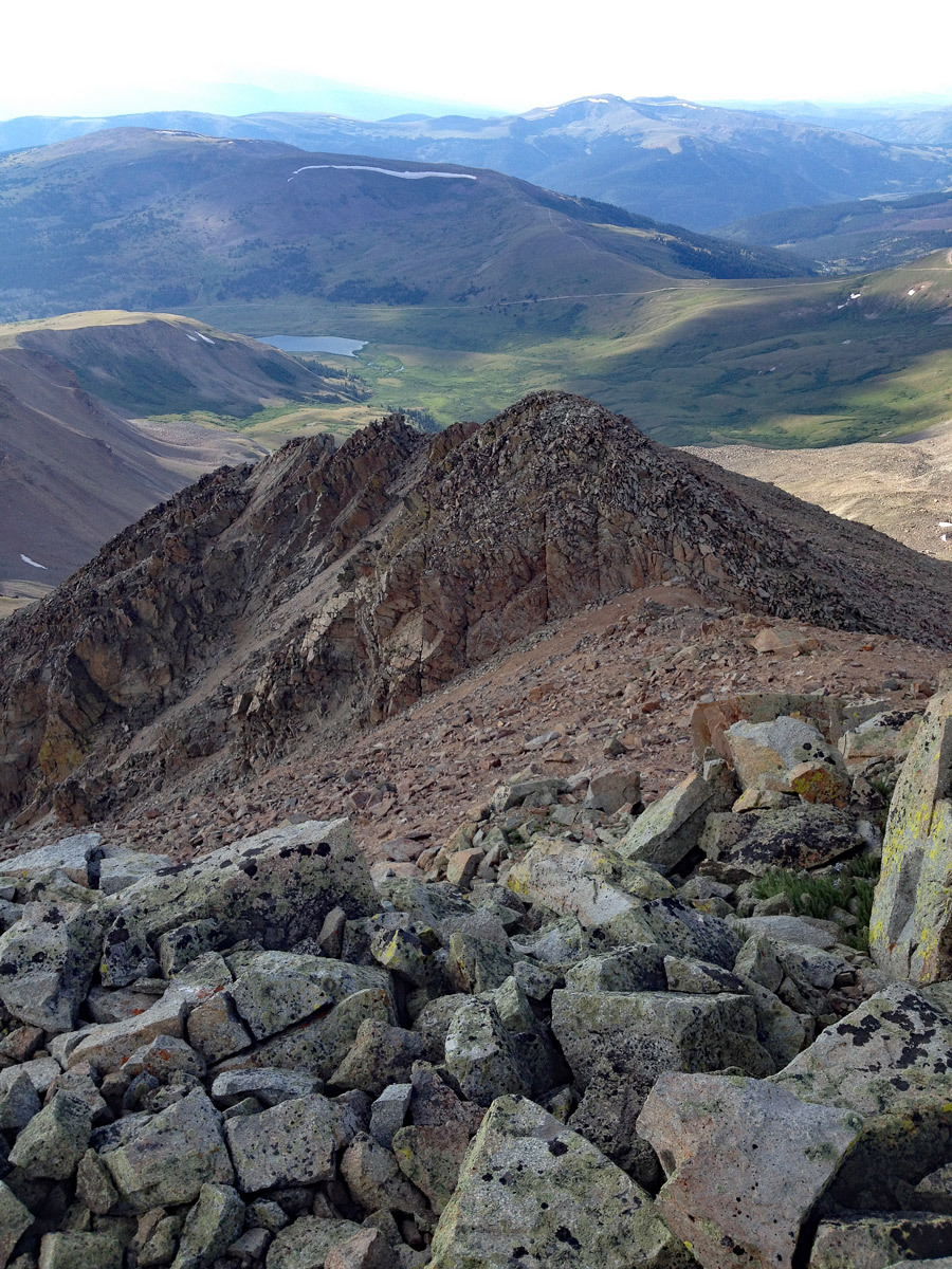
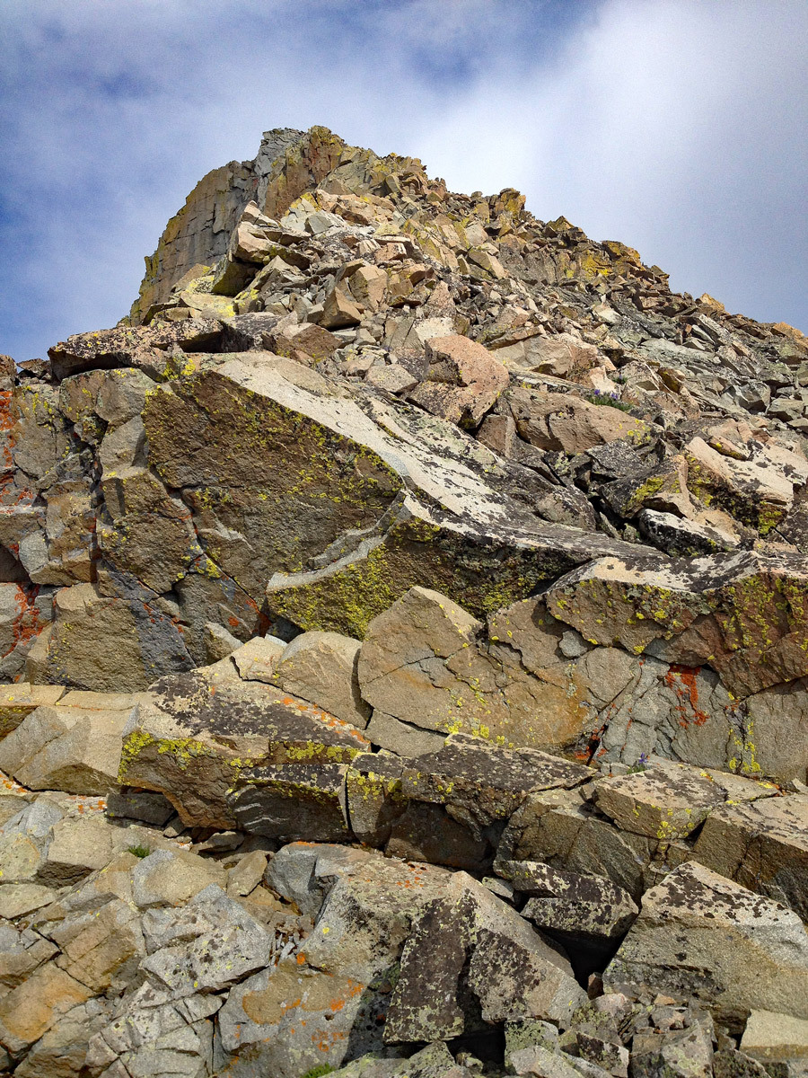
Once on the west ridge's crest, begin your climb. The ridge is interspersed with several rocky ribs which bisect the ridge crest to form several small 'teeth'. These ribs are generally best traversed on the south (climber's left) side of the ridge. The northern side would offer a much more airy challenge! You'll encounter 4-5 major ribs along your route, with each rib offering multiple lines and generally pleasant scrambling ranging from class 2+ to a few short sections that may require a 4th class move or two. The rock is generally solid & secure, but do be wary of the occasional loose handhold. We were generally able to stay either directly on, or near the ridge crest the majority of the way. From the last rib, it's a short stroll SE to the summit on typical Mosquito range talus.
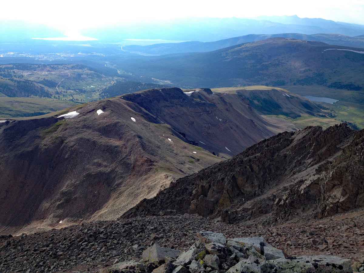
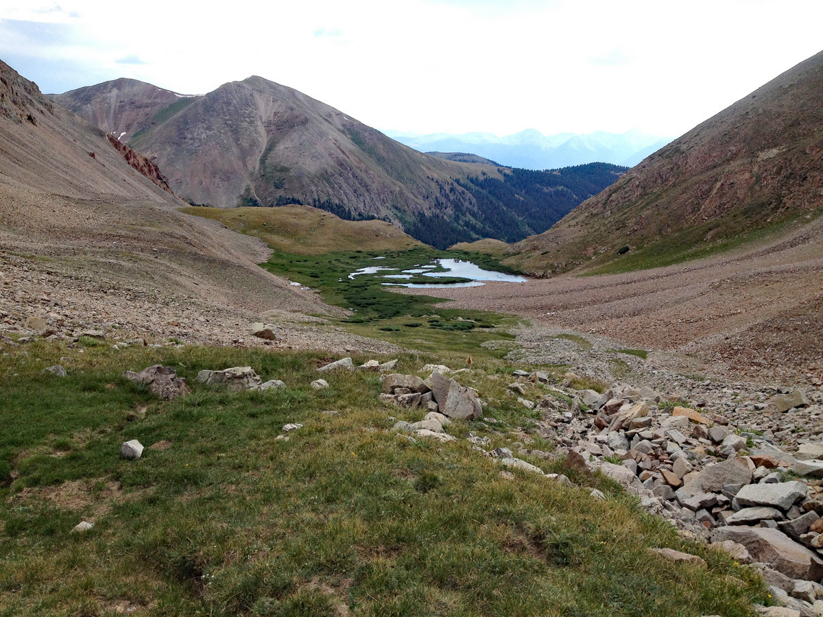
From the summit, the most expedient way down to your vehicle will be to follow the grassy SE slopes back to CO Rte 2B, then hike a short distance back along the road. To take this route, follow the SW ridge off of Dyer Peak for just over 1/4 mile to about 13,500'. Take a moment to observe the terrain. Your goal will be to follow the broad, SE ridge that shows on topo maps. In reality, this ridge is so broad that it can be hard to distinguish, depending on your vantage point. Use your best judgement, and steer yourself down toward the road coming up Iowa Amphitheater below you. Avoid any temptation to veer too far south, as this leads into rocky terrain which contain several small cliff bands. You will be best served by aiming more east than south along your descent and trying to stay near the aforementioned ridge line. The terrain should be mostly tundra as you descend lower, with some interspersed rocky sections. Once you've reached the road, follow it back approximately 1.25 miles to your vehicle.
Additional BETA
Links to other information, routes & trip reports for this peak that may be helpful. -