LoJ: #442 (Pre-LiDAR #450) / 13,248' Belleview Mountain
Peak Summary
An easy Class 3 ascent with some short, fun scrambling in the heart of the Elk Mountains. Can be accessed three different ways; from Aspen by Maroon Lake and the West Maroon Pass trail (passenger car access); from Crested Butte & Scofield Pass and the south end of the West Maroon Pass trail (still accessible by passenger car but more difficult); or from Rustler Gulch which is how we did it. Lidar measurements changed the elevation from 13,233 to 13,248 ft.
Belleview Mtn. SE Ridge Route
-
Trailhead
Approach Map Photos
-
Rustler Gulch TH
If coming from either the Front Range or the Western Slope, drive to Gunnison. From Gunnison, drive north on SH135 to Crested Butte. Stay on this main road as it enters the town, driving on through a major intersection with stop signs. Continue north on what becomes CR317 to the base of the ski area which is the Town of Mt. Crested Butte. Continue on the same road and a little after the main village and passing numerous condos, etc., the road will change over to a graded dirt road. During summer months, water trucks douse the road to help hold down the dust. Driving this road just after one of those trucks has gone through can change the road to a squishy, muddy mess, briefly. Begin measuring mileages from the end of the pavement. At 2.9 miles the road crosses the East River. Continue on CR317 to the site of Gothic which has a small but nice visitor center (3.4 miles) where you can inquire about parking regulations, hiking and biking trails and the research that is conducted in this area. During summer months daylight hours, this road is heavily travelled and parking is restricted to designated areas.
Continue driving NW past Gothic another 1.9 miles to the Gothic Campground, (5.3 from pavement end). There are only 4 designated sites here. From June 15 to August 15, camping in primitive, undesignated sites anywhere in this section of the East River Valley is not permitted so this campground is technically your only option between those dates. From the campground turnoff, drive another .9 mile for the Rustler Gulch turnoff (6.2 from pavement end). If in a passenger vehicle, you should park here and plan on getting your feet wet to cross the East River. It is possible to drive down the road a little and park in some limited spots, but there's little sense in trying to continue across the river unless you have 4WD. The road that heads up Rustler Gulch is FR317.2B on CalTopo. The Gunnison National Forest map does not really show this road very clearly because it follows along the wilderness boundary. If you do have 4WD and the East River is not in high stage runoff, drive on down the rocky stretch through some close, tall willows and ford the river. Once across, there is another area where about a half dozen vehicles can park and even a campsite. The road will head immediately and steeply uphill for .7 mile to an intersection where you'll see a gate across the road that heads off to the right. Park here if there's any room to do so. Two or three vehicles might be able to fit in off the road just enough to let other vehicles by. Coordinates for this spot are: N38° 59' 57.31" W107° 00' 11.05". There's a stand of tall willows here. About .2 mile back there is a road that turns off on the right that goes to a campsite, but cattle use the same area when allowed to graze here.
Camping
Right after where FR317.2B crosses the East River, there's an area that can accommodate a limited number of vehicles and some primitive camping right off the road. Then further up the road a short distance is another primitive spot that could accommodate a single vehicle on the right.
For camping further away, try the Gothic Campground about a half mile before FR317.2B or some other primitive spots either back toward Gothic or further up the main valley of the East River. Keep in mind tha primitive site camping is not allowed June 15 to August 15 in the East River Valley area.
Campsite Locations
East River Crossing › N 38° 59' 23.07", W 107° 00' 28.35"Elevation 9,710 ft.Gothic CG › N 38° 58' 52.76", W 107° 00' 20.48"Elevation 9,640 ft.
-
From Rustler Gulch TH via Rustler Gulch Campsite
For this "approach" there are two possible start points. If in a passenger car, the start will be where FR317.2B turns off of FR317 to cross the East River. You will then need to walk up FR317.2B to the trailhead coordinates. If you have 4WD, the start will be about a mile up after having forded the East River at the trailhead coordinates provided. There's a fence line and gate across the road/trail there.
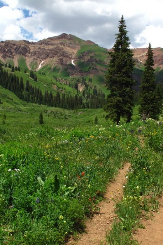
From the gate, walk north on the old road bed. In July, you'll enjoy a plethora of wildflowers that will distract you from the hiking. Heading up the well-used trail, walk through an open meadow before entering a forested section with a considerable amount of bog, exacerbated by the horses that pass through regularly. Gingerly walk through, trying not to get too muddy this early into the backpack and continued on into open, flower-filled meadows that prompted us to frequently stop and take photos. This was just a taste of what awaits in upper Rustler. In short order, you'll come to a creek crossing that probably will require boot removal. However, a trail heading off to the right along the creek into the woods and willows goes to a place where you might be able to gingerly cross on some small logs and get across the creek. Once across, this side trail continues and eventually leads back to the main trail, but not before taking you through an incredible meadow of more wildflowers where you may want to spend even more time taking photos.
From this meadow, the open trail continues north and then begins to turn east into the upper basin. Continue up to where the trail has decidedly turned east and stop at a place where the creek, not too far below, cascades over some rock outcrops. Walk down and hop across the creek and hike up into a stand of trees and explore around. There was a faint game trail through here and a lot of fallen timber. Head upward and eastward through the timber. Near to where you exit the timber on the east side is a campsite, just the right size for two tents, with an old fallen log for cooking and eating and an old fire ring. See our field checked coordinates (2019). This makes an excellent base camp for the six 13er summits you can access from this valley and is out of the way of the day hiking foot traffic that frequents this valley. A game trail of sorts leads east from the campsite, then turns north through lower willows back down to the creek for an easy crossing and to regain the main trail.
Camping
The upper basin of Rustler Gulch is so verdant and filled with wildflowers, you'll not likely find any campsite unless you want to trod down a bunch of flowers. The camp location described above is the only really decent campsite we found that would do minimal damage to the abundant wildflowers.
Campsite Locations
Rustler Camp N 39° 01' 25.00", W 106° 59' 26.80"Elevation 10,865 ft.
Open This Approach in a New Window
Route Map Photos
Route Info Belleview Mtn. SE Ridge
Click thumbnail to view full-size photo + captionRoute Description
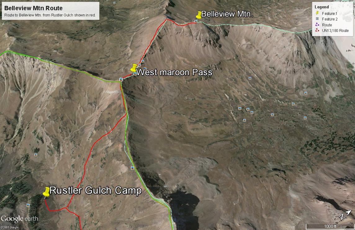
Year Climbed: 2013This route description begins from the suggested campsite in Rustler Gulch. In calculating the total mileage for Belleview Mtn., you should include the backpack(or hike in) from the trailhead.
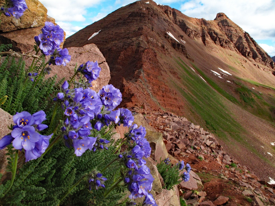
From the suggested campsite, work back across the creek to the north and cross the main trail. Head uphill through the lush, flowering vegetation in a NNW direction, aiming for a small group of trees that appear to sit on a small bench. From those trees, you'll have a clear view into a basin that continues to head NNW, that's mostly grass & tundra filled with a section of some non-abusive willows higher up. It won't take long hiking in the vegetation with no trail to find your boots quite soaked from the previous evenings rain, if there's been any. And, once again, the flowers are so prolific, we were constantly stopping to take multiple photos. Utilize the drainage bottom to avoid tramping through so may wildflowers. It's also a little easier to see where you're putting your feet.
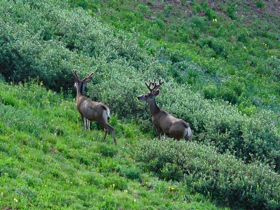
The going, once again, is steep, but not difficult. As you reach the upper part of the basin, there is another minor bench-like area with some willows. Work your way through. We flushed out some deer from the willows that quickly bounded away to the opposite side of the basin. We watched them some and took a few camera shots before continuing on. Tundra will carry you almost all the way to the saddle and even after that, as you walk west along the ridge, it is still on mostly tundra and some of the maroon rock found in this part of the Elks. Quickly pass over the no-count summit and head down to the pass, usually infested with hiking tourists, especially on weekends. It can be rather amusing to stop and watch some of these tourists struggling their way up or down the trail over the pass.
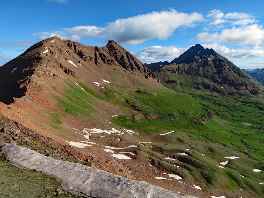
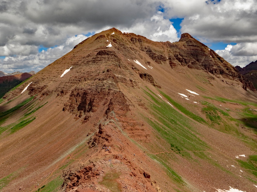
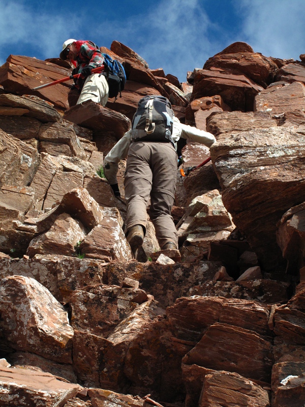
Now, begin the main ascent toward Belleview. This is the entertaining part of the day. At first, there's a well-used path that leads upward either by, around or through various rock obstacles. Much of the route is cairned. There was one section that led us on the south side of some cliffbands along a fairly wide ledge and after that, a brief and steep ascent up a rubble filled couloir and back to the ridgeline. We encountered more obstacles than we expected from our initial view of the SE ridge, but the going was never too difficult, though there was some route finding involved. It took us longer than expected to reach the false, southern summit of Belleview, which from a distance does not look nearly as high as the true summit, but in reality comes fairly close. By that point, you will be walking on almost exclusively, broken, flat platelets of maroon rock that the entire upper peak is made of.From the false summit, walk north along the wide ridge. As you approach the summit block/pinnacle, swing to the right and contour upward onto the eastern flank and then turn up toward the summit for the final gain. As you approach the final section to the summit, the climbing becomes third class on highly fractured rock. This made holds for hands and stable positions for feet rather tenuous. Exercise quite a bit of care for the final 50 feet or so, and you should be able to stand on this enjoyable summit in short order. It had taken us considerably longer to get here from the pass than we had expected. On the summit, Maroon Peak looms over this summit and seems to dwarf it. It's an impressive view.
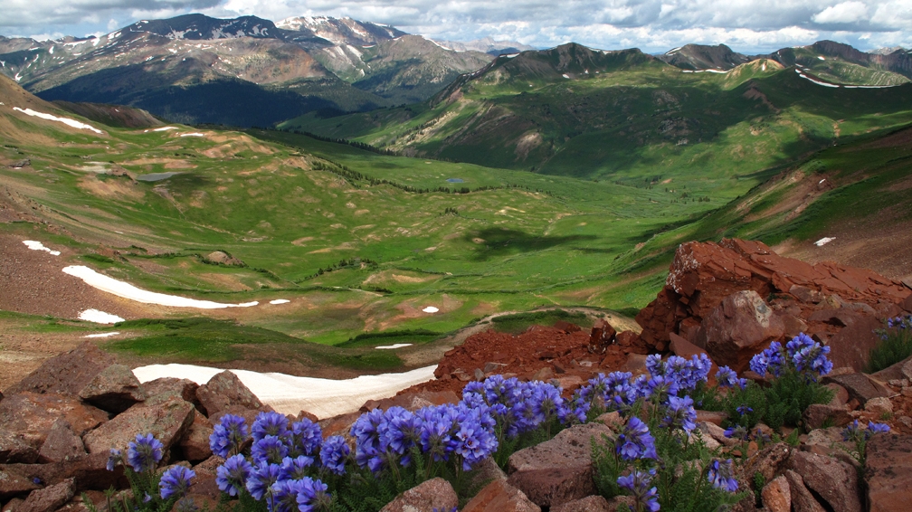
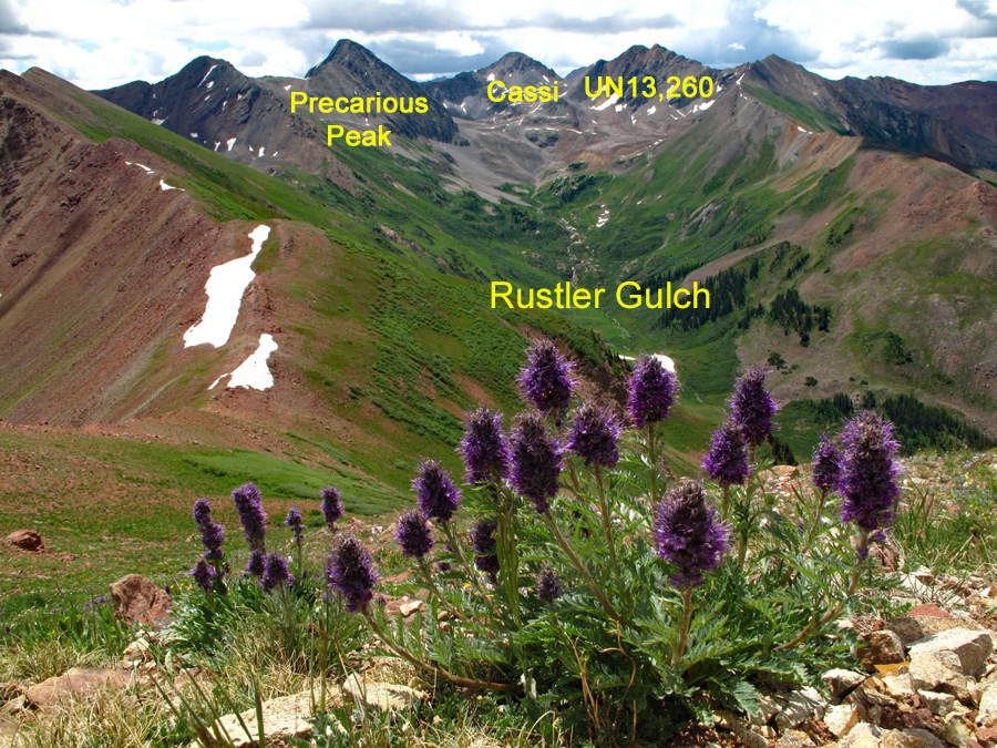
To descend, take a very careful descent off the summit block as you came and walk along the connecting ridge back to the false summit. Enjoy the view of the vast, tundra-filled Fravert Basin to the west. Retrace your ascent route as closely as you can. Then, it's back to the pass, probably still overrun with touroids, then head on up east to the no-count summit. From this summit, enjoy a dramatic view of Rustler Gulch and pause for more photos. Then, there's the long, continuous drop back to your campsite, and/or Rustler Gulch far below.
Additional BETA
Links to other information, routes & trip reports for this peak that may be helpful. -
