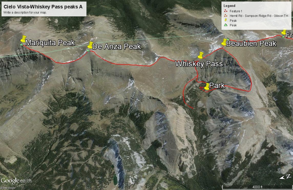
LoJ: #324 (Pre-LiDAR #316) / 13,398' Mariquita Peak
Peak Summary
Mariquita Peak lies north of De Anza Peak B in the southern Sangre de Cristo. While the De Anza summit appears to lie within the boundaries of the Cielo Vista Ranch, Mariquita Peak does not according to the map source we have. Mariquita is not on government land however and hence, is privately owned. A portion of the peak may be a part of the Forbes-Trinchera Blanca Ranch which is now owned by Louis Bacon. Much of that land has been placed into a "conservation easement" managed by US Fish & Wildlife. We do not currently know if the current property owners allow access to Mariquita, therefore climb this peak at your own risk. Accessed from either the north or the south along the central ridge joining all these peaks on the El Valle quad, Mariquita is a Class 2 summit with a moderately rocky approach from either direction. 4WD is advised for access either from Whiskey Pass or the Purgatoire Campground and FR 437. You can learn more about this area at the following links, one of which contains some interesting history of the area. The third link leads to a page where you can select a pdf link to a map of both the northern and southern sections of the ranch. Lidar data reduced the elevation 7 feet.